Login
Register


CQF
H L Sonny Callahan Airport
Official FAA Data Effective 2025-12-25 0901Z
Chart Supplement

VFR Chart of KCQF
Sectional Charts at SkyVector.com
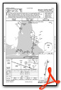
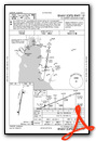
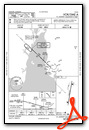
IFR Chart of KCQF
Enroute Charts at SkyVector.com
Location Information for KCQF
Coordinates: N30°27.63' / W87°52.62'Located 03 miles SE of Fairhope, Alabama on 144 acres of land. View all Airports in Alabama.
Surveyed Elevation is 91 feet MSL.
Operations Data
|
|
Airport Communications
| AWOS-3PT: | 118.425 Tel. 251-928-3242 |
|---|---|
| MOBILE APPROACH: | 118.5 269.3 |
| MOBILE DEPARTURE: | 118.5 269.3 |
| UNICOM: | 123.000 |
| CTAF: | 123.000 |
| ASOS at BFM (14.0 NW): | 251-431-6762 |
| ATIS at BFM (14.0 NW): | 135.575 |
| ATIS at JKA (14.8 SE): | 134.525 |
- APCH/DEP SVC PRVDD BY HOUSTON ARTCC (ZHU) ON FREQS 127.65/285.475 (MOBILE RCAG) WHEN MOBIL APCH CTL (MOB) CLSD.
Nearby Navigation Aids
|
| ||||||||||||||||||||||||||||||||||||||||||||||||||||||||||||


Runway 01/19
| Dimensions: | 6604 x 100 feet / 2013 x 30 meters | |
|---|---|---|
| Surface: | Asphalt / Grooved in Fair Condition | |
| Weight Limits: | S-36, D-58 | |
| Edge Lighting: | High Intensity | |
| Runway 01 | Runway 19 | |
| Coordinates: | N30°27.09' / W87°52.72' | N30°28.17' / W87°52.52' |
| Elevation: | 86.7 | 91.1 |
| Traffic Pattern: | Left | Left |
| Runway Heading: | 9° True | 189° True |
| Markings: | Precision Instrument in fair condition. | Precision Instrument in fair condition. |
| Glide Slope Indicator | P4L (3.00° Glide Path Angle) | P4L (3.00° Glide Path Angle) |
| REIL: | Yes | Yes |
Services Available
| Fuel: | 100LL (blue), Jet A+ |
|---|---|
| Transient Storage: | Hangars,Tiedowns |
| Airframe Repair: | MAJOR |
| Engine Repair: | MAJOR |
| Bottled Oxygen: | HIGH/LOW |
| Bulk Oxygen: | NOT AVAILABLE |
| Other Services: | AVIONICS,PILOT INSTRUCTION,AIRCRAFT RENTAL |
Ownership Information
| Ownership: | Publicly owned | |
|---|---|---|
| Owner: | FAIRHOPE AIRPORT AUTHORITY | |
| PO DRAWER 429 | ||
| FAIRHOPE, AL 36533 | ||
| 251-383-8515 | ||
| Manager: | DAVE FRIEDEL | |
| PO DRAWER 429 | ||
| FAIRHOPE, AL 36533 | ||
| 251-383-8515 | ||
Other Remarks
- NOISE ABATEMENT RWY 01 & 19, DEP STRAIGHT OUT TIL RCHG 600 FT AGL.
- FOR CD CTC MOBILE APCH AT 251-662-6236, WHEN APCH CLSD CTC HOUSTON ARTCC AT 281-230-5622.
- ACTVT REIL RWY 01 & 19; PAPI RWY 01 & 19; HIRL RWY 01/19 - CTAF. HIRL RWY 01/19 PRESET TO LOW INTST; INCR INTST - CTAF.
Weather Minimums
Instrument Approach Procedure (IAP) Charts
Nearby Airports with Instrument Procedures
| ID | Name | Heading / Distance | ||
|---|---|---|---|---|
 |
5R4 | Holk Field At Foley Municipal Airport | 102° | 9.3 |
|
KBFM | Mobile International Airport | 315° | 14.0 |
|
KJKA | Gulf Shores International/Jack Edwards Field Airport | 133° | 14.8 |
|
2R5 | St Elmo Airport | 276° | 20.8 |
|
KMOB | Mobile Regional Airport | 306° | 23.5 |
|
1R8 | Bay Minette Municipal Airport | 006° | 24.7 |
|
KNPA | Pensacola NAS (Forrest Sherman Field) Airport | 102° | 29.7 |
|
KPQL | Trent Lott International Airport | 270° | 33.8 |
|
KPNS | Pensacola International Airport | 088° | 35.8 |
|
0R1 | Atmore Municipal Airport | 033° | 40.0 |
|
KNSE | Whiting Field NAS North Airport | 070° | 46.9 |
|
KNDZ | Whiting Field NAS South Airport | 072° | 46.9 |
Airport Images
Do you have a recent image of this airport? Upload it here!


