Login
Register


CUH
Cushing Municipal Airport
Official FAA Data Effective 2026-02-19 0901Z
Chart Supplement

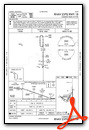
VFR Chart of KCUH
Sectional Charts at SkyVector.com
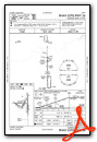
IFR Chart of KCUH
Enroute Charts at SkyVector.com
Location Information for KCUH
Coordinates: N35°57.00' / W96°46.41'Located 02 miles S of Cushing, Oklahoma on 672 acres of land. View all Airports in Oklahoma.
Surveyed Elevation is 925 feet MSL.
Operations Data
|
|
Airport Communications
| AWOS-3PT: | 118.25 Tel. (918) 225-6072 |
|---|---|
| CTAF: | 122.800 |
| UNICOM: | 122.800 |
| AWOS-3PT at CQB (13.8 S): | 119.275 405-258-6724 |
| ASOS at SWO (19.9 NW): | 135.725 405-743-8150 |
| ASOS at GOK (31.8 W): | 133.975 405-282-0478 |
- APCH/DEP CTL SVC PRVDD BY KANSAS CITY ARTCC (ZKC) ON FREQS 127.8/319.1 (PONCA CITY RCAG).
Nearby Navigation Aids
|
| ||||||||||||||||||||||||||||||||||||||||||||||||||||||||||||


Runway 18/36
| Dimensions: | 5201 x 100 feet / 1585 x 30 meters | |
|---|---|---|
| Surface: | Concrete / Grooved in Good Condition | |
| Weight Limits: | 4 /R/B/X/T, S-30 | |
| Edge Lighting: | Medium Intensity | |
| Runway 18 | Runway 36 | |
| Coordinates: | N35°57.44' / W96°46.16' | N35°56.58' / W96°46.15' |
| Elevation: | 916.0 | 878.7 |
| Traffic Pattern: | Left | Left |
| Runway Heading: | 180° True | 360° True |
| Declared Distances: | TORA:5201 TODA:5201 ASDA:4986 LDA:4986 | TORA:5201 TODA:5201 ASDA:5201 LDA:4986 |
| Markings: | Non-Precision Instrument in fair condition. | Non-Precision Instrument in fair condition. |
| Glide Slope Indicator | P4L (3.00° Glide Path Angle) | P4L (3.00° Glide Path Angle) |
| REIL: | Yes | Yes |
| Obstacles: | 50 ft Trees 1373 ft from runway, 48 ft right of center | |
Runway 08/26
| Dimensions: | 2700 x 40 feet / 823 x 12 meters | |
|---|---|---|
| Surface: | Turf in Good Condition | |
| Runway 08 | Runway 26 | |
| Coordinates: | N35°57.03' / W96°46.93' | N35°57.03' / W96°46.38' |
| Elevation: | 923.8 | 900.6 |
| Traffic Pattern: | Left | Left |
| Runway Heading: | 90° True | 270° True |
| Markings: | Non-Standard in good condition. | Non-Standard in good condition. |
| Obstacles: | 32 ft Trees 387 ft from runway | |
Runway 02/20
| Dimensions: | 2650 x 60 feet / 808 x 18 meters | |
|---|---|---|
| Surface: | Turf in Good Condition | |
| Runway 02 | Runway 20 | |
| Coordinates: | N35°56.82' / W96°46.51' | N35°57.19' / W96°46.23' |
| Elevation: | 891.1 | 905.1 |
| Traffic Pattern: | Left | Left |
| Runway Heading: | 31° True | 211° True |
| Markings: | Non-Standard in good condition. | Non-Standard in good condition. |
| Obstacles: | 35 ft Trees 528 ft from runway | |
Runway 11/29
| Dimensions: | 2500 x 50 feet / 762 x 15 meters | |
|---|---|---|
| Surface: | Turf in Good Condition | |
| Runway 11 | Runway 29 | |
| Coordinates: | N35°57.06' / W96°46.91' | N35°56.85' / W96°46.48' |
| Elevation: | 925.1 | 891.0 |
| Traffic Pattern: | Left | Left |
| Runway Heading: | 122° True | 302° True |
| Markings: | Non-Standard in good condition. | Non-Standard in good condition. |
| Obstacles: | 42 ft Trees 475 ft from runway | |
Services Available
| Fuel: | 100LL (blue), Jet-A |
|---|---|
| Transient Storage: | Hangars,Tiedowns |
| Airframe Repair: | MAJOR |
| Engine Repair: | MAJOR |
| Bottled Oxygen: | LOW |
| Bulk Oxygen: | LOW |
| Other Services: | AIR AMBULANCE SERVICES,PARACHUTE JUMP ACTIVITY |
Ownership Information
| Ownership: | Publicly owned | |
|---|---|---|
| Owner: | CITY OF CUSHING | |
| PO BOX 311 | ||
| CUSHING, OK 74023 | ||
| 918-225-2394 | ||
| Manager: | MIKE MIDDLETON | |
| 2414 TOM MALONEY DR | ||
| CUSHING, OK 74023 | ||
| 918-225-0881 | ||
Other Remarks
- FOR CD CTC KANSAS CITY ARTCC AT 913-254-8508.
- RWY 08/26 & 11/29 SOFT WHEN WET.
- 0LL FUEL AVBL H24 WITH CREDIT CARD.
- ACTVT REIL RWY 18 & 36 - CTAF; PAPI RWY 18 & 36 ON CONSLY; MIRL RWY 18/36 SS-SR PRESET MED INTST; INCR INTST - CTAF.
Weather Minimums

Instrument Approach Procedure (IAP) Charts
Nearby Airports with Instrument Procedures
| ID | Name | Heading / Distance | ||
|---|---|---|---|---|
 |
KCQB | Chandler Regional Airport | 189° | 13.7 |
|
3F7 | Jones Memorial Airport | 116° | 19.2 |
|
KSWO | Stillwater Regional Airport | 309° | 19.8 |
|
O47 | Prague Municipal Airport | 174° | 28.2 |
|
KGOK | Guthrie/Edmond Regional Airport | 259° | 31.9 |
|
KOWP | William R Pogue Municipal Airport | 065° | 33.1 |
|
F22 | Perry Municipal Airport | 316° | 35.8 |
|
KSNL | Shawnee Regional Airport | 193° | 36.5 |
|
KRVS | Tulsa Riverside Airport | 081° | 38.8 |
|
KSRE | Seminole Municipal Airport | 173° | 40.8 |
|
KOKM | Okmulgee Regional/Paul and Betty Abbott Field Airport | 112° | 43.7 |
|
KTIK | Tinker AFB Airport | 223° | 43.9 |
Airport Images
Do you have a recent image of this airport? Upload it here!


