Login
Register


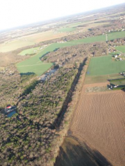
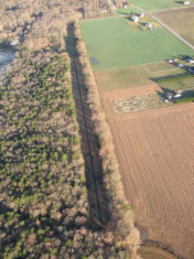
DE14
Huey Airport
Official FAA Data Effective 2026-02-19 0901Z
VFR Chart of DE14
Sectional Charts at SkyVector.com
IFR Chart of DE14
Enroute Charts at SkyVector.com
Location Information for DE14
Coordinates: N38°44.64' / W75°32.10'Located 03 miles E of Bridgeville, Delaware. View all Airports in Delaware.
Estimated Elevation is 45 feet MSL.
Operations Data
|
|
Airport Communications
| ASOS at GED (8.7 E): | 118.375 302-855-1052 |
|---|---|
| D-ATIS at DOV (23.4 N): | 127.825 |
| ASOS at SBY (24.2 S): | 118.325 410-341-0868 |
Nearby Navigation Aids
|
| ||||||||||||||||||||||||||||||||||||||||||||||||||||||||||||


Runway 14/32
| Dimensions: | 2600 x 110 feet / 792 x 34 meters | |
|---|---|---|
| Surface: | Turf | |
| Runway 14 | Runway 32 | |
| Obstacles: | 50 ft Trees ft from runway | 50 ft Trees ft from runway |
Ownership Information
| Ownership: | Privately Owned | |
|---|---|---|
| Owner: | GENE H. HUEY | |
| 17149 OAK RD. | ||
| BRIDGEVILLE, DE 19933 | ||
| 302-604-0494 | ||
| Manager: | GENE H. HUEY | |
| 17149 OAK RD. | ||
| BRIDGEVILLE, DE 19933 | ||
| 302-604-0494 | ||
Other Remarks
- FOR CD CTC WASHINGTON ARTCC AT 703-771-3587.
Nearby Airports with Instrument Procedures
| ID | Name | Heading / Distance | ||
|---|---|---|---|---|
 |
KGED | Delaware Coastal Airport | 112° | 8.9 |
|
N06 | Laurel Airport | 193° | 12.4 |
|
KRJD | Gooden Airpark Airport | 311° | 20.6 |
|
KDOV | Dover AFB Airport | 007° | 23.3 |
|
KSBY | Salisbury-Ocean City Wicomico Regional Airport | 177° | 24.2 |
|
KESN | Easton/Newnam Field Airport | 278° | 25.3 |
|
KCGE | Cambridge-Dorchester Regional Airport | 242° | 26.3 |
|
33N | Delaware Airpark Airport | 353° | 28.6 |
|
KOXB | Ocean City Municipal Airport | 143° | 32.4 |
|
KWWD | Cape May County Airport | 061° | 33.4 |
|
W29 | Bay Bridge Airport | 290° | 39.8 |
|
KMIV | Millville Municipal Airport | 029° | 43.2 |