Login
Register


DUJ
Dubois Regional Airport
Official FAA Data Effective 2025-11-27 0901Z
Chart Supplement

VFR Chart of KDUJ
Sectional Charts at SkyVector.com
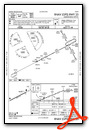
IFR Chart of KDUJ
Enroute Charts at SkyVector.com
Location Information for KDUJ
Coordinates: N41°10.70' / W78°53.92'Located 07 miles NW of Dubois, Pennsylvania on 399 acres of land. View all Airports in Pennsylvania.
Surveyed Elevation is 1816 feet MSL.
Operations Data
|
|
Airport Communications
| ASOS: | 119.025 Tel. 814-328-5140 |
|---|---|
| CTAF: | 123.000 |
| UNICOM: | 123.000 |
| AWOS-3P at OYM (22.3 NE): | 118.05 814-834-9416 |
| ASOS at FIG (23.2 E): | 119.275 814-765-9703 |
| AWOS-3 at AXQ (24.7 W): | 118.275 814-297-1486 |
- APCH/DEP SVC PRVDD BY CLEVELAND ARTCC (ZOB) ON FREQS 126.725/291.65 (DUBOIS RCAG).
Nearby Navigation Aids
|
| ||||||||||||||||||||||||||||||||||||||||||||||||||||||


Runway 07/25
| Dimensions: | 5503 x 100 feet / 1677 x 30 meters | |
|---|---|---|
| Surface: | Asphalt / Grooved in Good Condition | |
| Weight Limits: | S-45, D-60, ST-93
PCR VALUE: 630/F/A/X/T
| |
| Edge Lighting: | High Intensity | |
| Runway 07 | Runway 25 | |
| Coordinates: | N41°10.49' / W78°54.45' | N41°10.91' / W78°53.39' |
| Elevation: | 1816.6 | 1816.8 |
| Traffic Pattern: | Left | Left |
| Runway Heading: | 62° True | 242° True |
| Declared Distances: | TORA:5503 TODA:5503 ASDA:5503 LDA:5503 | TORA:5503 TODA:5503 ASDA:5503 LDA:5503 |
| Markings: | Precision Instrument in good condition. | Precision Instrument in good condition. |
| Glide Slope Indicator | V2L (3.00° Glide Path Angle) | P4L (3.00° Glide Path Angle) |
| Approach Lights: | MALSR 1,400 Foot Medium-intensity Approach Lighting System with runway alignment indicator lights. | |
| REIL: | Yes | |
| Obstacles: | 48 ft Trees 1772 ft from runway, 706 ft right of center | |
Services Available
| Fuel: | 100LL (blue), Jet-A |
|---|---|
| Transient Storage: | Tiedowns |
| Airframe Repair: | NONE |
| Engine Repair: | NONE |
| Bottled Oxygen: | NONE |
| Bulk Oxygen: | NONE |
Ownership Information
| Ownership: | Publicly owned | |
|---|---|---|
| Owner: | CLEARFIELD-JEFFERSON COUNTIES | REGIONAL AIRPORT AUTHORITY |
| 377 AVIATION WAY | ||
| REYNOLDSVILLE, PA 15851 | ||
| 814-328-5311 | ||
| Manager: | ROBERT W. SHAFFER | |
| 377 AVIATION WAY | ||
| REYNOLDSVILLE, PA 15851 | ||
| 814-328-5311 | ||
Other Remarks
- FLOCKS OF BIRDS ON & INVOF ARPT.
- TPA 983 FT AGL. TPA FOR LARGE TURBINE POWERED ACFT 1483 FT AGL.
- FOR CD CTC CLEVELAND ARTCC AT 440-774-0234.
- ALL SFCS WIP; GRASS CUTTING APRIL THRU OCT.
- RWY & TWY CONDS NOT MNT OUTSIDE OF NML ATNDNC HRS.
- ACTVT HIRL RY 07/25, REIL & VASI RY 07, MALSR RY 25, & TWY LGTS - CTAF. PAPI RY 25 ON 24 HRS.
Weather Minimums

Instrument Approach Procedure (IAP) Charts


Nearby Airports with Instrument Procedures
| ID | Name | Heading / Distance | ||
|---|---|---|---|---|
 |
N35 | Punxsutawney Municipal Airport | 186° | 12.8 |
|
KOYM | St Marys Municipal Airport | 051° | 22.8 |
|
KFIG | Clearfield-Lawrence Airport | 109° | 23.3 |
|
KAXQ | Clarion County Airport | 276° | 24.8 |
|
KIDI | Indiana County/Jimmy Stewart Field Airport | 195° | 34.1 |
|
KBFD | Bradford Regional Airport | 017° | 39.2 |
|
KPSB | Mid-State Airport | 115° | 40.8 |
|
6P7 | Mcville Airport | 230° | 41.4 |
|
9G8 | Ebensburg Airport | 172° | 43.4 |
|
KFKL | Venango Regional Airport | 285° | 45.1 |
|
6G1 | Titusville Airport | 304° | 46.0 |
|
KUNV | State College Regional Airport | 112° | 51.6 |


