Login
Register
OYM
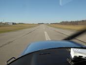
St Marys Municipal Airport
Official FAA Data Effective 2026-01-22 0901Z
VFR Chart of KOYM
Sectional Charts at SkyVector.com
IFR Chart of KOYM
Enroute Charts at SkyVector.com
Location Information for KOYM
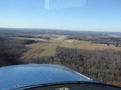
Coordinates: N41°24.75' / W78°30.16'Located 03 miles SE of St Marys, Pennsylvania on 283 acres of land. View all Airports in Pennsylvania.
Surveyed Elevation is 1934 feet MSL.
Operations Data
|
|
Airport Communications
| AWOS-3P: | 118.05 Tel. 814-834-9416 |
|---|---|
| CTAF: | 122.700 |
| UNICOM: | 122.700 |
| ASOS at FIG (22.2 S): | 119.275 814-765-9703 |
| ASOS at DUJ (22.7 SW): | 119.025 814-328-5140 |
| ASOS at BFD (24.2 N): | 133.825 814-368-2581 |
- CLEARANCE DELIVERY PRVDD BY ALTOONA RADIO ON FREQ 122.4.
- APCH/DEP SVC PRVDD BY CLEVELAND ARTCC (ZOB) ON FREQS 126.725/291.65 (DUBOIS RCAG).
Nearby Navigation Aids
|
| ||||||||||||||||||||||||||||||||||||||||||||||||||||||
Runway 10/28
| Dimensions: | 4300 x 75 feet / 1311 x 23 meters | |
|---|---|---|
| Surface: | Asphalt / Grooved in Good Condition | |
| Weight Limits: | S-33 | |
| Edge Lighting: | Medium Intensity | |
| Runway 10 | Runway 28 | |
| Coordinates: | N41°24.75' / W78°30.63' | N41°24.75' / W78°29.69' |
| Elevation: | 1902.4 | 1934.3 |
| Traffic Pattern: | Left | Left |
| Runway Heading: | 90° True | 270° True |
| Markings: | Non-Precision Instrument in good condition. | Non-Precision Instrument in good condition. |
| Glide Slope Indicator | P4L (3.00° Glide Path Angle) PAPI UNUSBL BYD 5 DEGS RIGHT OF CNTRLN. | P4L (3.00° Glide Path Angle) PAPI UNUSBL BYD 8 DEGS RIGHT OF CNTRLN. |
| Approach Lights: | MALS 1,400 Foot Medium-intensity Approach Lighting System. | |
| Obstacles: | 142 ft Trees 3684 ft from runway, 340 ft left of center +7 FT FENCE 200 FT N OF RY 0-200 FT. +15 FT PUBLIC ROAD 0-200 FT & 225 FT L. PUBLIC ROAD OBSTN MKD BY LIGHTED POLES. |
72 ft Trees 2372 ft from runway, 523 ft left of center +13 FT FENCE N OF RY FM 0-176 FT, 219 FT LEFT. +23 FT PUBLIC ROAD, 222 FT RIGHT. PUBLIC ROAD OBSTN MKD BY LIGHTED POLES. |
Services Available
| Fuel: | 100LL (blue), Jet-A |
|---|---|
| Transient Storage: | Tiedowns |
| Airframe Repair: | MAJOR |
| Engine Repair: | MAJOR |
| Bottled Oxygen: | NONE |
| Bulk Oxygen: | NONE |
| Other Services: | PILOT INSTRUCTION |
Ownership Information
| Ownership: | Publicly owned | |
|---|---|---|
| Owner: | CITY OF ST. MARYS | |
| 159 CESSNA ROAD | ||
| ST MARYS, PA 15857 | ||
| 814-834-4671 | ||
| Manager: | VINCE CAGGIANO | |
| 159 CESSNA RD | ||
| ST MARYS, PA 15857 | ||
| 814-834-4671 | ||
Other Remarks
- FOR CD CTC CLEVELAND ARTCC AT 440-774-0234.
- COLD TEMPERATURE AIRPORT. ALTITUDE CORRECTION REQUIRED AT OR BELOW -36C.
- ACTVT MALS RWY 28; PAPI RWYS 10 & 28; MIRL RWY 10/28 - CTAF.
Weather Minimums
Instrument Approach Procedure (IAP) Charts
Nearby Airports with Instrument Procedures
| ID | Name | Heading / Distance | ||
|---|---|---|---|---|
 |
KFIG | Clearfield-Lawrence Airport | 169° | 22.1 |
 |
KDUJ | Dubois Regional Airport | 232° | 22.8 |
 |
KBFD | Bradford Regional Airport | 345° | 24.2 |
 |
N35 | Punxsutawney Municipal Airport | 216° | 33.0 |
 |
KPSB | Mid-State Airport | 149° | 36.8 |
 |
KAXQ | Clarion County Airport | 255° | 43.9 |
 |
N96 | Bellefonte Airport | 135° | 44.3 |
 |
KUNV | State College Regional Airport | 138° | 44.9 |
 |
KELZ | Wellsville Municipal/Tarantine Field Airport | 028° | 47.7 |
 |
KOLE | Cattaraugus County-Olean Airport | 006° | 50.0 |
 |
KLHV | William T Piper Memorial Airport | 108° | 51.6 |
 |
N38 | Grand Canyon Regional Airport | 068° | 53.3 |


