Login
Register


F17
Center Municipal Airport
Official FAA Data Effective 2026-02-19 0901Z
Chart Supplement

VFR Chart of F17
Sectional Charts at SkyVector.com
IFR Chart of F17
Enroute Charts at SkyVector.com
Location Information for F17
Coordinates: N31°49.90' / W94°9.39'Located 03 miles NE of Center, Texas on 150 acres of land. View all Airports in Texas.
Surveyed Elevation is 318 feet MSL.
Operations Data
|
|
Airport Communications
| AWOS-3PT: | 128.775 Tel. 936-598-3355 |
|---|---|
| UNICOM: | 122.800 |
| CTAF: | 122.800 |
| AWOS-3PT at 4F2 (22.1 N): | 121.125 903-690-0511 |
| AWOS-3PT at 3F3 (24.6 NE): | 119.125 318-872-3537 |
| AWOS-3PT at OCH (31.9 SW): | 135.625 936-564-5074 |
- APCH/DEP CTL SVC PRVDD BY FORT WORTH ARTCC (ZFW) ON FREQS 126.325/346.25 (SHREVEPORT RCAG).
Nearby Navigation Aids
|
| ||||||||||||||||||||||||||||||||||||||||||||||||||||||||||||


Runway 17/35
| Dimensions: | 5501 x 75 feet / 1677 x 23 meters | |
|---|---|---|
| Surface: | Asphalt in Good Condition | |
| Weight Limits: | S-30 | |
| Edge Lighting: | Medium Intensity | |
| Runway 17 | Runway 35 | |
| Coordinates: | N31°50.34' / W94°9.47' | N31°49.45' / W94°9.30' |
| Elevation: | 318.7 | 291.0 |
| Runway Heading: | 171° True | 351° True |
| Markings: | Non-Precision Instrument in good condition. | Non-Precision Instrument in good condition. |
| Glide Slope Indicator | P2L (3.00° Glide Path Angle) | P2L (3.00° Glide Path Angle) |
| Obstacles: | 26 ft Trees 201 ft from runway, 266 ft right of center CONTROLLING OBSTRUCTION EXCEEDS A 45 DEGREE SLOPE. 40 FT TREES, 0-199 FT DSTC, 200 FT R. |
40 ft Trees 201 ft from runway, 355 ft right of center 40 FT TREES, 199 FT DSTC, 244 FT R. |
Services Available
| Fuel: | 100LL (blue), Jet A+ |
|---|---|
| Transient Storage: | Tiedowns |
| Airframe Repair: | MINOR |
| Engine Repair: | MAJOR |
| Bottled Oxygen: | NONE |
| Bulk Oxygen: | NONE |
Ownership Information
| Ownership: | Publicly owned | |
|---|---|---|
| Owner: | CITY OF CENTER | |
| 617 TENAHA ST, PO BOX 1744 | ||
| CENTER, TX 75935 | ||
| 936-598-2941 | ||
| Manager: | JOHN SOLICE | |
| 617 TENAHA ST, PO BOX 1744 | ARPT PHYS ADS 397 FM 1656. | |
| CENTER, TX 75935 | ||
| 936-598-8119 | ||
Other Remarks
- DEER ON & INVOF ARPT.
- FOR CD IF UNA TO CTC ON FSS FREQ, CTC FORT WORTH ARTCC AT 817-858-7584.
- 0LL SELF SVC FUEL.
- MIRL RWY 17/35 PRESET LOW INTST; TO INCR INTST ACTVT - CTAF.
Weather Minimums

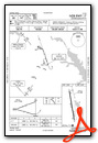
Instrument Approach Procedure (IAP) Charts


Nearby Airports with Instrument Procedures
| ID | Name | Heading / Distance | ||
|---|---|---|---|---|
 |
4F2 | Panola County-Sharpe Field Airport | 340° | 21.9 |
|
3F3 | C E 'Rusty' Williams Airport | 053° | 24.6 |
|
KOCH | Nacogdoches A L Mangham Jr Regional Airport | 241° | 32.2 |
|
3R4 | Hart Airport | 116° | 38.5 |
|
KRFI | Rusk County Airport | 297° | 40.0 |
|
KSHV | Shreveport Regional Airport | 024° | 40.5 |
|
KASL | Harrison County Airport | 349° | 42.0 |
|
KGGG | East Texas Regional Airport | 319° | 43.5 |
|
0R7 | The Red River Airport | 077° | 44.4 |
|
KLFK | Angelina County Airport | 220° | 47.0 |
|
KBAD | Barksdale AFB Airport | 031° | 47.4 |
|
KDTN | Shreveport Downtown Airport | 026° | 47.4 |
Airport Images
Do you have a recent image of this airport? Upload it here!


