Login
Register


FA54
Coral Creek Airport
Official FAA Data Effective 2026-02-19 0901Z
VFR Chart of FA54
Sectional Charts at SkyVector.com
IFR Chart of FA54
Enroute Charts at SkyVector.com
Location Information for FA54
Coordinates: N26°51.22' / W82°15.16'Located 02 miles NE of Placida, Florida on 193 acres of land. View all Airports in Florida.
Estimated Elevation is 7 feet MSL.
Operations Data
|
|
Airport Communications
| FORT MYERS APPROACH: | 127.05 |
|---|---|
| FORT MYERS DEPARTURE: | 127.05 |
| LUBBR STAR: | 119.65 353.575 |
| AWOS-3PT at 54A (0.5 NE): | 120.00 941-725-0701 |
| ASOS at PGD (14.4 E): | 135.675 941-639-0076 |
| ATIS at PGD (14.5 E): | 135.675 |
Nearby Navigation Aids
|
| ||||||||||||||||||||||||||||||||||||||||||||||||


Runway 05/23
| Dimensions: | 6000 x 100 feet / 1829 x 30 meters | |
|---|---|---|
| Surface: | Asphalt in Excellent Condition | |
| Weight Limits: | S-30, D-100 | |
| Edge Lighting: | Medium Intensity | |
| Runway 05 | Runway 23 | |
| Coordinates: | N26°50.90' / W82°15.57' | N26°51.55' / W82°14.74' |
| Elevation: | 7.0 | 7.0 |
| Traffic Pattern: | Right | Left |
| Runway Heading: | 49° True | 229° True |
| Displaced Threshold: | 250 Feet | 446 Feet |
| Markings: | Non-Precision Instrument in good condition. | Non-Precision Instrument in good condition. |
| Glide Slope Indicator | P4L (3.00° Glide Path Angle) | P4L (3.00° Glide Path Angle) |
| REIL: | Yes | Yes |
| Obstacles: | 61 ft Trees 1242 ft from runway, 60 ft right of center | 32 ft Power Line 600 ft from runway, 150 ft right of center |
Services Available
| Fuel: | 100LL (blue), Jet A+ |
|---|---|
| Transient Storage: | Hangars,Tiedowns |
| Airframe Repair: | NOT AVAILABLE |
| Engine Repair: | NOT AVAILABLE |
| Bottled Oxygen: | NONE |
| Bulk Oxygen: | NONE |
Ownership Information
| Ownership: | Privately Owned | |
|---|---|---|
| Owner: | BK IV AS LLC D/B/A CORAL CREEK ARPT | |
| ATTN: STEPHANIE NEWMAN, 18130 EDISON AVENUE | ||
| CHESTERFIELD, MO 63005 | ||
| 636-532-9205 | ||
| Manager: | MOE HUNN | ADDL CTC STEPHANIE NEWMAN 636-532-9205; SNEWMAN@SPIRITFLIGHTEAST.COM |
| 11901 GASPARILLA ROAD | ||
| PLACIDA, FL 33946 | ||
| (941) 214-3012 | ||
Other Remarks
- ARPT ADVISORY - 130.65
- 54A AWOS-3PT IS ASSOCIATED WITH CORAL CREEK AIRPORT FA54.
- FOR CD CTC FORT MYERS APCH AT 239-416-1026, WHEN APCH CLSD CTC MIAMI ARTCC AT 305-716-1731.
- ACTVT REIL RWY 5 & 23; PAPI RWY 5 & 23; MIRL RWY 05/23 - CTAF.
- ACTVT BCN - 130.65.
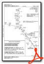
Standard Terminal Arrival (STAR) Charts

Nearby Airports with Instrument Procedures
| ID | Name | Heading / Distance | ||
|---|---|---|---|---|
 |
KPGD | Punta Gorda Airport | 074° | 14.6 |
|
KVNC | Venice Municipal Airport | 322° | 16.4 |
|
KFMY | Page Field Airport | 127° | 26.3 |
|
X06 | Arcadia Municipal Airport | 047° | 30.2 |
|
KRSW | Southwest Florida International Airport | 125° | 32.8 |
|
KSRQ | Sarasota/Bradenton International Airport | 333° | 36.2 |
|
KCHN | Wauchula Municipal Airport | 026° | 44.3 |
|
X14 | La Belle Municipal Airport | 098° | 44.8 |
|
KAPF | Naples Municipal Airport | 148° | 49.2 |
|
KIMM | Immokalee Regional Airport | 118° | 52.3 |
|
KSPG | Albert Whitted Airport | 339° | 58.1 |
|
KAVO | Avon Park Exec Airport | 041° | 58.7 |
Airport Images
Do you have a recent image of this airport? Upload it here!


