Login
Register


IMM
Immokalee Regional Airport
Official FAA Data Effective 2026-01-22 0901Z
Chart Supplement

VFR Chart of KIMM
Sectional Charts at SkyVector.com
IFR Chart of KIMM
Enroute Charts at SkyVector.com
Location Information for KIMM
Coordinates: N26°26.02' / W81°24.03'Located 01 miles NE of Immokalee, Florida on 1330 acres of land. View all Airports in Florida.
Surveyed Elevation is 37 feet MSL.
Operations Data
|
|
Airport Communications
| AWOS-3: | 118.525 Tel. 239-657-2038 |
|---|---|
| FORT MYERS APPROACH: | 124.125 371.85 |
| FORT MYERS DEPARTURE: | 124.125 371.85 |
| CTAF: | 122.900 |
| D-ATIS at RSW (20.0 W): | 124.65 |
| ASOS at RSW (20.1 W): | 124.65 239-416-1031 |
| AWOS-3PT at 2IS (26.2 NE): | 124.175 863-983-7020 |
- APCH/DEP SVC PRVDD BY MIAMI ARTCC ON FREQS 134.75/322.5(FORT MYERS RCAG) WHEN FORT MYERS APCH CTL CLSD.
Nearby Navigation Aids
|
| ||||||||||||||||||||||||||||||||||||||||||||||||


Runway 09/27
| Dimensions: | 5000 x 100 feet / 1524 x 30 meters | |
|---|---|---|
| Surface: | Asphalt in Good Condition | |
| Weight Limits: | 23 /F/A/X/T, S-68, D-97, ST-110 | |
| Edge Lighting: | Medium Intensity | |
| Runway 09 | Runway 27 | |
| Coordinates: | N26°26.22' / W81°24.24' | N26°26.25' / W81°23.33' |
| Elevation: | 37.1 | 34.0 |
| Traffic Pattern: | Left | Left |
| Runway Heading: | 89° True | 269° True |
| Markings: | Non-Precision Instrument in fair condition. | Non-Precision Instrument in fair condition. |
| Glide Slope Indicator | P4L (3.00° Glide Path Angle) | P4L (3.00° Glide Path Angle) |
| REIL: | Yes | Yes |
| Obstacles: | 21 ft Trees 920 ft from runway, 285 ft left of center | 12 ft Trees 695 ft from runway, 250 ft right of center |
Runway 18/36
| Dimensions: | 4550 x 150 feet / 1387 x 46 meters | |
|---|---|---|
| Surface: | Asphalt in Excellent Condition | |
| Weight Limits: | 8 /F/B/Y/T, S-27, D-42, ST-90 | |
| Edge Lighting: | Medium Intensity | |
| Runway 18 | Runway 36 | |
| Coordinates: | N26°26.16' / W81°24.31' | N26°25.41' / W81°24.28' |
| Elevation: | 35.9 | 33.3 |
| Traffic Pattern: | Left | Left |
| Runway Heading: | 178° True | 358° True |
| Markings: | Non-Precision Instrument in good condition. | Non-Precision Instrument in good condition. |
| Glide Slope Indicator | P4L (3.00° Glide Path Angle) | P4L (3.00° Glide Path Angle) |
| REIL: | Yes | Yes |
| Obstacles: | 19 ft Trees 900 ft from runway, 225 ft left of center | 42 ft Tree 1875 ft from runway, 225 ft right of center |
Services Available
| Fuel: | 100LL (blue), Jet-A, Jet A+ |
|---|---|
| Transient Storage: | Hangars,Tiedowns |
| Airframe Repair: | MINOR |
| Engine Repair: | MINOR |
| Bottled Oxygen: | NONE |
| Bulk Oxygen: | NONE |
| Other Services: | CROP DUSTING SERVICES,CHARTER SERVICE,GLIDER SERVICE |
Ownership Information
| Ownership: | Publicly owned | |
|---|---|---|
| Owner: | COLLIER COUNTY AIRPORT AUTHORITY | |
| 2005 MAINSAIL DR., SUITE 1 | ||
| NAPLES, FL 34114 | ||
| 239-252-8400 | ||
| Manager: | BRYANT GARRETT | ALT CTC: SPENCER BRILLON (239) 252-8393 |
| 165 AIRPARK BLVD | ||
| IMMOKALEE, FL 34142 | ||
| 239-252-8425 | ||
Other Remarks
- CROP DUSTING ACTVTY DURG DALGT HRS.
- WILDLIFE, BANNER TOWING & ULTRALIGHT ACTVTY ON AND INVOF ARPT.
- AFT HR SVC - AMGR.
- FOR CD CTC FORT MYERS APCH AT 239-416-1026, WHEN APCH CLSD CTC MIAMI ARTCC AT 305-716-1731.
- 0LL CREDIT CARD FUEL AVBL H24.
- ACTVT REIL RWY 9, 27, 18, & 36; MIRL RWY 09/27 & 18/36 - CTAF.
Weather Minimums

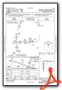
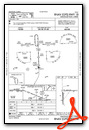
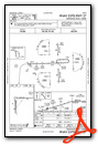
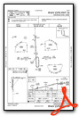
Instrument Approach Procedure (IAP) Charts
Nearby Airports with Instrument Procedures
| ID | Name | Heading / Distance | ||
|---|---|---|---|---|
 |
X14 | La Belle Municipal Airport | 355° | 18.4 |
|
KRSW | Southwest Florida International Airport | 287° | 20.1 |
|
2IS | Airglades Airport | 046° | 26.0 |
|
KAPF | Naples Municipal Airport | 230° | 26.3 |
|
KFMY | Page Field Airport | 290° | 26.5 |
|
KMKY | Marco Island Exec Airport | 209° | 30.1 |
|
KPGD | Punta Gorda Airport | 312° | 43.0 |
|
KPHK | Palm Beach County Glades Airport | 060° | 43.4 |
|
KTNT | Dade-Collier Training and Transition Airport | 141° | 43.7 |
|
X06 | Arcadia Municipal Airport | 332° | 51.3 |
|
FA54 | Coral Creek Airport | 298° | 52.3 |
|
KOBE | Okeechobee County Airport | 030° | 57.9 |
Airport Images
Do you have a recent image of this airport? Upload it here!


