Login
Register


FOT
Rohnerville Airport
Official FAA Data Effective 2026-02-19 0901Z
Chart Supplement

VFR Chart of KFOT
Sectional Charts at SkyVector.com
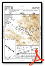
IFR Chart of KFOT
Enroute Charts at SkyVector.com
Location Information for KFOT
Coordinates: N40°33.24' / W124°7.96'Located 03 miles SE of Fortuna, California on 541 acres of land. View all Airports in California.
Surveyed Elevation is 392 feet MSL.
Operations Data
|
|
Airport Communications
| AWOS-3: | 133.8 Tel. 707-725-2909 |
|---|---|
| CTAF: | 122.900 |
| ASOS at ACV (25.6 N): | 118.525 707-839-7429 |
| AWOS-2 at O16 (31.7 SE): | 133.0 707-923-4291 |
| AWOS-3 at O54 (56.3 E): | 120.850 530-623-3810 |
- APCH/DEP CTL SVC PRVDD BY SEATTLE ARTCC (ZSE) ON FREQS 124.85/306.3 (ARCATA RCAG).
- COMMUNICATIONS PRVDD BY OAKLAND RADIO ON FREQ 122.3 (CRESCENT CITY RCO).
Nearby Navigation Aids
|
| ||||||||||||||||||||||||||||||||||||


Runway 11/29
| Dimensions: | 4004 x 100 feet / 1220 x 30 meters | |
|---|---|---|
| Surface: | Asphalt in Fair Condition | |
| Weight Limits: | S-30 | |
| Edge Lighting: | Medium Intensity | |
| Runway 11 | Runway 29 | |
| Coordinates: | N40°33.44' / W124°8.30' | N40°33.04' / W124°7.62' |
| Elevation: | 340.5 | 392.7 |
| Traffic Pattern: | Right | Left |
| Runway Heading: | 127° True | 307° True |
| Markings: | Non-Precision Instrument in fair condition. | Non-Precision Instrument in fair condition. |
| Glide Slope Indicator | V4R (3.00° Glide Path Angle) | |
| REIL: | Yes | Yes |
Services Available
| Fuel: | 100LL (blue) |
|---|---|
| Transient Storage: | Tiedowns |
| Airframe Repair: | NOT AVAILABLE |
| Engine Repair: | NOT AVAILABLE |
| Bottled Oxygen: | NONE |
| Bulk Oxygen: | NONE |
Ownership Information
| Ownership: | Publicly owned | |
|---|---|---|
| Owner: | HUMBOLDT COUNTY | |
| 1106 2ND ST | ||
| EUREKA, CA 95501 | ||
| 707-839-5401 | ||
| Manager: | JUSTIN HOPMAN | ARPT MANAGER LOCATED AT CA REDWOOD COAST-HUMBOLDT COUNTY ARPT. |
| 3561 BOEING AVE. | ||
| MCKINLEYVILLE, CA 95519 | ||
| 707-382-2551 | ||
Other Remarks
- USFS AND CDF FIRE RETARDENT STATION.
- DEER INVOF OF RYS.
- FOR CD CTC SEATTLE ARTCC AT 253-351-3694.
- ACTVT REIL RWY 11 & 29; MIRL RWY 11/29 - CTAF.
- DUSK-DAWN
Weather Minimums
Instrument Approach Procedure (IAP) Charts

Nearby Airports with Instrument Procedures
| ID | Name | Heading / Distance | ||
|---|---|---|---|---|
 |
KEKA | Murray Field Airport | 003° | 15.0 |
|
KACV | California Redwood Coast-Humboldt County Airport | 002° | 25.4 |
|
KCEC | Jack Mc Namara Field Airport | 356° | 73.7 |
|
O28 | Ells Field/Willits Municipal Airport | 151° | 74.8 |
|
O85 | Benton Field Airport | 088° | 78.9 |
|
KLLR | Little River Airport | 167° | 79.4 |
|
KRDD | Redding Regional Airport | 091° | 84.2 |
|
KRBL | Red Bluff Municipal Airport | 105° | 89.6 |
|
KBOK | Brookings Airport | 355° | 91.4 |
|
O46 | Weed Airport | 053° | 94.3 |
|
KUKI | Ukiah Municipal Airport | 152° | 95.8 |
|
O37 | Haigh Field Airport | 118° | 104.2 |
Airport Images
Do you have a recent image of this airport? Upload it here!


