Login
Register


GCD
Grant County Regional/Ogilvie Field Airport
Official FAA Data Effective 2026-02-19 0901Z
Chart Supplement

KGCD Airport Diagram

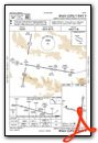
VFR Chart of KGCD
Sectional Charts at SkyVector.com
IFR Chart of KGCD
Enroute Charts at SkyVector.com
Location Information for KGCD
Coordinates: N44°24.18' / W118°58.06'Located 01 miles SW of John Day, Oregon on 335 acres of land. View all Airports in Oregon.
Surveyed Elevation is 3702 feet MSL.
Operations Data
|
|
Airport Communications
| AWOS-3: | 118.375 Tel. 541-575-1122 |
|---|---|
| CTAF: | 122.800 |
| UNICOM: | 122.800 |
| ASOS at BNO (48.5 S): | 135.575 541-573-1382 |
| ASOS at BKE (56.0 NE): | 134.275 541-523-5412 |
| AWOS-3PT at LGD (67.1 NE): | 135.075 541-963-6824 |
- APCH/DEP CTL SVC PRVDD BY SEATTLE ARTCC (ZSE) ON FREQS 128.15/257.75 (REDMOND RCAG).
Nearby Navigation Aids
|
| ||||||||||||||||||||||||||||||||||||


Runway 17/35
| Dimensions: | 5224 x 75 feet / 1592 x 23 meters | |
|---|---|---|
| Surface: | Asphalt in Good Condition | |
| Weight Limits: | S-12 | |
| Edge Lighting: | Medium Intensity | |
| Runway 17 | Runway 35 | |
| Coordinates: | N44°24.65' / W118°57.77' | N44°23.80' / W118°57.86' |
| Elevation: | 3675.0 | 3702.5 |
| Traffic Pattern: | Left | Left |
| Runway Heading: | 184° True | 4° True |
| Markings: | Basic in fair condition. | Basic in fair condition. |
| Glide Slope Indicator | P2L (3.50° Glide Path Angle) | |
| REIL: | Yes | |
Runway 09/27
| Dimensions: | 4100 x 60 feet / 1250 x 18 meters | |
|---|---|---|
| Surface: | Asphalt in Good Condition | |
| Weight Limits: | S-12 | |
| Edge Lighting: | Medium Intensity | |
| Runway 09 | Runway 27 | |
| Coordinates: | N44°24.24' / W118°58.81' | N44°24.01' / W118°57.93' |
| Elevation: | 3646.8 | 3688.8 |
| Traffic Pattern: | Left | Right |
| Runway Heading: | 110° True | 290° True |
| Markings: | Non-Precision Instrument in good condition. | Basic in good condition. |
| Glide Slope Indicator | P4L (3.00° Glide Path Angle) | |
| REIL: | Yes | |
| Obstacles: | 10 ft Fence 333 ft from runway | |
Helipad H1
| Dimensions: | 30 x 30 feet / 9 x 9 meters | |
|---|---|---|
| Surface: | Concrete | |
| Coordinates: | N44°24.12' / W118°57.73' | N0°0.00' / E0°0.00' |
| Elevation: | 3690.0 | |
Helipad H2
| Dimensions: | 20 x 20 feet / 6 x 6 meters | |
|---|---|---|
| Surface: | Concrete | |
| Coordinates: | N44°24.10' / W118°57.73' | N0°0.00' / E0°0.00' |
| Elevation: | 3689.0 | |
Helipad H3
| Dimensions: | 20 x 20 feet / 6 x 6 meters | |
|---|---|---|
| Surface: | Concrete | |
| Coordinates: | N44°24.07' / W118°57.73' | N0°0.00' / E0°0.00' |
| Elevation: | 3631.4 | |
Services Available
| Fuel: | 100LL (blue), Jet-A |
|---|---|
| Transient Storage: | Tiedowns |
| Airframe Repair: | NOT AVAILABLE |
| Engine Repair: | NOT AVAILABLE |
| Bottled Oxygen: | NOT AVAILABLE |
| Bulk Oxygen: | NOT AVAILABLE |
Ownership Information
| Ownership: | Publicly owned | |
|---|---|---|
| Owner: | GRANT COUNTY REGIONAL AIRPORT | |
| , 201 S. HUMBOLT, STE. 280 | ||
| CANYON CITY, OR 97820 | ||
| 541-575-1151 | ||
| Manager: | HALEY WALKER | |
| 72000 AIRPORT ROAD | ||
| JOHN DAY, OR 97845 | ||
| 541-575-1151 | ||
Other Remarks
- SOFT EDGES ALG RWYS & TWYS. TWYS MKD WITH REFLECTORS.
- 8 FT FENCE ARND ARPT.
- HEL ACT JUL-OCT.
- FOR CD CTC SEATTLE ARTCC AT 253-351-3694.
- AFT HR SELF SVC FUEL AVBL.
- PLUS AIMING POINT.
- PLUS AIMING POINT.
- ACTVT REIL RWY 09 & 17; PAPI RWY 09; MIRL RWY 09/27 & 17/35 - CTAF. PAPI RWY 17 ON CONSLY.
Weather Minimums


Instrument Approach Procedure (IAP) Charts

Nearby Airports with Instrument Procedures
| ID | Name | Heading / Distance | ||
|---|---|---|---|---|
 |
KBNO | Burns Municipal Airport | 179° | 48.7 |
|
KBKE | Baker City Municipal Airport | 061° | 56.1 |
|
KLGD | La Grande/Union County Airport | 037° | 67.2 |
|
9S9 | Lexington Airport | 334° | 70.2 |
|
KPDT | Eastern Oregon Regional At Pendleton Airport | 003° | 77.7 |
|
S39 | Prineville Airport | 265° | 83.7 |
|
KHRI | Hermiston Municipal Airport | 351° | 86.4 |
|
S87 | Weiser Municipal Airport | 097° | 87.3 |
|
KONO | Ontario Municipal Airport | 104° | 87.4 |
|
KJSY | Joseph State Airport | 051° | 92.9 |
|
KRDM | Roberts Field Airport | 265° | 94.4 |
|
S33 | Madras Municipal Airport | 280° | 95.2 |