Login
Register


HJO
Hanford Municipal Airport
Official FAA Data Effective 2026-01-22 0901Z
Chart Supplement

VFR Chart of KHJO
Sectional Charts at SkyVector.com
IFR Chart of KHJO
Enroute Charts at SkyVector.com
Location Information for KHJO
Coordinates: N36°19.00' / W119°37.66'Located 01 miles SE of Hanford, California on 132 acres of land. View all Airports in California.
Estimated Elevation is 239 feet MSL.
Operations Data
|
|
Airport Communications
| ASOS: | 134.75 Tel. 559-585-8076 |
|---|---|
| FRESNO APPROACH: | 123.9 |
| FRESNO DEPARTURE: | 123.9 |
| CLEARANCE DELIVERY: | 123.9 |
| CTAF: | 122.800 |
| UNICOM: | 122.800 |
| AWOS-3PT at VIS (11.6 E): | 119.925 559-651-2418 |
| AWOS-3 at NLC (15.1 W): | 121.575 559-998-2336 |
| ATIS at NLC (15.7 W): | 121.575 |
Nearby Navigation Aids
|
| ||||||||||||||||||||||||||||||||||||||||||||||||


Runway 14/32
| Dimensions: | 5179 x 75 feet / 1579 x 23 meters | |
|---|---|---|
| Surface: | Asphalt in Good Condition | |
| Weight Limits: | S-30, D-45 | |
| Edge Lighting: | Medium Intensity | |
| Runway 14 | Runway 32 | |
| Coordinates: | N36°19.38' / W119°37.91' | N36°18.63' / W119°37.41' |
| Elevation: | 239.5 | 237.5 |
| Traffic Pattern: | Left | Right |
| Runway Heading: | 151° True | 331° True |
| Markings: | Basic in good condition. | Non-Precision Instrument in good condition. |
| Glide Slope Indicator | P4R (4.00° Glide Path Angle) | P4L (3.00° Glide Path Angle) PAPI RY 32 UNUSBL BYD 2 NM. |
| REIL: | Yes | |
| Obstacles: | 17 ft Road 245 ft from runway | |
Services Available
| Fuel: | 100LL (blue) |
|---|---|
| Transient Storage: | Tiedowns |
| Airframe Repair: | MAJOR |
| Engine Repair: | MINOR |
| Bottled Oxygen: | HIGH/LOW |
| Bulk Oxygen: | NONE |
| Other Services: | CHARTER SERVICE,PILOT INSTRUCTION,AIRCRAFT SALES |
Ownership Information
| Ownership: | Publicly owned | |
|---|---|---|
| Owner: | CITY OF HANFORD | |
| 315 N DOUTY ST | ||
| HANFORD, CA 93230 | ||
| 559-585-2516 | ||
| Manager: | BOB LOOGMAN | |
| 900 SOUTH 10TH AVENUE | ||
| HANFORD, CA 93230 | ||
| 559-585-2589 | ||
Other Remarks
- FOR CD CTC FRESNO APCH AT 559-454-9805.
- 0LL FUEL SELF-SERVICE AVBL 24 HRS.
- AFTER DARK ACTVT REIL RWY 32; MIRL RWY 14/32 - CTAF.
Weather Minimums

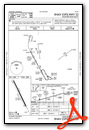
Instrument Approach Procedure (IAP) Charts

Nearby Airports with Instrument Procedures
| ID | Name | Heading / Distance | ||
|---|---|---|---|---|
 |
KVIS | Visalia Municipal Airport | 089° | 11.4 |
|
KTLR | Mefford Field Airport | 123° | 17.5 |
|
O32 | Reedley Municipal Airport | 021° | 22.9 |
|
KFCH | Fresno Chandler Exec Airport | 339° | 26.6 |
|
KFAT | Fresno Yosemite International Airport | 350° | 27.9 |
|
KPTV | Porterville Municipal Airport | 121° | 32.4 |
|
C80 | New Coalinga Municipal Airport | 254° | 33.7 |
|
KDLO | Delano Municipal Airport | 150° | 39.2 |
|
KMAE | Madera Municipal Airport | 329° | 46.6 |
|
F34 | Firebaugh Airport | 309° | 51.9 |
|
KMIT | Shafter-Minter Field Airport | 156° | 52.9 |
|
KBFL | Meadows Field Airport | 152° | 59.8 |


