Login
Register


JAU
Colonel Tommy C Stiner Airfield Airport
Official FAA Data Effective 2025-11-27 0901Z
Chart Supplement

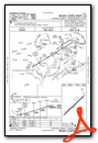
VFR Chart of KJAU
Sectional Charts at SkyVector.com
IFR Chart of KJAU
Enroute Charts at SkyVector.com
Location Information for KJAU
Coordinates: N36°20.05' / W84°9.78'Located 01 miles E of Jacksboro, Tennessee on 84 acres of land. View all Airports in Tennessee.
Surveyed Elevation is 1179 feet MSL.
Operations Data
|
|
Airport Communications
| AWOS-3: | 124.975 Tel. 423-566-6474 |
|---|---|
| UNICOM: | 122.800 |
| CTAF: | 122.800 |
| AWOS-3 at SCX (21.6 W): | 135.025 423-569-6651 |
| AWOS-3 at DKX (26.2 SE): | 125.375 865-579-6151 |
| AWOS-3 at 1A6 (26.4 NE): | 119.425 606-248-3095 |
- APCH/DEP SVC PRVDD BY ATLANTA ARTCC ON FREQS 133.6/254.3 (HINCH MOUNTAIN RCAG).
Nearby Navigation Aids
|
| ||||||||||||||||||||||||||||||||||||||||||||||||||||||||||||


Runway 05/23
| Dimensions: | 4000 x 75 feet / 1219 x 23 meters | |
|---|---|---|
| Surface: | Asphalt in Good Condition | |
| Weight Limits: | S-25 | |
| Edge Lighting: | Medium Intensity | |
| Runway 05 | Runway 23 | |
| Coordinates: | N36°19.81' / W84°10.07' | N36°20.28' / W84°9.49' |
| Elevation: | 1133.7 | 1179.9 |
| Traffic Pattern: | Left | Left |
| Runway Heading: | 46° True | 226° True |
| Markings: | Basic in good condition. | Basic in good condition. |
| Glide Slope Indicator | P2L (3.00° Glide Path Angle) | P2L (3.00° Glide Path Angle) |
| REIL: | Yes | Yes |
| Obstacles: | 28 ft Trees 630 ft from runway, 111 ft left of center | 9 ft Trees 318 ft from runway, 81 ft left of center |
Services Available
| Fuel: | 100LL (blue), Jet-A |
|---|---|
| Transient Storage: | Hangars,Tiedowns |
| Airframe Repair: | NOT AVAILABLE |
| Engine Repair: | NOT AVAILABLE |
| Bottled Oxygen: | NOT AVAILABLE |
| Bulk Oxygen: | NOT AVAILABLE |
Ownership Information
| Ownership: | Publicly owned | |
|---|---|---|
| Owner: | CAMPBELL COUNTY | |
| COUNTY COURTHOUSE, PO BOX 435 | ||
| JACKSBORO, TN 37757 | ||
| 423-562-2526 | ||
| Manager: | BERT LOUPE | |
| 610 MEMORIAL LANE | ||
| JACKSBORO, TN 37757 | ||
| 423-562-9966 | ||
Other Remarks
- HIGH TRRN S-NE.
- DEER & COYOTE ON RWY.
- FOR CD CTC ATLANTA ARTCC AT 770-210-7692.
- ACTVT REIL RWY 5 & 23; MIRL RWY 5/23 - CTAF. PAPI RWY 05 & 23 ON CONSLY.
Weather Minimums
Instrument Approach Procedure (IAP) Charts
Nearby Airports with Instrument Procedures
| ID | Name | Heading / Distance | ||
|---|---|---|---|---|
 |
KSCX | Scott Municipal Airport | 289° | 21.7 |
|
18I | Mc Creary County Airport | 333° | 24.3 |
|
KDKX | Knoxville Downtown Island Airport | 147° | 26.3 |
|
1A6 | Middlesboro/Bell County Airport | 051° | 26.4 |
|
KBYL | Williamsburg-Whitley County Airport | 356° | 27.7 |
|
3A2 | New Tazewell Municipal Airport | 081° | 29.7 |
|
KTYS | Mc Ghee Tyson Airport | 165° | 32.4 |
|
KRKW | Rockwood Municipal Airport | 226° | 35.6 |
|
2A1 | Jamestown Municipal Airport | 271° | 38.0 |
|
KMOR | Moore-Murrell Airport | 103° | 39.3 |
|
KGKT | Gatlinburg-Pigeon Forge Airport | 132° | 42.0 |
|
KLOZ | London/Corbin/Magee Airport | 005° | 45.3 |
Airport Images
Do you have a recent image of this airport? Upload it here!


