Login
Register


K81
Miami County Airport
Official FAA Data Effective 2026-01-22 0901Z
Chart Supplement

VFR Chart of K81
Sectional Charts at SkyVector.com
IFR Chart of K81
Enroute Charts at SkyVector.com
Location Information for K81
Coordinates: N38°32.44' / W94°55.21'Located 03 miles SW of Paola, Kansas on 230 acres of land. View all Airports in Kansas.
Surveyed Elevation is 943 feet MSL.
Operations Data
|
|
Airport Communications
| KANSAS CITY APPROACH: | 118.9 251.075 |
|---|---|
| KANSAS CITY DEPARTURE: | 118.9 251.075 |
| UNICOM: | 122.800 |
| CTAF: | 122.800 |
| AWOS-3PT at OWI (15.7 W): | 118.25 785-242-2185 |
| ASOS at IXD (17.5 N): | 135.325 913-780-6987 |
| ATIS at OJC (20.3 NE): | 119.35 |
Nearby Navigation Aids
|
| ||||||||||||||||||||||||||||||||||||||||||||||||||||||||||||


Runway 03/21
| Dimensions: | 3398 x 60 feet / 1036 x 18 meters | |
|---|---|---|
| Surface: | Asphalt in Good Condition | |
| Weight Limits: | 8 /F/D/Y/U | |
| Edge Lighting: | Medium Intensity | |
| Runway 03 | Runway 21 | |
| Coordinates: | N38°32.25' / W94°55.39' | N38°32.69' / W94°54.95' |
| Elevation: | 938.8 | 940.7 |
| Traffic Pattern: | Left | Left |
| Runway Heading: | 38° True | 218° True |
| Markings: | Non-Precision Instrument in good condition. | Non-Precision Instrument in good condition. |
| Glide Slope Indicator | P2L (3.40° Glide Path Angle) | P2L (3.00° Glide Path Angle) |
| REIL: | Yes | Yes |
| Obstacles: | 70 ft Trees 1600 ft from runway, 26 ft left of center | 65 ft Tree 1850 ft from runway, 295 ft right of center |
Runway 15/33
| Dimensions: | 1940 x 60 feet / 591 x 18 meters | |
|---|---|---|
| Surface: | Turf in Fair Condition | |
| Runway 15 | Runway 33 | |
| Coordinates: | N38°32.53' / W94°55.38' | N38°32.24' / W94°55.19' |
| Elevation: | 925.9 | 941.0 |
| Traffic Pattern: | Left | Left |
| Runway Heading: | 153° True | 333° True |
| Obstacles: | 33 ft Power Line 90 ft from runway, 135 ft right of center | |
Services Available
| Fuel: | 100LL (blue) |
|---|---|
| Transient Storage: | Tiedowns |
| Airframe Repair: | MAJOR |
| Engine Repair: | MAJOR |
| Bottled Oxygen: | NONE |
| Bulk Oxygen: | NONE |
| Other Services: | PILOT INSTRUCTION |
Ownership Information
| Ownership: | Publicly owned | |
|---|---|---|
| Owner: | MIAMI COUNTY | SHANE KRULL, CO. ADMIN. |
| 201 S. PEARL | ||
| PAOLA, KS 66071 | ||
| 913-294-9500 | ||
| Manager: | CHARLES BARTLETT | CHASBART@EMBARQMAIL.COM |
| 32549 W 327TH ST | ||
| PAOLA, KS 66071 | ||
| 913-594-0978 | ||
Other Remarks
- FOR CD CTC KANSAS CITY APCH AT 816-329-2710.
- 0LL FUEL 24 HRS SELF-SERV.
- ACTVT REIL RWY 03 & 21; PAPI RWY 03 & 21, MIRL RWY 03/21 - CTAF.
- DUSK-2400
Weather Minimums

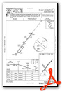
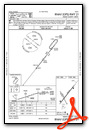
Instrument Approach Procedure (IAP) Charts
Nearby Airports with Instrument Procedures
| ID | Name | Heading / Distance | ||
|---|---|---|---|---|
 |
KOWI | Ottawa Municipal Airport | 269° | 15.7 |
|
KIXD | New Century Aircenter Airport | 004° | 17.5 |
|
KOJC | Johnson County Exec Airport | 024° | 20.3 |
|
KLRY | Lawrence Smith Memorial Airport | 081° | 27.5 |
|
KBUM | Butler Memorial Airport | 118° | 31.2 |
|
KLWC | Lawrence Regional Airport | 333° | 31.4 |
|
KLXT | Kansas City/Lee's Summit Regional Airport | 045° | 35.9 |
|
KMKC | Kansas City Downtown/Wheeler Field Airport | 023° | 38.1 |
|
KUKL | Coffey County Airport | 249° | 40.5 |
|
KFOE | Topeka Regional Airport | 305° | 42.7 |
|
3GV | East Kansas City Airport | 049° | 43.6 |
|
KFSK | Fort Scott Municipal Airport | 170° | 45.1 |
Airport Images
Do you have a recent image of this airport? Upload it here!


