Login
Register
OWI
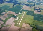
Ottawa Municipal Airport
Official FAA Data Effective 2025-12-25 0901Z
VFR Chart of KOWI
Sectional Charts at SkyVector.com
IFR Chart of KOWI
Enroute Charts at SkyVector.com
Location Information for KOWI
Coordinates: N38°32.35' / W95°15.19'Located 04 miles S of Ottawa, Kansas on 352 acres of land. View all Airports in Kansas.
Surveyed Elevation is 966 feet MSL.
Operations Data
|
|
Airport Communications
| AWOS-3PT: | 118.25 Tel. 785-242-2185 |
|---|---|
| CTAF: | 122.800 |
| UNICOM: | 122.800 |
| ASOS at IXD (24.4 NE): | 135.325 913-780-6987 |
| AWOS-3PT at UKL (26.2 SW): | 121.125 620-364-2435 |
| ASOS at LWC (28.4 N): | 121.225 785-749-1309 |
- APCH/DEP CTL SVC PRVDD BY KANSAS CITY ARTCC (ZKC) ON FREQS 127.725/270.25 (EMPORIA RCAG).
Nearby Navigation Aids
|
| ||||||||||||||||||||||||||||||||||||||||||||||||||||||||||||
Runway 17/35
| Dimensions: | 4500 x 75 feet / 1372 x 23 meters | |
|---|---|---|
| Surface: | Concrete in Good Condition | |
| Weight Limits: | 11 /R/C/X/U, S-30, D-30 | |
| Edge Lighting: | Medium Intensity | |
| Runway 17 | Runway 35 | |
| Coordinates: | N38°32.74' / W95°15.15' | N38°32.00' / W95°15.14' |
| Elevation: | 964.4 | 964.1 |
| Traffic Pattern: | Right | Left |
| Runway Heading: | 180° True | 360° True |
| Markings: | Non-Precision Instrument in good condition. | Non-Precision Instrument in good condition. |
| Glide Slope Indicator | P2L (3.25° Glide Path Angle) | P2L (3.25° Glide Path Angle) |
| REIL: | Yes | Yes |
| Obstacles: | 65 ft Tree 1171 ft from runway, 462 ft right of center | |
Runway 13/31
| Dimensions: | 1550 x 95 feet / 472 x 29 meters | |
|---|---|---|
| Surface: | Turf in Good Condition | |
| Runway 13 | Runway 31 | |
| Coordinates: | N38°32.38' / W95°15.45' | N38°32.22' / W95°15.21' |
| Elevation: | 963.1 | 957.4 |
| Traffic Pattern: | Right | Left |
| Runway Heading: | 131° True | 311° True |
| Obstacles: | 22 ft Tree 778 ft from runway, 21 ft right of center | 44 ft Pole 1089 ft from runway, 11 ft right of center |
Services Available
| Fuel: | 100LL (blue), Jet-A |
|---|---|
| Transient Storage: | Hangars,Tiedowns |
| Airframe Repair: | NONE |
| Engine Repair: | NONE |
| Bottled Oxygen: | NONE |
| Bulk Oxygen: | NONE |
| Other Services: | GLIDER SERVICE,PILOT INSTRUCTION,AIRCRAFT SALES,ANNUAL SURVEYING |
Ownership Information
| Ownership: | Publicly owned | |
|---|---|---|
| Owner: | CITY OF OTTAWA | |
| POST OFFICE BOX 60 | ||
| OTTAWA, KS 66067 | ||
| 785-229-3630 | ||
| Manager: | JIM REEDER | |
| 2178 MONTANA RD | ||
| OTTAWA, KS 66067 | ||
| 785-242-5310 | AMGR CELL 785-418-5271. | |
Other Remarks
- ULTRALIGHT ACTIVITY ON & INVOF ARPT.
- FBO SVCS NOT AVBL EASTER, THANKSGIVING AND CHRISTMAS DAY.
- 75 FT POLES 1700 FT N OF AER 17 MKD W/RED LGTS. PLINE MKD W/RED BALLS.
- WILDLIFE ON & INVOF ARPT
- FOR CD CTC KANSAS CITY ARTCC AT 913-254-8508.
- TWY AND HOLD LINE MKGS POOR.
- RWY 13/31 MKD WITH WHITE BUCKETS.
- ACTVT REILS RWY 17 & 35; PAPI RWY 17 & 35 - CTAF. MIRL RWY 17/35 PRESET ON LOW INTST TO INCR INTST - CTAF.
Weather Minimums
Instrument Approach Procedure (IAP) Charts
Nearby Airports with Instrument Procedures
| ID | Name | Heading / Distance | ||
|---|---|---|---|---|
 |
K81 | Miami County Airport | 089° | 15.7 |
 |
KIXD | New Century Aircenter Airport | 044° | 24.4 |
 |
KUKL | Coffey County Airport | 237° | 26.4 |
 |
KLWC | Lawrence Regional Airport | 003° | 28.3 |
 |
KOJC | Johnson County Exec Airport | 052° | 30.5 |
 |
KFOE | Topeka Regional Airport | 322° | 31.3 |
 |
KTOP | Philip Billard Municipal Airport | 331° | 36.2 |
 |
K88 | Allen County Airport | 188° | 40.7 |
 |
KLRY | Lawrence Smith Memorial Airport | 084° | 43.0 |
 |
KBUM | Butler Memorial Airport | 108° | 45.6 |
 |
KEMP | Emporia Municipal Airport | 254° | 45.9 |
 |
KMKC | Kansas City Downtown/Wheeler Field Airport | 041° | 46.7 |


