Login
Register


BPT
Jack Brooks Regional Airport
Official FAA Data Effective 2025-11-27 0901Z
Chart Supplement

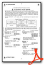
KBPT Airport Diagram

VFR Chart of KBPT
Sectional Charts at SkyVector.com
IFR Chart of KBPT
Enroute Charts at SkyVector.com
Location Information for KBPT
Coordinates: N29°57.05' / W94°1.24'Located 09 miles SE of Beaumont/Port Arthur, Texas on 1799 acres of land. View all Airports in Texas.
Surveyed Elevation is 14 feet MSL.
Operations Data
|
|
Airport Communications
| ATIS: | 126.3 |
|---|---|
| ASOS: | 126.3 Tel. 409-223-4011 |
| BEAUMONT TOWER: | 119.5 |
| BEAUMONT GROUND: | 124.85 |
| HOUSTON APPROACH: | 121.3 377.1 |
| HOUSTON DEPARTURE: | 121.3 377.1 |
| CLEARANCE DELIVERY: | 118.3 |
| CTAF: | 119.500 |
| EMERG: | 121.5 243.0 |
| TRSA: | 121.3 377.1 |
| UNICOM: | 122.950 |
| AWOS-3PT at BMT (12.3 NW): | 118.425 409-866-2832 |
| AWOS-3 at ORG (13.3 NE): | 118.975 409-670-9591 |
| AWOS-3PT at UXL (35.2 E): | 118.175 337-558-5321 |
Nearby Navigation Aids
|
| ||||||||||||||||||||||||||||||||||||||||||||||||||||||||||||


Runway 12/30
| Dimensions: | 6751 x 150 feet / 2058 x 46 meters | |
|---|---|---|
| Surface: | Concrete / Grooved in Good Condition | |
| Weight Limits: | S-90, D-170, ST-230
PCR VALUE: 578/R/C/W/T
| |
| Edge Lighting: | High Intensity | |
| Runway 12 | Runway 30 | |
| Coordinates: | N29°57.32' / W94°1.67' | N29°56.75' / W94°0.57' |
| Elevation: | 14.4 | 5.8 |
| Traffic Pattern: | Left | Left |
| Runway Heading: | 121° True | 301° True |
| Declared Distances: | TORA:6751 TODA:6751 ASDA:6508 LDA:6508 | TORA:6751 TODA:6751 ASDA:6751 LDA:6751 |
| Markings: | Precision Instrument in good condition. | Precision Instrument in good condition. |
| Glide Slope Indicator | V4L (3.00° Glide Path Angle) | |
| RVR Equipment | Touchdown | Rollout |
| Approach Lights: | MALSR 1,400 Foot Medium-intensity Approach Lighting System with runway alignment indicator lights. | |
| REIL: | Yes | |
| Obstacles: | 46 ft Tree 1041 ft from runway, 618 ft right of center | 41 ft Tree 1024 ft from runway, 529 ft right of center |
Runway 16/34
| Dimensions: | 5071 x 150 feet / 1546 x 46 meters | |
|---|---|---|
| Surface: | Asphalt-Concrete / Grooved in Fair Condition FIRST 1000 FT RWY 16 MUCH DARKER THAN REMAINDER OF RWY. FIRST 4271 FT OF RWY 34 GRVD. | |
| Weight Limits: | S-70, D-90, ST-145
PCR VALUE: 172/R/D/W/T
| |
| Edge Lighting: | High Intensity | |
| Runway 16 | Runway 34 | |
| Coordinates: | N29°57.48' / W94°1.52' | N29°56.67' / W94°1.29' |
| Elevation: | 14.4 | 10.9 |
| Traffic Pattern: | Left | Left |
| Runway Heading: | 166° True | 346° True |
| Declared Distances: | TORA:5070 TODA:5070 ASDA:5070 LDA:5070 | TORA:5070 TODA:5070 ASDA:5070 LDA:5070 |
| Markings: | Non-Precision Instrument in good condition. | Non-Precision Instrument in good condition. |
| Glide Slope Indicator | P4R (3.00° Glide Path Angle) | V4L (3.00° Glide Path Angle) |
| REIL: | Yes | Yes |
Services Available
| Fuel: | 100LL (blue), Jet-A |
|---|---|
| Transient Storage: | Hangars,Tiedowns |
| Airframe Repair: | MINOR |
| Engine Repair: | MINOR |
| Bottled Oxygen: | NONE |
| Bulk Oxygen: | LOW |
| Other Services: | AIR FREIGHT SERVICES,CHARTER SERVICE,PILOT INSTRUCTION,AIRCRAFT RENTAL |
Ownership Information
| Ownership: | Publicly owned | |
|---|---|---|
| Owner: | JEFFERSON COUNTY | |
| 1149 PEARL ST 4TH FLOOR | ||
| BEAUMONT, TX 77701 | ||
| 409-835-8466 | ||
| Manager: | ALEX RUPP | |
| 5000 JERRY WARE DR SUITE 100 | ||
| BEAUMONT, TX 77705 | ||
| 409-719-4900 | ||
Other Remarks
- BIRD ACTVTY ON & INVOF ARPT.
- FOR CD WHEN ATCT IS CLSD CTC HOUSTON APCH AT 281-443-5844 TO CNL IFR AT 281-443-5888.
- DUSK-DAWN. WHEN ATCT CLSD REIL RWYS 16, 30 & 34; HIRL RWY 12/30 & 16/34 PRESET MED INTST. ACTVT MALSR RWY 12 - CTAF.
Weather Minimums

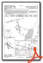
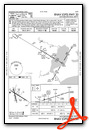
Instrument Approach Procedure (IAP) Charts


Nearby Airports with Instrument Procedures
| ID | Name | Heading / Distance | ||
|---|---|---|---|---|
 |
KBMT | Beaumont Municipal Airport | 305° | 12.4 |
|
KORG | Orange County Airport | 057° | 13.3 |
|
T90 | Chambers County/Winnie Stowell Airport | 249° | 22.8 |
|
45R | Hawthorne Field Airport | 331° | 26.2 |
|
T00 | Chambers County Airport | 252° | 35.2 |
|
KUXL | Southland Field Airport | 071° | 35.3 |
|
T78 | Liberty Municipal Airport | 282° | 36.1 |
|
5R8 | De Quincy Industrial Airpark Airport | 043° | 40.9 |
|
KLCH | Lake Charles Regional Airport | 075° | 42.8 |
|
54T | Rwj Airpark Airport | 255° | 44.6 |
|
KCWF | Chennault International Airport | 070° | 48.3 |
|
KHPY | Baytown Airport | 258° | 49.6 |
Airport Images
Do you have a recent image of this airport? Upload it here!


