Login
Register


DYR
Dyersburg Regional Airport
Official FAA Data Effective 2026-01-22 0901Z
Chart Supplement

VFR Chart of KDYR
Sectional Charts at SkyVector.com
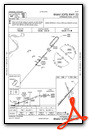
IFR Chart of KDYR
Enroute Charts at SkyVector.com
Location Information for KDYR
Coordinates: N35°59.88' / W89°24.39'Located 02 miles S of Dyersburg, Tennessee on 275 acres of land. View all Airports in Tennessee.
Surveyed Elevation is 337 feet MSL.
Operations Data
|
|
Airport Communications
| AWOS-3PT: | 135.625 Tel. 731-287-0300 |
|---|---|
| CTAF: | 123.050 |
| UNICOM: | 123.050 |
| ASOS at HKA (21.0 W): | 135.025 870-763-8206 |
| AWOS-3 at M04 (26.5 S): | 118.575 901-476-1705 |
| AWOS-3 at UCY (30.5 NE): | 135.325 731-885-9161 |
- APCH/DEP SVC PRVDD BY MEMPHIS ARTCC ON FREQS 134.65/316.15 (MCKELLAR RCAG).
Nearby Navigation Aids
|
| ||||||||||||||||||||||||||||||||||||||||||||||||||||||||||||


Runway 04/22
| Dimensions: | 5698 x 98 feet / 1737 x 30 meters | |
|---|---|---|
| Surface: | Asphalt in Good Condition | |
| Weight Limits: | 9 /F/D/X/T, S-24 | |
| Edge Lighting: | Medium Intensity | |
| Runway 04 | Runway 22 | |
| Coordinates: | N35°59.43' / W89°24.83' | N36°0.14' / W89°24.08' |
| Elevation: | 291.5 | 334.6 |
| Traffic Pattern: | Left | Left |
| Runway Heading: | 40° True | 221° True |
| Displaced Threshold: | 694 Feet | |
| Markings: | Non-Precision Instrument in good condition. | Non-Precision Instrument in good condition. |
| Glide Slope Indicator | P4L (3.00° Glide Path Angle) | P4L (3.00° Glide Path Angle) |
| REIL: | Yes | Yes |
| Obstacles: | 69 ft Tree 1471 ft from runway, 370 ft left of center | |
Runway 16/34
CLSD INDEFLY. | ||
| Dimensions: | 4001 x 74 feet / 1220 x 23 meters | |
|---|---|---|
| Surface: | Asphalt in Poor Condition | |
| Weight Limits: | S-50, D-75, ST-135 | |
| Runway 16 | Runway 34 | |
| Coordinates: | N36°0.33' / W89°24.43' | N35°59.70' / W89°24.18' |
| Elevation: | 337.7 | 325.3 |
| Traffic Pattern: | Left | Left |
| Runway Heading: | 162° True | 342° True |
| Markings: | Basic in fair condition. | Basic in fair condition. |
| Obstacles: | 27 ft Tree 947 ft from runway, 292 ft left of center | 78 ft Tree 816 ft from runway, 355 ft left of center |
Services Available
| Fuel: | 100LL (blue), Jet A+ |
|---|---|
| Transient Storage: | Hangars,Tiedowns |
| Airframe Repair: | NONE |
| Engine Repair: | NONE |
| Bottled Oxygen: | NONE |
| Bulk Oxygen: | NONE |
Ownership Information
| Ownership: | Publicly owned | |
|---|---|---|
| Owner: | CITY OF DYERSBURG | |
| CITY HALL, PO BOX 1358 | ||
| DYERSBURG, TN 38024 | ||
| (731) 288-7600 | ||
| Manager: | DIAN DAWSON | |
| 315 AIRPORT ROAD | ||
| DYERSBURG, TN 38024 | ||
| 731-445-3979 | ||
Other Remarks
- FOR CD CTC MEMPHIS ARTCC AT 901-368-8453/8449.
- ACTVT REIL RWY 04 & 22; MIRL RWY 04/22 - CTAF. PAPI RWY 04 & 22 ON CONSLY.
Weather Minimums


Instrument Approach Procedure (IAP) Charts

Nearby Airports with Instrument Procedures
| ID | Name | Heading / Distance | ||
|---|---|---|---|---|
 |
M05 | Caruthersville Memorial Airport | 308° | 16.7 |
|
KHKA | Blytheville Municipal Airport | 260° | 20.9 |
|
M12 | Steele Municipal Airport | 285° | 22.8 |
|
KBYH | Arkansas International Airport | 265° | 26.2 |
|
M04 | Covington Municipal Airport | 199° | 26.4 |
|
KTGC | Gibson County Airport | 098° | 27.4 |
|
M53 | Humboldt Municipal Airport | 114° | 28.4 |
|
KUCY | Everett-Stewart Regional Airport | 041° | 30.7 |
|
KTKX | Kennett Memorial Airport | 294° | 33.5 |
|
KEIW | County Memorial Airport | 343° | 33.5 |
|
KMKL | Jackson Regional Airport | 134° | 33.8 |
|
7M4 | Osceola Municipal Airport | 238° | 34.7 |
Airport Images
Do you have a recent image of this airport? Upload it here!


