Login
Register


EMM
Kemmerer Municipal Airport
Official FAA Data Effective 2026-01-22 0901Z
Chart Supplement

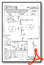
VFR Chart of KEMM
Sectional Charts at SkyVector.com
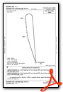
IFR Chart of KEMM
Enroute Charts at SkyVector.com
Location Information for KEMM
Coordinates: N41°49.44' / W110°33.42'Located 02 miles NW of Kemmerer, Wyoming on 400 acres of land. View all Airports in Wyoming.
Surveyed Elevation is 7288 feet MSL.
Operations Data
|
|
Airport Communications
| AWOS-3PT: | 119.675 Tel. 307-877-9838 |
|---|---|
| UNICOM: | 122.800 |
| CTAF: | 122.800 |
| AWOS-3PT at FBR (26.7 S): | 118.8 307-782-3226 |
| ASOS at EVW (39.4 SW): | 120.0 307-789-0585 |
| AWOS-3 at 1U7 (43.0 NW): | 118.525 208 847 0613 |
- APCH/DEP CTL SVC PRVDD BY SALT LAKE CITY ARTCC (ZLC) ON FREQS 124.35/353.5 (GREEN RIVER RCAG).
Nearby Navigation Aids
|
| ||||||||||||||||||||||||||||||||||||

Runway 16/34
| Dimensions: | 8203 x 75 feet / 2500 x 23 meters | |
|---|---|---|
| Surface: | Asphalt in Good Condition | |
| Weight Limits: | S-18 | |
| Edge Lighting: | Medium Intensity | |
| Runway 16 | Runway 34 | |
| Coordinates: | N41°49.99' / W110°33.54' | N41°48.65' / W110°33.34' |
| Elevation: | 7288.7 | 7275.9 |
| Traffic Pattern: | Left | Left |
| Runway Heading: | 174° True | 354° True |
| Markings: | Non-Precision Instrument in good condition. | Non-Precision Instrument in good condition. |
| Glide Slope Indicator | P2L (3.25° Glide Path Angle) | P2L (3.25° Glide Path Angle) |
| REIL: | Yes | Yes |
Runway 10/28
| Dimensions: | 3271 x 60 feet / 997 x 18 meters | |
|---|---|---|
| Surface: | Turf-Dirt in Fair Condition | |
| Runway 10 | Runway 28 | |
| Coordinates: | N41°49.84' / W110°33.68' | N41°49.57' / W110°33.06' |
| Elevation: | 7287.2 | 7280.1 |
| Traffic Pattern: | Left | Left |
| Runway Heading: | 121° True | 301° True |
| Markings: | None in good condition. | None in good condition. |
| Obstacles: | 7 ft Fence 105 ft from runway | |
Runway 04/22
| Dimensions: | 2671 x 60 feet / 814 x 18 meters | |
|---|---|---|
| Surface: | Concrete in Fair Condition | |
| Weight Limits: | S-9 | |
| Edge Lighting: | Medium Intensity | |
| Runway 04 | Runway 22 | |
| Coordinates: | N41°49.40' / W110°33.64' | N41°49.65' / W110°33.16' |
| Elevation: | 7285.8 | 7284.3 |
| Traffic Pattern: | Right | |
| Runway Heading: | 54° True | 234° True |
| Markings: | Basic in fair condition. | Basic in fair condition. |
Services Available
| Fuel: | 100LL (blue), Jet-A |
|---|---|
| Transient Storage: | Hangars,Tiedowns PILOT SPLD TIE DOWN ROPES RQRD. |
| Airframe Repair: | NONE |
| Engine Repair: | NONE |
| Bottled Oxygen: | NONE |
| Bulk Oxygen: | NONE |
Ownership Information
| Ownership: | Publicly owned | |
|---|---|---|
| Owner: | CITY OF KEMMERER | ALSO LINCOLN COUNTY - 307-877-9056 |
| 220 WYO HIWAY 233 | ||
| KEMMERER, WY 83101 | ||
| 307-828-2350 | ||
| Manager: | CHAD NIELSON | |
| 220 WYO HIWAY. 233 | ||
| KEMMERER, WY 83101 | ||
| 307-727-7856 | FOR ASSISTANCE AFT HRS PHONE 307-727-7856 | |
Other Remarks
- TERRAIN DROPS OFF STEEPLY 55' PRIOR TO APCH END RY 10.
- FOR CD CTC SALT LAKE ARTCC AT 801-320-2568.
- TERRAIN DROPS OFF STEEPLY 81' PRIOR TO APCH END RY 4.
- 0LL FUEL AVBL H24 VIA SELF SVC CREDIT CARD READER LCTD INSIDE PILOT LOUNGE EAST DOOR.
- ACTVT REIL RWYS 16 & 34; PAPI RWYS 16 & 34; MIRL RWYS 04/22 & 16/34 - CTAF.
Weather Minimums

Instrument Approach Procedure (IAP) Charts

Departure Procedure (DP) Charts
Nearby Airports with Instrument Procedures
| ID | Name | Heading / Distance | ||
|---|---|---|---|---|
 |
KFBR | Fort Bridger Airport | 165° | 26.7 |
|
KEVW | Evanston-Uinta County Burns Field Airport | 213° | 39.3 |
|
1U7 | Bear Lake County Airport | 306° | 43.4 |
|
KBPI | Miley Memorial Field Airport | 023° | 49.7 |
|
KAFO | Afton Lincoln County/General Boyd L Eddins Field Airport | 342° | 55.8 |
|
KLGU | Logan-Cache Airport | 268° | 58.1 |
|
KPNA | Ralph Wenz Field Airport | 029° | 67.2 |
|
KRKS | Southwest Wyoming Regional Airport | 101° | 68.4 |
|
KBMC | Brigham City Regional Airport | 257° | 69.6 |
|
KOGD | Ogden-Hinckley Airport | 240° | 75.7 |
|
KHIF | Hill AFB Airport | 237° | 76.4 |
|
KSLC | Salt Lake City International Airport | 226° | 89.4 |
Airport Images
Do you have a recent image of this airport? Upload it here!


