Login
Register


HBR
Hobart Regional Airport
Official FAA Data Effective 2025-11-27 0901Z
Chart Supplement

VFR Chart of KHBR
Sectional Charts at SkyVector.com
IFR Chart of KHBR
Enroute Charts at SkyVector.com
Location Information for KHBR
Coordinates: N34°59.40' / W99°3.18'Located 03 miles SE of Hobart, Oklahoma on 1119 acres of land. View all Airports in Oklahoma.
Surveyed Elevation is 1563 feet MSL.
Operations Data
|
|
Airport Communications
| ASOS: | 133.325 Tel. 580-726-6651 |
|---|---|
| ALTUS APPROACH: | 125.1 353.7 |
| ALTUS DEPARTURE: | 125.1 290.9 |
| UNICOM: | 122.800 |
| CTAF: | 122.800 |
| ATIS at LTS (22.0 SW): | 109.8 |
| ASOS at CSM (22.2 N): | 118.450 580-562-4811 |
| AWOS-3PT at AXS (22.6 SW): | 118.825 580-477-1745 |
- APCH/DEP CTL SVC PRVDD BY FORT WORTH ARTCC (ZFW) ON FREQS 128.4/269.375 (CLINTON-SHERMAN RCAG) WHEN ALTUS APCH CTL CLSD.
Nearby Navigation Aids
|
| ||||||||||||||||||||||||||||||||||||||||||


Runway 17/35
| Dimensions: | 5507 x 100 feet / 1679 x 30 meters | |
|---|---|---|
| Surface: | Asphalt in Good Condition | |
| Weight Limits: | S-20 | |
| Edge Lighting: | Medium Intensity | |
| Runway 17 | Runway 35 | |
| Coordinates: | N34°59.93' / W99°3.26' | N34°59.02' / W99°3.27' |
| Elevation: | 1540.5 | 1561.2 |
| Traffic Pattern: | Left | Left |
| Runway Heading: | 180° True | 360° True |
| Markings: | Non-Precision Instrument in good condition. | Non-Precision Instrument in good condition. |
| Glide Slope Indicator | P4L (3.00° Glide Path Angle) | P4L (3.00° Glide Path Angle) |
Runway 03/21
| Dimensions: | 2975 x 60 feet / 907 x 18 meters | |
|---|---|---|
| Surface: | Asphalt in Fair Condition | |
| Weight Limits: | S-9 | |
| Runway 03 | Runway 21 | |
| Coordinates: | N34°59.07' / W99°3.24' | N34°59.41' / W99°2.82' |
| Elevation: | 1560.8 | 1544.7 |
| Traffic Pattern: | Left | Left |
| Runway Heading: | 45° True | 225° True |
| Markings: | Basic in poor condition. | Basic in poor condition. |
Services Available
| Fuel: | 100LL (blue), Jet A+ |
|---|---|
| Transient Storage: | Tiedowns |
| Airframe Repair: | NONE |
| Engine Repair: | NONE |
| Bottled Oxygen: | NONE |
| Bulk Oxygen: | NONE |
| Other Services: | CROP DUSTING SERVICES |
Ownership Information
| Ownership: | Publicly owned | |
|---|---|---|
| Owner: | CITY OF HOBART | |
| PO BOX 231 | ||
| HOBART, OK 73651 | ||
| 580-726-3100 | ||
| Manager: | KEVIN MAGRADY | |
| 22019 E 1396 RD | ||
| HOBART, OK 73651 | ||
| 580-726-2719 | ||
Other Remarks
- FOR CD IF UNA TO CTC ON FSS FREQ, CTC FORT WORTH ARTCC AT 817-858-7584.
- RWY 03 MARKINGS SVRLY FADED.
- RWY 21 MARKINGS SVRLY FADED.
- 0LL FUEL AVBL 24 HR SELF SERVICE WITH MAJOR CREDIT CARD.
Weather Minimums


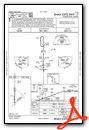
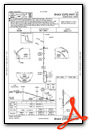
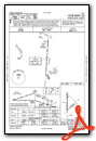
Instrument Approach Procedure (IAP) Charts
Nearby Airports with Instrument Procedures
| ID | Name | Heading / Distance | ||
|---|---|---|---|---|
 |
KLTS | Altus AFB Airport | 208° | 22.0 |
|
KCSM | Clinton/Sherman Airport | 340° | 22.2 |
|
KAXS | Altus/Quartz Mountain Regional Airport | 219° | 22.4 |
|
2K4 | Scott Field Airport | 256° | 24.2 |
|
KELK | Elk City Regional Business Airport | 327° | 31.3 |
|
KCLK | Clinton Regional Airport | 010° | 33.4 |
|
KOJA | Weatherford Stafford Airport | 029° | 38.3 |
|
KFDR | Frederick Regional Airport | 174° | 38.4 |
|
KLAW | Lawton-Fort Sill Regional Airport | 128° | 40.4 |
|
O35 | Hollis Municipal Airport | 248° | 45.6 |
|
2O8 | Hinton Municipal Airport | 048° | 46.7 |
|
F05 | Wilbarger County Airport | 194° | 47.2 |
Airport Images
Do you have a recent image of this airport? Upload it here!


