Login
Register


M34
Kentucky Dam State Park Airport
Official FAA Data Effective 2026-02-19 0901Z
Chart Supplement

VFR Chart of M34
Sectional Charts at SkyVector.com
IFR Chart of M34
Enroute Charts at SkyVector.com
Location Information for M34
Coordinates: N37°0.59' / W88°17.96'Located 03 miles SE of Calvert City, Kentucky on 208 acres of land. View all Airports in Kentucky.
Surveyed Elevation is 350 feet MSL.
Operations Data
|
|
Airport Communications
| CTAF: | 123.000 |
|---|---|
| UNICOM: | 123.000 |
| AWOS-3 at M25 (19.9 SW): | 120.625 270-247-2094 |
| AWOS-3 at CEY (21.0 S): | 119.975 270-489-2424 |
| AWOS-3P at GDA (21.5 NE): | 118.15 270-965-4877 |
- APCH/DEP SVC PRVDD BY MEMPHIS ARTCC ON FREQS 133.65/292.15 (PADUCAH RCAG).
Nearby Navigation Aids
|
| ||||||||||||||||||||||||||||||||||||||||||||||||||||||||||||


Runway 10/28
| Dimensions: | 3997 x 100 feet / 1218 x 30 meters | |
|---|---|---|
| Surface: | Asphalt in Good Condition | |
| Weight Limits: | S-12 | |
| Edge Lighting: | Medium Intensity | |
| Runway 10 | Runway 28 | |
| Coordinates: | N37°0.64' / W88°18.37' | N37°0.54' / W88°17.56' |
| Elevation: | 349.8 | 350.8 |
| Traffic Pattern: | Left | Left |
| Runway Heading: | 98° True | 278° True |
| Markings: | Non-Precision Instrument in good condition. | Non-Precision Instrument in good condition. |
| Glide Slope Indicator | P2L (4.00° Glide Path Angle) | P2L (4.00° Glide Path Angle) |
| REIL: | Yes | Yes |
| Obstacles: | 62 ft Trees 594 ft from runway, 280 ft left of center | |
Services Available
| Fuel: | 100LL (blue), Jet-A |
|---|---|
| Transient Storage: | Tiedowns |
| Airframe Repair: | NOT AVAILABLE |
| Engine Repair: | NOT AVAILABLE |
| Bottled Oxygen: | NOT AVAILABLE |
| Bulk Oxygen: | NOT AVAILABLE |
Ownership Information
| Ownership: | Publicly owned | |
|---|---|---|
| Owner: | CALVERT CITY KENTUCKY | |
| 2 HUDSON HOLLOW UNIT 1 | ||
| FRANKFORT, KY 40601 | ||
| (502) 892-3367 | ||
| Manager: | JOHN WARD | |
| P.O. BOX 36 | ||
| CALVERT CITY, KY 42029 | ||
| (270) 395-7138 | ||
Other Remarks
- DEER & GEESE ON & INVOF ARPT.
- FOR CD CTC MEMPHIS ARTCC AT 901-368-8453/8449.
- ACTVT REIL RWY 10 & 28; PAPI RWY 10 & 28; MIRL RWY 10/28 - CTAF.
Weather Minimums

Instrument Approach Procedure (IAP) Charts

Nearby Airports with Instrument Procedures
| ID | Name | Heading / Distance | ||
|---|---|---|---|---|
 |
M25 | Mayfield Graves County Airport | 223° | 19.9 |
|
KCEY | Kyle-Oakley Field Airport | 189° | 21.0 |
|
KGDA | Marion-Crittenden County James C Johnson Regional Airport | 024° | 21.5 |
|
2M0 | Princeton-Caldwell County Airport | 073° | 22.2 |
|
KPAH | Barkley Regional Airport | 277° | 22.9 |
|
KTWT | Sturgis Municipal Airport | 027° | 35.9 |
|
KPHT | Henry County Airport | 185° | 40.6 |
|
KHVC | Hopkinsville-Christian County Airport | 102° | 41.6 |
|
1M7 | Fulton Airport | 225° | 41.6 |
|
KHOP | Campbell AAF (Fort Campbell) Airport | 117° | 43.8 |
|
KCIR | Cairo Regional Airport | 274° | 44.3 |
|
2I0 | Madisonville Regional Airport | 064° | 47.9 |
Airport Images
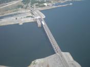
By: seeds007


