Login
Register


MLS
Frank Wiley Field Airport
Official FAA Data Effective 2026-02-19 0901Z
Chart Supplement

KMLS Airport Diagram

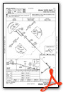
VFR Chart of KMLS
Sectional Charts at SkyVector.com
IFR Chart of KMLS
Enroute Charts at SkyVector.com
Location Information for KMLS
Coordinates: N46°25.61' / W105°53.29'Located 02 miles NW of Miles City, Montana on 1640 acres of land. View all Airports in Montana.
Surveyed Elevation is 2634 feet MSL.
Operations Data
|
|
Airport Communications
| ASOS: | 135.575 Tel. 406-232-1465 |
|---|---|
| UNICOM: | 123.000 |
| CTAF: | 123.000 |
| AWOS-3PT at 1S3 (31.7 W): | 121.125 406-346-2571 |
| AWOS-3PT at M46 (48.4 SW): | 118.525 406-748-3849 |
| AWOS-2 at 4U6 (61.1 N): | 119.025 406-485-3760 |
- COMMUNICATIONS PRVDD BY GREAT FALLS RADIO ON 122.2 (MILES CITY RCO).
- APCH/DEP CTL SVC PRVDD BY SALT LAKE ARTCC (ZLC) ON 126.85/305.2 (MILES CITY RCAG).
Nearby Navigation Aids
|
| ||||||||||||||||||||||||

Runway 04/22
| Dimensions: | 5764 x 75 feet / 1757 x 23 meters | |
|---|---|---|
| Surface: | Asphalt in Good Condition | |
| Weight Limits: | S-24, D-24 | |
| Edge Lighting: | Medium Intensity | |
| Runway 04 | Runway 22 | |
| Coordinates: | N46°25.17' / W105°54.04' | N46°25.76' / W105°52.96' |
| Elevation: | 2634.1 | 2625.2 |
| Traffic Pattern: | Left | Left |
| Runway Heading: | 52° True | 232° True |
| Declared Distances: | TORA:5764 TODA:5764 ASDA:5764 LDA:5764 | TORA:5764 TODA:5764 ASDA:5764 LDA:5764 |
| Markings: | Non-Precision Instrument in good condition. | Non-Precision Instrument in good condition. |
| Glide Slope Indicator | P2L (3.00° Glide Path Angle) | P2L (3.00° Glide Path Angle) |
| REIL: | Yes | Yes |
| Obstacles: | 17 ft Road 778 ft from runway | |
Runway 13/31
| Dimensions: | 5624 x 100 feet / 1714 x 30 meters | |
|---|---|---|
| Surface: | Asphalt / Grooved in Good Condition | |
| Weight Limits: | S-38, D-55, ST-85 | |
| Edge Lighting: | Medium Intensity | |
| Runway 13 | Runway 31 | |
| Coordinates: | N46°26.09' / W105°53.56' | N46°25.44' / W105°52.61' |
| Elevation: | 2630.0 | 2625.6 |
| Traffic Pattern: | Left | Left |
| Runway Heading: | 135° True | 315° True |
| Declared Distances: | TORA:5624 TODA:5624 ASDA:5624 LDA:5624 | TORA:5624 TODA:5624 ASDA:5624 LDA:5624 |
| Markings: | Non-Precision Instrument in good condition. | Non-Precision Instrument in good condition. |
| Glide Slope Indicator | P2L (3.00° Glide Path Angle) | P2L (3.00° Glide Path Angle) |
| REIL: | Yes | Yes |
Services Available
| Fuel: | 100LL (blue), Jet-A |
|---|---|
| Transient Storage: | Hangars,Tiedowns CTC AMGR. |
| Airframe Repair: | NOT AVAILABLE |
| Engine Repair: | NOT AVAILABLE |
| Bottled Oxygen: | NOT AVAILABLE |
| Bulk Oxygen: | NOT AVAILABLE |
Ownership Information
| Ownership: | Publicly owned | |
|---|---|---|
| Owner: | MILES CITY | |
| PO BOX 910, 77 FRANK WILEY FIELD | ||
| MILES CITY, MT 59301 | ||
| 406-874-8602 | ||
| Manager: | JEFF LANGKAU | |
| 596 REYNOLDS RD | ||
| MILES CITY, MT 59301 | ||
| 406-951-0955 | ||
Other Remarks
- TRNG ACT WI 15 MI. BIRDS INVOF ARPT.
- COND UNMNT - AMGR.
- FOR CD IF UNA TO CTC ON FSS FREQ, CTC SALT LAKE ARTCC AT 801-320-2568.
- 0LL AFT HR - 406-234-1296 OR 406-951-0955.
- ACTVT REIL RWY 04, 13, 22, & 31; PAPI RWY 04, 13, 22, & 31; MIRL RWY 04/22 & RWY 13/31 - CTAF.
Weather Minimums


Instrument Approach Procedure (IAP) Charts


Nearby Airports with Instrument Procedures
| ID | Name | Heading / Distance | ||
|---|---|---|---|---|
 |
1S3 | Tillitt Field Airport | 253° | 32.0 |
|
M46 | Colstrip Airport | 225° | 48.6 |
|
4U6 | Circle Town County Airport | 012° | 61.0 |
|
KGDV | Dawson Community Airport | 045° | 61.7 |
|
KBHK | Baker Municipal Airport | 093° | 67.9 |
|
20U | Beach Airport | 068° | 84.2 |
|
00U | Big Horn County Airport | 241° | 84.6 |
|
KOLF | L M Clayton Airport | 007° | 100.9 |
|
KSDY | Sidney-Richland Regional Airport | 041° | 103.6 |
|
PO1 | Poplar Municipal Airport | 015° | 106.7 |
|
KBWW | Bowman Regional Airport | 097° | 108.8 |
|
KSHR | Sheridan County Airport | 205° | 109.6 |
Fuel Providers

Airport Images

By: mcairport


