Login
Register


4U6
Circle Town County Airport
Official FAA Data Effective 2025-12-25 0901Z
Chart Supplement

VFR Chart of 4U6
Sectional Charts at SkyVector.com
IFR Chart of 4U6
Enroute Charts at SkyVector.com
Location Information for 4U6
Coordinates: N47°25.10' / W105°33.65'Located 01 miles E of Circle, Montana on 140 acres of land. View all Airports in Montana.
Surveyed Elevation is 2441 feet MSL.
Operations Data
|
|
Airport Communications
| AWOS-2: | 119.025 Tel. 406-485-3760 |
|---|---|
| UNICOM: | 122.800 |
| CTAF: | 122.800 |
| AWOS-3PT at GDV (35.0 SE): | 135.075 406-687-3346 |
| ASOS at OLF (40.6 N): | 118.325 406-653-3865 |
| AWOS-3PT at PO1 (45.9 N): | 135.325 406-448-2453 |
- APCH/DEP CTL SVC PRVDD BY SALT LAKE ARTCC ( ZLC) ON FREQS 126.85/305.2 (GLASGOW RCAG).
Nearby Navigation Aids
|
| ||||||||||||||||||||||||||||||

Runway 12/30
| Dimensions: | 4100 x 75 feet / 1250 x 23 meters | |
|---|---|---|
| Surface: | Asphalt in Poor Condition TRANSVERSE CRACKS AT 100 FT INTVLS WITH SGFNT WID AND DPT. | |
| Weight Limits: | S-12 | |
| Edge Lighting: | Medium Intensity | |
| Runway 12 | Runway 30 | |
| Coordinates: | N47°25.37' / W105°33.93' | N47°24.85' / W105°33.30' |
| Elevation: | 2425.2 | 2441.4 |
| Traffic Pattern: | Left | Left |
| Runway Heading: | 140° True | 320° True |
| Markings: | Non-Precision Instrument in fair condition. | Non-Precision Instrument in fair condition. |
| Glide Slope Indicator | P2L (3.00° Glide Path Angle) | P2L (3.00° Glide Path Angle) |
Runway 03/21
CLSD WINTER MONTHS. | ||
| Dimensions: | 2280 x 195 feet / 695 x 59 meters | |
|---|---|---|
| Surface: | Turf in Poor Condition RWY IS RUF, WITH LONG GRASS, RWY EDGES ARE NOT MKD. | |
| Runway 03 | Runway 21 | |
| Coordinates: | N47°24.96' / W105°33.93' | N47°25.21' / W105°33.51' |
| Elevation: | 2425.8 | 2422.1 |
| Traffic Pattern: | Left | Left |
| Runway Heading: | 48° True | 229° True |
Services Available
| Fuel: | 100LL (blue) |
|---|---|
| Transient Storage: | Hangars,Tiedowns |
| Airframe Repair: | MAJOR |
| Engine Repair: | MAJOR |
| Bottled Oxygen: | NONE |
| Bulk Oxygen: | NONE |
| Other Services: | CROP DUSTING SERVICES |
Ownership Information
| Ownership: | Publicly owned | |
|---|---|---|
| Owner: | MC CONE COUNTY & CITY OF CIRCLE | |
| COUNTY COURTHOUSE PO BOX199 | ||
| CIRCLE, MT 59215 | ||
| 406-485-3505 | ||
| Manager: | JEFF SKYBERG | |
| BOX 336 | ||
| CIRCLE, MT 59215 | ||
| 406-485-2481 | ||
Other Remarks
- HAS -8 FT DRAINAGE DITCH 200 FT FM RY 03/21 THLDS.
- FOR CD CTC SALT LAKE ARTCC AT 801-320-2568.
- UNUSBL IN WET WEATHER.
- 03/21 THRS MKD WITH RED CONES.
- ACTVT MIRL RY 12/30 & PAPI RY 12 AND RY 30 - CTAF.
Weather Minimums

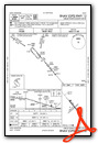
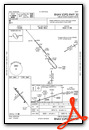
Instrument Approach Procedure (IAP) Charts
Nearby Airports with Instrument Procedures
| ID | Name | Heading / Distance | ||
|---|---|---|---|---|
 |
KGDV | Dawson Community Airport | 118° | 35.1 |
|
KOLF | L M Clayton Airport | 359° | 40.6 |
|
PO1 | Poplar Municipal Airport | 020° | 45.9 |
|
KSDY | Sidney-Richland Regional Airport | 072° | 58.2 |
|
KMLS | Frank Wiley Field Airport | 192° | 61.0 |
|
KGGW | Wokal Field/Glasgow-Valley County Airport | 318° | 63.9 |
|
20U | Beach Airport | 114° | 71.1 |
|
1S3 | Tillitt Field Airport | 212° | 81.6 |
|
9S2 | Scobey Airport | 003° | 83.6 |
|
KBHK | Baker Municipal Airport | 139° | 83.7 |
|
KXWA | Williston Basin International Airport | 054° | 88.9 |
|
KPWD | Sher-Wood Airport | 026° | 92.3 |
Airport Images
Do you have a recent image of this airport? Upload it here!


