Login
Register


MSV
Sullivan County International Airport
Official FAA Data Effective 2026-02-19 0901Z
Chart Supplement

VFR Chart of KMSV
Sectional Charts at SkyVector.com
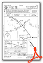
IFR Chart of KMSV
Enroute Charts at SkyVector.com
Location Information for KMSV
Coordinates: N41°42.10' / W74°47.70'Located 06 miles NW of Monticello, New York on 600 acres of land. View all Airports in New York.
Surveyed Elevation is 1403 feet MSL.
Operations Data
|
|
Airport Communications
| AWOS-3PT: | 124.725 Tel. 845-583-5056 |
|---|---|
| NEW YORK APPROACH: | 132.75 363.1 |
| NEW YORK DEPARTURE: | 132.75 363.1 |
| CLEARANCE DELIVERY: | 121.6 |
| UNICOM: | 122.800 |
| CTAF: | 122.800 |
| AWOS-AV at JC9 (6.6 NE): | 118.0 |
| ASOS at MGJ (26.5 SE): | 119.275 845-457-1486 |
| ASOS at FWN (31.1 S): | 118.525 973-875-0859 |
Nearby Navigation Aids
|
| ||||||||||||||||||||||||||||||||||||||||||||||||||||||||||||


Runway 15/33
| Dimensions: | 6298 x 150 feet / 1920 x 46 meters | |
|---|---|---|
| Surface: | Asphalt / Grooved in Excellent Condition RWY 15 LONGITUDINAL CRACKING WITH WEEDS IN CRACKS. | |
| Weight Limits: | S-95, D-131, ST-223
PCR VALUE: 596/F/C/X/T
| |
| Edge Lighting: | High Intensity | |
| Runway 15 | Runway 33 | |
| Coordinates: | N41°42.51' / W74°48.12' | N41°41.69' / W74°47.28' |
| Elevation: | 1402.8 | 1380.1 |
| Traffic Pattern: | Left | Left |
| Runway Heading: | 143° True | 323° True |
| Displaced Threshold: | 298 Feet | 300 Feet |
| Declared Distances: | TORA:6298 TODA:6298 ASDA:6198 LDA:5900 | TORA:6298 TODA:6298 ASDA:6098 LDA:5798 |
| Markings: | Precision Instrument in good condition. | Non-Precision Instrument in good condition. |
| Glide Slope Indicator | P4L (3.00° Glide Path Angle) | P4L (3.00° Glide Path Angle) |
| REIL: | Yes | Yes |
| Obstacles: | 62 ft Trees 2050 ft from runway, 750 ft left of center 8 FT GROUND AER 320 FT LEFT. |
19 ft Trees 520 ft from runway, 500 ft left of center |
Services Available
| Fuel: | 100LL (blue), Jet-A |
|---|---|
| Transient Storage: | Hangars,Tiedowns |
| Airframe Repair: | MAJOR |
| Engine Repair: | MINOR |
| Bottled Oxygen: | NONE |
| Bulk Oxygen: | NONE |
| Other Services: | AIR AMBULANCE SERVICES,CHARTER SERVICE |
Ownership Information
| Ownership: | Publicly owned | |
|---|---|---|
| Owner: | SULLIVAN COUNTY DPW | |
| 100 NORTH ST | ||
| MONTICELLO, NY 12701 | ||
| 845-807-0261 | ||
| Manager: | JULIAN MOTOLA | |
| 100 NORTH ST | ||
| MONTICELLO, NY 12701 | ||
| 845-807-0326 | ||
Other Remarks
- BIRDS/WATERFOWL, COYOTE & DEER ON & INVOF ARPT.
- FOR CD CTC NEW YORK APCH AT 516-683-2448 OR 121.6
- 0LL SELF SVC 100LL FUEL AVBL 24 HRS DLY.
- JET A FUEL AVBL; 0800-1700 CALL 845-807-0325. AFTR HRS ADVN NOTICE REQ.
- ACTVT REIL RWY 15 & 33; HIRL RWY 15/33; TWY LGTS - CTAF. PAPI RWY 15 & 33 OPR CONSLY.
Weather Minimums


Instrument Approach Procedure (IAP) Charts


Nearby Airports with Instrument Procedures
| ID | Name | Heading / Distance | ||
|---|---|---|---|---|
 |
N82 | Wurtsboro/Sullivan County Airport | 112° | 16.3 |
|
N89 | Joseph Y Resnick Airport | 084° | 18.9 |
|
N30 | Cherry Ridge Airport | 241° | 23.4 |
|
06N | Randall Airport | 131° | 24.3 |
|
KMGJ | Orange County Airport | 115° | 26.5 |
|
KFWN | Sussex Airport | 165° | 31.1 |
|
KSWF | New York Stewart International Airport | 110° | 33.2 |
|
4N1 | Greenwood Lake Airport | 149° | 39.9 |
|
20N | Kingston-Ulster Airport | 065° | 41.0 |
|
KPOU | Hudson Valley Regional Airport | 095° | 41.2 |
|
12N | Aeroflex/Andover Airport | 176° | 41.6 |
|
KMPO | Pocono Mountains Regional Airport | 218° | 42.9 |
Airport Images
Do you have a recent image of this airport? Upload it here!


