Login
Register


ONP
Newport Municipal Airport
Official FAA Data Effective 2026-02-19 0901Z
Chart Supplement

VFR Chart of KONP
Sectional Charts at SkyVector.com
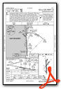
IFR Chart of KONP
Enroute Charts at SkyVector.com
Location Information for KONP
Coordinates: N44°34.82' / W124°3.48'Located 03 miles S of Newport, Oregon on 700 acres of land. View all Airports in Oregon.
Surveyed Elevation is 160 feet MSL.
Operations Data
|
|
Airport Communications
| AWOS-3: | 133.9 Tel. 541-867-4175 |
|---|---|
| CTAF: | 122.800 |
| UNICOM: | 122.800 |
| AWOS-3PT at CVO (33.1 E): | 135.775 541-754-0081 |
| AWOS-3PT at 6S2 (35.9 S): | 118.225 541-997-8664 |
| AWOS-3PT at S12 (42.9 E): | 119.925 541-967-3508 |
- APCH/DEP CTL SVC PRVDD BY SEATTLE ARTCC (ZSE)ON FREQS 125.8/291.7 (HORTON RCAG).
Nearby Navigation Aids
|
| ||||||||||||||||||||||||||||||||||||||||||


Runway 16/34
| Dimensions: | 5398 x 100 feet / 1645 x 30 meters | |
|---|---|---|
| Surface: | Asphalt in Good Condition | |
| Weight Limits: | 34 /F/D/X/T, S-75, D-120, ST-170 | |
| Edge Lighting: | High Intensity | |
| Runway 16 | Runway 34 | |
| Coordinates: | N44°35.21' / W124°3.56' | N44°34.32' / W124°3.50' |
| Elevation: | 152.1 | 158.8 |
| Traffic Pattern: | Right | Left |
| Runway Heading: | 177° True | 357° True |
| Displaced Threshold: | 300 Feet | |
| Declared Distances: | TORA:5398 TODA:5398 ASDA:5398 LDA:5398 | TORA:5398 TODA:5398 ASDA:5398 LDA:5098 |
| Markings: | Precision Instrument in fair condition. | Precision Instrument in fair condition. |
| Glide Slope Indicator | P4L (3.00° Glide Path Angle) | P4L (3.00° Glide Path Angle) RWY 34 PAPI BEYOND 3DEG LEFT AND 5DEG RIGHT OF RCL UNUSABLE |
| Approach Lights: | MALSR 1,400 Foot Medium-intensity Approach Lighting System with runway alignment indicator lights. | |
| REIL: | Yes | |
| Obstacles: | 24 ft Trees 356 ft from runway, 450 ft left of center | 25 ft Trees 467 ft from runway |
Runway 02/20
| Dimensions: | 3001 x 75 feet / 915 x 23 meters | |
|---|---|---|
| Surface: | Asphalt in Good Condition | |
| Weight Limits: | S-33, D-50, ST-84 | |
| Edge Lighting: | Medium Intensity | |
| Runway 02 | Runway 20 | |
| Coordinates: | N44°34.72' / W124°3.58' | N44°35.12' / W124°3.16' |
| Elevation: | 130.0 | 160.1 |
| Traffic Pattern: | Left | Right |
| Runway Heading: | 37° True | 217° True |
| Declared Distances: | TORA:3001 TODA:3001 ASDA:3001 LDA:3001 | TORA:3001 TODA:3001 ASDA:3001 LDA:3001 |
| Markings: | Basic in fair condition. | Basic in fair condition. |
| Obstacles: | 17 ft Ground 875 ft from runway, 300 ft right of center | 67 ft Tree 1085 ft from runway, 100 ft right of center |
Services Available
| Fuel: | 100LL (blue), Jet-A |
|---|---|
| Transient Storage: | Hangars,Tiedowns |
| Airframe Repair: | NOT AVAILABLE |
| Engine Repair: | NOT AVAILABLE |
| Bottled Oxygen: | NONE |
| Bulk Oxygen: | NONE |
| Other Services: | AIR FREIGHT SERVICES |
Ownership Information
| Ownership: | Publicly owned | |
|---|---|---|
| Owner: | CITY OF NEWPORT | |
| 169 SW COAST HWY | ||
| NEWPORT, OR 97365 | ||
| 541-574-0603 | ||
| Manager: | LANCE VANDERBECK | |
| 135 SE 84TH | ||
| NEWPORT, OR 97365 | ||
| (541) 867-7422 | ||
Other Remarks
- BIRDS, DEER & COYOTES ON AND INVOF ARPT.
- FOR CD IF UNA TO CTC ON FSS FREQ, CTC SEATTLE ARTCC AT 253-351-3694.
- PILOTS CONDUCTING EFVS OPS; BE AWARE LED ALS IN USE RWY 16.
- PPR FOR ACR OPNS WITH MORE THAN 30 PSGR SEATS CALL AMGR 541-867-7422.
- 0LL FOR FUEL AFT HRS CALL 541-867-7422 OR 541-530-1364.
- ACTVT MALSR RWY 16; MIRL RYS 02/20 & HIRL 16/34 AND PAPIS RWY 16 & RWY 34 AND REIL RY 34 - CTAF.
Weather Minimums


Instrument Approach Procedure (IAP) Charts


Departure Procedure Obstacles (DPO) Charts

Nearby Airports with Instrument Procedures
| ID | Name | Heading / Distance | ||
|---|---|---|---|---|
 |
KCVO | Corvallis Municipal Airport | 098° | 33.4 |
|
S12 | Albany Municipal Airport | 085° | 42.9 |
|
KEUG | Mahlon Sweet Field Airport | 126° | 45.5 |
|
KSLE | Mcnary Field Airport | 065° | 49.3 |
|
KTMK | Tillamook Airport | 011° | 51.3 |
|
KMMV | Mc Minnville Municipal Airport | 046° | 53.9 |
|
77S | Hobby Field Airport | 130° | 59.8 |
|
KUAO | Aurora State Airport | 053° | 67.9 |
|
KOTH | Southwest Oregon Regional Airport | 186° | 70.3 |
|
KHIO | Portland-Hillsboro Airport | 038° | 74.5 |
|
KRBG | Roseburg Regional Airport | 159° | 86.0 |
|
KVUO | Pearson Field Airport | 043° | 86.3 |
Airport Images

By: blendy


