Login
Register
P34
Mifflintown Airport
Official FAA Data Effective 2026-01-22 0901Z
VFR Chart of P34
Sectional Charts at SkyVector.com
IFR Chart of P34
Enroute Charts at SkyVector.com
Location Information for P34
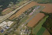
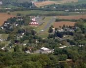
Coordinates: N40°35.94' / W77°24.34'Located 02 miles N of Mifflintown, Pennsylvania on 25 acres of land. View all Airports in Pennsylvania.
Estimated Elevation is 545 feet MSL.
Operations Data
|
|
Airport Communications
| UNICOM: | 122.800 |
|---|---|
| CTAF: | 122.800 |
| AWOS-3PT at RVL (11.0 NW): | 123.85 717-667-3993 |
| ASOS at FLF (23.7 NW): | 814-237-5778 |
| D-ATIS at UNV (25.1 NW): | 127.65 |
- APCH/DEP SVC PRVDD BY ZNY ARTCC ON 134.8/338.3 (PHILIPSBURG RCAG).
Nearby Navigation Aids
|
| ||||||||||||||||||||||||||||||||||||||||||||||||
Runway 08/26
| Dimensions: | 2627 x 50 feet / 801 x 15 meters | |
|---|---|---|
| Surface: | Asphalt in Good Condition | |
| Edge Lighting: | Low Intensity | |
| Runway 08 | Runway 26 | |
| Coordinates: | N40°35.85' / W77°24.60' | N40°36.02' / W77°24.08' |
| Elevation: | 543.5 | 540.0 |
| Displaced Threshold: | 232 Feet | |
| Markings: | Basic in good condition. | Non-Standard in good condition. |
| Obstacles: | 42 ft Trees 214 ft from runway, 243 ft right of center APCH SLP 11:1 TO DTHR. RWY 08 HAS 20-50 FT HIGH TREES 150 FT FM RWY END TO 430 FT BHND RWY END, 60-170 FT L OF CNTRLN; 20-40 FT HIGH STRUCTURES & TREES 50 FT FM RWY END TO 530 FT BHND RWY END, 90-160 FT R OF CNTRLN. |
29 ft Trees 672 ft from runway, 143 ft right of center |
Services Available
| Fuel: | NONE |
|---|---|
| Transient Storage: | Hangars |
| Airframe Repair: | NONE |
| Engine Repair: | NONE |
| Bottled Oxygen: | NOT AVAILABLE |
| Bulk Oxygen: | NOT AVAILABLE |
Ownership Information
| Ownership: | Privately Owned | |
|---|---|---|
| Owner: | MIFFLINTOWN AIRPARK LLC | |
| 600 AIRPORT DR. | ||
| MIFFLINTOWN, PA 17059 | ||
| 717-436-2725 | ||
| Manager: | BRUCE LISLE | |
| 600 AIRPORT DR. | ||
| MIFFLINTOWN, PA 17059 | ||
| 717-436-2725 | ||
Other Remarks
- FOR CD CTC NEW YORK ARTCC AT 631-468-1425.
- RWY NOT MKD FOR NPI APCH.
- RWY 8 CLSD TO NGT VISUAL APCH DUE TO SEV APCH AND PRIM SFC OBSTNS.
- ACTVT LIRL 08/26, WDI LGTS - CTAF.
- ACTVT ROTG BCN - CTAF.
Weather Minimums
Instrument Approach Procedure (IAP) Charts
Departure Procedure (DP) Charts
Nearby Airports with Instrument Procedures
| ID | Name | Heading / Distance | ||
|---|---|---|---|---|
 |
KRVL | Mifflin County Airport | 295° | 11.1 |
 |
KUNV | State College Regional Airport | 306° | 25.2 |
 |
N96 | Bellefonte Airport | 312° | 25.4 |
 |
N94 | Carlisle Airport | 156° | 26.8 |
 |
KSEG | Penn Valley Airport | 061° | 28.1 |
 |
KLHV | William T Piper Memorial Airport | 358° | 32.2 |
 |
KCXY | Capital City Airport | 131° | 34.2 |
 |
KPSB | Mid-State Airport | 299° | 35.5 |
 |
KMDT | Harrisburg International Airport | 129° | 38.2 |
 |
74N | Bendigo Airport | 093° | 38.7 |
 |
N68 | Franklin County Regional Airport | 196° | 39.1 |
 |
8N8 | Danville Airport | 058° | 40.6 |


