Login
Register
LHV
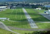
William T Piper Memorial Airport
Official FAA Data Effective 2026-01-22 0901Z
VFR Chart of KLHV
Sectional Charts at SkyVector.com
IFR Chart of KLHV
Enroute Charts at SkyVector.com
Location Information for KLHV
Coordinates: N41°8.15' / W77°25.34'Located 02 miles E of Lock Haven, Pennsylvania on 112 acres of land. View all Airports in Pennsylvania.
Surveyed Elevation is 555 feet MSL.
Operations Data
|
|
Airport Communications
| CTAF: | 122.800 |
|---|---|
| UNICOM: | 122.800 |
| ASOS at IPT (23.5 E): | 125.225 570-360-5258 |
| D-ATIS at UNV (25.8 SW): | 127.65 |
| AWOS-3 at UNV (25.9 SW): | 127.65 814-865-8799 |
- APCH/DEP SVC PRVDD BY NEW YORK ARTCC ON FREQS 134.8/338.3 (PHILIPSBURG RCAG).
Nearby Navigation Aids
|
| ||||||||||||||||||||||||||||||||||||||||||||||||
Runway 09L/27R
| Dimensions: | 3799 x 75 feet / 1158 x 23 meters | |
|---|---|---|
| Surface: | Asphalt in Good Condition | |
| Weight Limits: | S-12 | |
| Edge Lighting: | Medium Intensity | |
| Runway 09L | Runway 27R | |
| Coordinates: | N41°8.12' / W77°25.75' | N41°8.20' / W77°24.93' |
| Elevation: | 554.7 | 555.0 |
| Traffic Pattern: | Left | Right |
| Runway Heading: | 82° True | 262° True |
| Displaced Threshold: | 465 Feet | |
| Markings: | Non-Precision Instrument in good condition. | Non-Precision Instrument in good condition. |
| Glide Slope Indicator | P2L (3.50° Glide Path Angle) UNUSBL BYD 5 DEGS LEFT OF CNTRLN. | P2L (4.00° Glide Path Angle) UNUSBL BYD 6 DEGS LEFT & 8 DEGS RIGHT OF CNTRLN. |
| REIL: | Yes | Yes |
| Obstacles: | 51 ft Trees 1100 ft from runway, 44 ft left of center | 47 ft Trees 377 ft from runway, 119 ft left of center 14 FT BERM 84 FT OUT ON CNTRLN RWY 27R. |
Runway 09R/27L
| Dimensions: | 2179 x 100 feet / 664 x 30 meters | |
|---|---|---|
| Surface: | Turf in Good Condition | |
| Runway 09R | Runway 27L | |
| Coordinates: | N41°8.11' / W77°25.57' | N41°8.15' / W77°25.10' |
| Elevation: | 553.3 | 553.8 |
| Traffic Pattern: | Right | |
| Runway Heading: | 82° True | 262° True |
| Markings: | Non-Standard in good condition. | Non-Standard in good condition. |
| Obstacles: | 69 ft Trees 1257 ft from runway, 84 ft left of center | |
Services Available
| Fuel: | 100LL (blue), Jet-A |
|---|---|
| Transient Storage: | Hangars,Tiedowns |
| Airframe Repair: | MAJOR |
| Engine Repair: | MAJOR |
| Bottled Oxygen: | NONE |
| Bulk Oxygen: | NONE |
| Other Services: | PILOT INSTRUCTION,AIRCRAFT RENTAL,AIRCRAFT SALES |
Ownership Information
| Ownership: | Publicly owned | |
|---|---|---|
| Owner: | CITY OF LOCK HAVEN | |
| 20 EAST CHURCH STREET | ||
| LOCK HAVEN, PA 17745 | ||
| 570-893-5610 | ||
| Manager: | DOUGLAS WENKER | |
| 353 PROCTOR STREET | ||
| LOCK HAVEN, PA 17745 | ||
| 570-748-5123 | ||
Other Remarks
- LOCAL WX ON CTAF (3 CLICKS).
- BIRD ACTIVITY ON & INVOF ARPT.
- NO SIMULTANEOUS RWY OPS.
- FOR CD CTC NEW YORK ARTCC AT 631-468-1425.
- RWY 09R/27L CLSD SS-SR DLY.
- WHITE CONES MARK RWY EDGE AND THLD.
- WHITE CONES MARK RWY EDGE AND THLD.
- 0LL FUEL AVBL AFT HOURS BY PRIOR REQ; CALL 570-295-7952 OR 570-726-3462.
- ACTVT PAPI RWY 09L & 27R; MIRL RWY 09L/27R - CTAF.
Weather Minimums
Instrument Approach Procedure (IAP) Charts
Nearby Airports with Instrument Procedures
| ID | Name | Heading / Distance | ||
|---|---|---|---|---|
 |
N96 | Bellefonte Airport | 230° | 23.4 |
 |
KIPT | Williamsport Regional Airport | 074° | 23.5 |
 |
KUNV | State College Regional Airport | 228° | 25.8 |
 |
KRVL | Mifflin County Airport | 198° | 29.0 |
 |
KSEG | Penn Valley Airport | 126° | 31.6 |
 |
P34 | Mifflintown Airport | 178° | 32.2 |
 |
KPSB | Mid-State Airport | 243° | 33.8 |
 |
N38 | Grand Canyon Regional Airport | 001° | 35.5 |
 |
8N8 | Danville Airport | 107° | 37.1 |
 |
N79 | Northumberland County Airport | 114° | 43.4 |
 |
KFIG | Clearfield-Lawrence Airport | 263° | 45.3 |
 |
N13 | Bloomsburg Municipal Airport | 100° | 45.6 |


