Login
Register
PS11
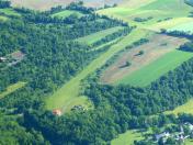
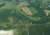
Mc Cardle Farm Airport
Official FAA Data Effective 2026-02-19 0901Z
VFR Chart of PS11
Sectional Charts at SkyVector.com
IFR Chart of PS11
Enroute Charts at SkyVector.com
Location Information for PS11
Coordinates: N40°38.72' / W77°33.32'Located 01 miles NE of Burnham, Pennsylvania on 55 acres of land. View all Airports in Pennsylvania.
Estimated Elevation is 600 feet MSL.
Operations Data
|
|
Airport Communications
| AWOS-3PT at RVL (3.7 NW): | 123.85 717-667-3993 |
|---|---|
| ASOS at FLF (16.4 NW): | 814-237-5778 |
| D-ATIS at UNV (18.1 NW): | 127.65 |
Nearby Navigation Aids
|
| ||||||||||||||||||||||||||||||||||||||||||||||||||||||
Runway 05/23
| Dimensions: | 1800 x 100 feet / 549 x 30 meters | |
|---|---|---|
| Surface: | Turf in Excellent Condition | |
| Runway 05 | Runway 23 | |
| Obstacles: | 34 ft Trees 266 ft from runway, 13 ft left of center | |
Ownership Information
| Ownership: | Privately Owned | |
|---|---|---|
| Owner: | GUY R MC CARDLE | |
| 102 SOUTH LOGAN BLVD | ||
| BURNHAM, PA 17009 | ||
| 717-248-1337 | ||
| Manager: | GUY R MC CARDLE | |
| 102 SOUTH LOGAN BLVD | ||
| BURNHAM, PA 17009 | ||
| 717-248-1337 | ||
Other Remarks
- FOR CD CTC NEW YORK ARTCC AT 631-468-1425.
- RWY MKD WITH BARRELS.
Nearby Airports with Instrument Procedures
| ID | Name | Heading / Distance | ||
|---|---|---|---|---|
 |
KRVL | Mifflin County Airport | 300° | 3.8 |
 |
P34 | Mifflintown Airport | 112° | 7.4 |
 |
KUNV | State College Regional Airport | 312° | 18.1 |
 |
N96 | Bellefonte Airport | 320° | 18.7 |
 |
KPSB | Mid-State Airport | 300° | 28.2 |
 |
KLHV | William T Piper Memorial Airport | 011° | 30.0 |
 |
N94 | Carlisle Airport | 147° | 32.5 |
 |
KSEG | Penn Valley Airport | 071° | 33.2 |
 |
N68 | Franklin County Regional Airport | 185° | 40.5 |
 |
KAOO | Altoona/Blair County Airport | 239° | 40.8 |
 |
KCXY | Capital City Airport | 128° | 41.2 |
 |
8N8 | Danville Airport | 066° | 45.3 |


