Login
Register


PSX
Palacios Municipal Airport
Official FAA Data Effective 2026-02-19 0901Z
Chart Supplement

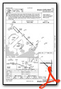
VFR Chart of KPSX
Sectional Charts at SkyVector.com
IFR Chart of KPSX
Enroute Charts at SkyVector.com
Location Information for KPSX
Coordinates: N28°43.65' / W96°15.06'Located 03 miles NW of Palacios, Texas on 1538 acres of land. View all Airports in Texas.
Surveyed Elevation is 14 feet MSL.
Operations Data
|
|
Airport Communications
| ASOS: | 118.025 Tel. 361-972-0101 |
|---|---|
| UNICOM: | 122.800 |
| CTAF: | 122.800 |
| AWOS-3 at PKV (23.2 W): | 118.275 361-552-3060 |
| AWOS-3PT at BYY (25.3 NE): | 118.075 979-323-1801 |
| AWOS-3 at ARM (31.9 N): | 118.475 979-532-2791 |
- APCH/DEP CTL SVC PRVDD BY HOUSTON ARTCC (ZHU) ON FREQS 135.05/353.6 (VICTORIA RCAG).
Nearby Navigation Aids
|
| ||||||||||||||||||||||||||||||||||||


Runway 08/26
| Dimensions: | 5001 x 150 feet / 1524 x 46 meters | |
|---|---|---|
| Surface: | Concrete in Poor Condition TALL VEGETATION ON RWY. | |
| Weight Limits: | S-46, D-58, ST-105 | |
| Runway 08 | Runway 26 | |
| Coordinates: | N28°43.82' / W96°15.73' | N28°43.82' / W96°14.79' |
| Elevation: | 10.8 | 12.4 |
| Traffic Pattern: | Left | Left |
| Runway Heading: | 90° True | 270° True |
| Markings: | in poor condition. | in poor condition. |
| Obstacles: | 18 ft Trees 418 ft from runway, 70 ft left of center WINDMILL. |
28 ft Tower 688 ft from runway, 290 ft left of center |
Runway 13/31
| Dimensions: | 5001 x 150 feet / 1524 x 46 meters | |
|---|---|---|
| Surface: | Concrete in Good Condition | |
| Weight Limits: | S-46, D-58, ST-105 | |
| Edge Lighting: | Medium Intensity | |
| Runway 13 | Runway 31 | |
| Coordinates: | N28°43.84' / W96°15.44' | N28°43.26' / W96°14.78' |
| Elevation: | 12.3 | 13.8 |
| Traffic Pattern: | Left | Left |
| Runway Heading: | 135° True | 315° True |
| Markings: | Non-Precision Instrument in fair condition. | Non-Precision Instrument in fair condition. |
| REIL: | Yes | Yes |
| Obstacles: | 15 ft Tree 463 ft from runway, 300 ft right of center | |
Runway 18/36
| Dimensions: | 5001 x 75 feet / 1524 x 23 meters | |
|---|---|---|
| Surface: | Concrete in Poor Condition TALL VEGETATION ON RWY. | |
| Weight Limits: | S-46, D-58, ST-105 | |
| Runway 18 | Runway 36 | |
| Coordinates: | N28°43.99' / W96°14.80' | N28°43.17' / W96°14.81' |
| Elevation: | 11.1 | 13.8 |
| Traffic Pattern: | Left | Left |
| Runway Heading: | 180° True | 0 |
| Markings: | Basic in fair condition. | Basic in fair condition. |
Services Available
| Fuel: | NONE |
|---|---|
| Transient Storage: | Tiedowns |
| Airframe Repair: | NOT AVAILABLE |
| Engine Repair: | NOT AVAILABLE |
| Bottled Oxygen: | NOT AVAILABLE |
| Bulk Oxygen: | NOT AVAILABLE |
Ownership Information
| Ownership: | Publicly owned | |
|---|---|---|
| Owner: | CITY OF PALACIOS | |
| PO BOX 845 | ||
| PALACIOS, TX 77465 | ||
| 361-972-3605 | ||
| Manager: | MANUEL GUEVARA | MANUEL GUEVARA |
| PO BOX 845 | ||
| PALACIOS, TX 77465 | ||
| 361-404-9909 | ||
Other Remarks
- THIS AIRPORT HAS BEEN SURVEYED BY THE NATIONAL GEODETIC SURVEY.
- VEGETATION ON TWY.
- COURTESY CAR AVBL.
- FOR CD IF UNA TO CTC ON FSS FREQ, CTC HOUSTON ARTCC AT 281-230-5622.
- TWYS, RWYS 8/26, 18/36 UNMKD.
- MIRL RWY 13/31 PRESET ON LOW INTST; TO INCR INTST ACTVT - CTAF.
Weather Minimums

Instrument Approach Procedure (IAP) Charts

Nearby Airports with Instrument Procedures
| ID | Name | Heading / Distance | ||
|---|---|---|---|---|
 |
KPKV | Calhoun County Airport | 259° | 23.2 |
|
26R | Jackson County Airport | 313° | 23.9 |
|
KBYY | Bay City Regional Airport | 054° | 25.2 |
|
KARM | Wharton Regional Airport | 009° | 31.9 |
|
KVCT | Victoria Regional Airport | 282° | 36.0 |
|
KLBX | Texas Gulf Coast Regional Airport | 061° | 47.4 |
|
KELA | Eagle Lake Airport | 355° | 52.4 |
|
KRKP | Aransas County Airport | 227° | 56.9 |
|
T85 | Yoakum Municipal Airport | 307° | 58.4 |
|
KAXH | Houston/Southwest Airport | 040° | 61.9 |
|
KSGR | Sugar Land Regional Airport | 030° | 62.0 |
|
KTME | Houston Exec Airport | 015° | 67.1 |
Airport Images
Do you have a recent image of this airport? Upload it here!


