Login
Register


S16
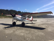
Copalis State Airport
Official FAA Data Effective 2026-01-22 0901Z
Chart Supplement

VFR Chart of S16
Sectional Charts at SkyVector.com
IFR Chart of S16
Enroute Charts at SkyVector.com
Location Information for S16
Coordinates: N47°8.69' / W124°11.36'Located 02 miles NW of Copalis, Washington on 16 acres of land. View all Airports in Washington.
Estimated Elevation is 1 feet MSL.
Operations Data
|
|
Airport Communications
| CTAF: | 122.900 |
|---|---|
| ASOS at HQM (14.7 SE): | 135.775 360-538-7021 |
| ASOS at SHN (42.8 E): | 119.275 360-358-3006 |
| ASOS at UIL (49.9 N): | 135.225 360-374-9731 |
Nearby Navigation Aids
|
| ||||||||||||||||||||||||||||||||||||


Runway 14/32
| Dimensions: | 3560 x 150 feet / 1085 x 46 meters | |
|---|---|---|
| Surface: | SAND in Fair Condition | |
| Runway 14 | Runway 32 | |
| Coordinates: | N47°8.97' / W124°11.49' | N47°8.41' / W124°11.22' |
| Elevation: | 1.0 | 1.0 |
| Traffic Pattern: | Right | |
| Runway Heading: | 162° True | 342° True |
| Obstacles: | 2 ft Other 0 ft from runway ROCK |
|
Services Available
| Fuel: | NONE |
|---|---|
| Transient Storage: | NONE |
| Airframe Repair: | NONE |
| Engine Repair: | NONE |
| Bottled Oxygen: | NONE |
| Bulk Oxygen: | NONE |
Ownership Information
| Ownership: | Publicly owned | |
|---|---|---|
| Owner: | WSDOT AVIATION DIVISION | |
| PO BOX 47312 | ||
| OLYMPIA, WA 98504-7264 | ||
| 800-552-0666 | ||
| Manager: | JOHN WILSON | |
| PO BOX 47312 | ||
| OLYMPIA, WA 98504-7264 | ||
| 360-618-2477 | ||
Other Remarks
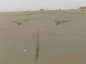
- RY AVBL WHEN TIDE IS LOW.
- VEHICLES, PEDESTRIANS & ANIMALS ON & INVOF RY.
Nearby Airports with Instrument Procedures
| ID | Name | Heading / Distance | ||
|---|---|---|---|---|
 |
KHQM | Bowerman Field Airport | 135° | 14.7 |
|
KSHN | Sanderson Field Airport | 082° | 43.0 |
|
KOLM | Olympia Regional Airport | 100° | 53.8 |
|
KCLS | Chehalis-Centralia Airport | 119° | 57.0 |
|
KAST | Astoria Regional Airport | 167° | 60.6 |
|
KPWT | Bremerton Ntl Airport | 069° | 61.7 |
|
KCLM | William R Fairchild International Airport | 025° | 64.9 |
|
KGRF | Gray AAF (Joint Base Lewis-Mcchord) Airport | 092° | 66.0 |
|
KTIW | Tacoma Narrows Airport | 083° | 66.3 |
|
KNOW | Port Angeles CGAS Airport | 027° | 67.6 |
|
KTDO | Ed Carlson Memorial Field/South Lewis County Airport | 124° | 69.7 |
|
KTCM | Mcchord Field (Joint Base Lewis-Mcchord) Airport | 089° | 70.2 |