Login
Register
NOW
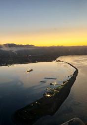
Port Angeles CGAS Airport
Official FAA Data Effective 2026-01-22 0901Z
VFR Chart of KNOW
Sectional Charts at SkyVector.com
IFR Chart of KNOW
Enroute Charts at SkyVector.com
Location Information for KNOW
Coordinates: N48°8.48' / W123°24.84'Located 02 miles N of Port Angeles, Washington. View all Airports in Washington.
Surveyed Elevation is 13 feet MSL.
Operations Data
|
|
Airport Communications
| AWOS-3P: | 118.325 Tel. 360-457-7529 |
|---|---|
| WHIDBEY APPROACH: | 118.2 285.65 |
| WHIDBEY DEPARTURE: | 118.2 285.65 |
| CLEARANCE DELIVERY: | 124.15 |
| CTAF: | 122.975 |
| UNICOM: | 122.975 |
| ASOS at CLM (3.9 W): | 135.175 360-457-1070 |
| AWOS-3P at 0S9 (24.7 E): | 119.025 360-379-1199 |
| ASOS at FHR (27.6 NE): | 135.675 360-378-8491 |
- E8 FREQS 8980 5692 AND 3120 ARE SSB.
- CTC CG-OPS 127.7/345.0. VFR ADVISORY ON 381.8/2182.0/2703.0/3120.0/5692.0/8980.0.
Nearby Navigation Aids
|
| ||||||||||||||||||||||||||||||||||||||||||||||||||||||
Runway 08/26
| Dimensions: | 4500 x 150 feet / 1372 x 46 meters | |
|---|---|---|
| Surface: | Asphalt | |
| Weight Limits: | 15 /F/B/W/T | |
| Edge Lighting: | Medium Intensity | |
| Runway 08 | Runway 26 | |
| Coordinates: | N48°8.50' / W123°25.39' | N48°8.45' / W123°24.29' |
| Elevation: | 9.0 | 8.0 |
| Runway Heading: | 93° True | 273° True |
Helipad H1
| Dimensions: | 100 x 100 feet / 30 x 30 meters | |
|---|---|---|
| Surface: | Asphalt | |
| Edge Lighting: | Low Intensity | |
Ownership Information
| Ownership: | ||
|---|---|---|
| Owner: | USCG | |
| 1 EDIZ HOOK | ||
| PORT ANGELES, WA 98362 | ||
| Manager: | OPERATIONS OFFICER | |
| 1 EDIZ HOOK | ||
| PORT ANGELES, WA 98362 | ||
| 360-417-5840 | ||
Other Remarks
- RSTD: CLSD TO NON-CG ACFT WO 24 HR PPR. C360-417-5840.
- RSTD: 24 HR PPR FOR ALL TRANS ACFT.
- TRAN ALERT: TRANS QTRS NOT AVBL.
- FOR CD CTC WHIDBEY APCH AT 360-257-3310.
- CTC PORT ANGELES AIR ON 345.0 OR 127.7, 15 MIN PRIOR TO LNDG.
- FUEL: J8 AVBL TO SAR AND CG MSN ONLY.
- BIRDS ON RY ALL YR. BLDGS AS CLOSE AS 126 FT FR RY CNTRLN.
Weather Minimums
Instrument Approach Procedure (IAP) Charts
Nearby Airports with Instrument Procedures
| ID | Name | Heading / Distance | ||
|---|---|---|---|---|
 |
KCLM | William R Fairchild International Airport | 249° | 3.7 |
 |
0S9 | Jefferson County International Airport | 101° | 24.8 |
 |
KFHR | Friday Harbor Airport | 034° | 27.7 |
 |
KOKH | Delaurentis Airport | 077° | 30.4 |
 |
CYYJ | Victoria International Airport | 359° | 30.4 |
 |
KNUW | Whidbey Island NAS (Ault Field) Airport | 067° | 32.9 |
 |
KORS | Orcas Island Airport | 030° | 39.5 |
 |
KBVS | Skagit Regional Airport | 063° | 44.4 |
 |
KPWT | Bremerton Ntl Airport | 145° | 47.1 |
 |
KPAE | Seattle Paine Field International Airport | 106° | 47.7 |
 |
KAWO | Arlington Municipal Airport | 088° | 50.4 |
 |
KBLI | Bellingham International Airport | 041° | 52.5 |


