Login
Register


SFZ
North Central State Airport
Official FAA Data Effective 2025-12-25 0901Z
Chart Supplement

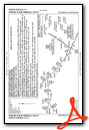
VFR Chart of KSFZ
Sectional Charts at SkyVector.com
IFR Chart of KSFZ
Enroute Charts at SkyVector.com
Location Information for KSFZ
Coordinates: N41°55.24' / W71°29.49'Located 03 miles E of Pawtucket, Rhode Island on 475 acres of land. View all Airports in Rhode Island.
Surveyed Elevation is 440 feet MSL.
Operations Data
|
|
Airport Communications
| AWOS-3PT: | 120.775 Tel. 401-334-0324 |
|---|---|
| PROVIDENCE APPROACH: | 123.675 244.875 |
| PROVIDENCE DEPARTURE: | 123.675 244.875 |
| CLEARANCE DELIVERY: | 124.35 |
| WIPOR STAR: | 123.675 244.875 |
| UNICOM: | 123.075 |
| CTAF: | 123.075 |
| ASOS at PVD (12.2 S): | 124.2 401-734-2818 |
| D-ATIS at PVD (12.2 S): | 124.2 |
| AWOS-3PT at 1B9 (13.9 E): | 118.675 774-372-2047 |
- APCH/DEP SVC PRVDD BY BOSTON ARTCC ON FREQS 124.85/307.9 (WOODSTOCK RCAG) WHEN PROVIDENCE APCH CTL CLSD.
Nearby Navigation Aids
|
| ||||||||||||||||||||||||||||||||||||||||||||||||||||||


Runway 05/23
| Dimensions: | 5000 x 100 feet / 1524 x 30 meters | |
|---|---|---|
| Surface: | Asphalt in Good Condition | |
| Weight Limits: | S-30, D-60 | |
| Edge Lighting: | High Intensity | |
| Runway 05 | Runway 23 | |
| Coordinates: | N41°55.00' / W71°29.75' | N41°55.70' / W71°29.16' |
| Elevation: | 418.7 | 419.0 |
| Traffic Pattern: | Left | Left |
| Runway Heading: | 32° True | 212° True |
| Markings: | Non-Precision Instrument in good condition. | Non-Precision Instrument in good condition. |
| Glide Slope Indicator | P4R (3.00° Glide Path Angle) | P4L (3.00° Glide Path Angle) |
| Approach Lights: | MALS 1,400 Foot Medium-intensity Approach Lighting System. | |
| REIL: | Yes | |
| Obstacles: | 53 ft Trees 2200 ft from runway, 700 ft right of center +10 FT TREES 150 FT FM THR, 180 FT L; +10 FT TREES 120 FT FM THR, 180 FT R. |
20 ft Trees 900 ft from runway, 150 ft right of center +15 FT TREES 170 FT FM THR, 90 FT R; +10 FT TREES 120 FT FM THR, 150 FT L. |
Runway 15/33
| Dimensions: | 3211 x 75 feet / 979 x 23 meters | |
|---|---|---|
| Surface: | Asphalt in Good Condition | |
| Weight Limits: | S-12 | |
| Edge Lighting: | Medium Intensity | |
| Runway 15 | Runway 33 | |
| Coordinates: | N41°55.29' / W71°29.76' | N41°54.88' / W71°29.30' |
| Elevation: | 425.5 | 440.2 |
| Traffic Pattern: | Left | Left |
| Runway Heading: | 140° True | 320° True |
| Markings: | Basic in good condition. | Basic in good condition. |
| Glide Slope Indicator | P4L (3.50° Glide Path Angle) | |
| REIL: | Yes | Yes |
| Obstacles: | 39 ft Trees 850 ft from runway, 200 ft right of center | 24 ft Trees 535 ft from runway, 90 ft left of center |
Services Available
| Fuel: | 100LL (blue), Jet-A, Jet A+ |
|---|---|
| Transient Storage: | Hangars,Tiedowns |
| Airframe Repair: | MAJOR |
| Engine Repair: | MAJOR |
| Bottled Oxygen: | NONE |
| Bulk Oxygen: | NONE |
| Other Services: | CHARTER SERVICE,GLIDER SERVICE,PILOT INSTRUCTION,PARACHUTE JUMP ACTIVITY,AIRCRAFT RENTAL,AIRCRAFT SALES |
Ownership Information
| Ownership: | Publicly owned | |
|---|---|---|
| Owner: | STATE OF RHODE ISLAND | |
| RHODE ISLAND AIRPORT CORP, 2000 POST RD | ||
| WARWICK, RI 02886 | ||
| 401-691-2000 | ||
| Manager: | IFTIKHAR AHMAD | |
| RHODE ISLAND AIRPORT CORP, 2000 POST RD | ||
| WARWICK, RI 02886 | ||
| 401-691-2000 | ||
Other Remarks
- RWY CONDS MAY NOT BE MNT OR RPRTD WHEN AP IS UNATNDD. CTC RI AP CORPORATION OPS AT 401-691-2265.
- FOR CD WHEN APCH CLSD CTC BOSTON ARTCC AT 603-879-6859.
- AP WILDLIFE HAZ DEER ACT INCREASED HN.
- NMRS UNLGTD OBSTNS UP TO 150 FT AGL SRNDG AIRFIELD.
- BIRDS & WILDLIFE ON & INVOF ARPT.
- LGTD 250 FT MSL TWR 3-2/5 MI SE.
- OVNGT PRKG FEE.
- +50 FT DROPOFF 250 FT FM RWY 05 END, +40 FT DROPOFF 250 FT FM RWY 23 END.
- SEASONAL SKYDIVING NE SIDE OF AIRFIELD.
- NOISE ABATEMENT PROCS IN EFCT, CTC AMGR.
- ACTVT MALS RWY 05; REIL RWY 23, 15 & 33; PAPI RWY 05, 15 & 23; HIRL RWY 05/23; MIRL RWY 15/33; TWY LGTS - CTAF.
Weather Minimums
Standard Terminal Arrival (STAR) Charts
Instrument Approach Procedure (IAP) Charts


Nearby Airports with Instrument Procedures
| ID | Name | Heading / Distance | ||
|---|---|---|---|---|
 |
1B6 | Hopedale Industrial Park Airport | 355° | 11.2 |
|
KPVD | Rhode Island Tf Green International Airport | 166° | 12.2 |
|
1B9 | Mansfield Municipal Airport | 069° | 14.0 |
|
KOQU | Quonset State Airport | 169° | 19.7 |
|
KTAN | Taunton Municipal/King Field Airport | 097° | 21.5 |
|
KOWD | Norwood Memorial Airport | 041° | 21.6 |
|
KUUU | Newport State Airport | 157° | 25.1 |
|
3B0 | Southbridge Municipal Airport | 294° | 26.8 |
|
KORH | Worcester Regional Airport | 320° | 26.9 |
|
KEWB | New Bedford Regional Airport | 121° | 28.1 |
|
6B6 | Minute Man Air Field Airport | 357° | 32.4 |
|
KIJD | Windham Airport | 251° | 32.7 |
Airport Images
Do you have a recent image of this airport? Upload it here!


