Login
Register


TAN
Taunton Municipal/King Field Airport
Official FAA Data Effective 2025-12-25 0901Z
Chart Supplement

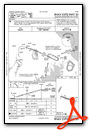
VFR Chart of KTAN
Sectional Charts at SkyVector.com
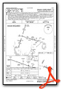
IFR Chart of KTAN
Enroute Charts at SkyVector.com
Location Information for KTAN
Coordinates: N41°52.44' / W71°0.91'Located 03 miles E of Taunton, Massachusetts on 256 acres of land. View all Airports in Massachusetts.
Surveyed Elevation is 41 feet MSL.
Operations Data
|
|
Airport Communications
| ASOS: | 132.675 Tel. 508-824-5005 |
|---|---|
| PROVIDENCE APPROACH: | 128.7 269.525 |
| PROVIDENCE DEPARTURE: | 128.7 269.525 |
| UNICOM: | 122.700 |
| CTAF: | 122.700 |
| AWOS-3PT at 1B9 (11.2 NW): | 118.675 774-372-2047 |
| ASOS at EWB (12.0 S): | 126.85 508-992-0195 |
| ATIS at EWB (12.1 S): | 126.85 |
- APCH/DEP SVC PRVDD BY BOSTON ARTCC ON FREQS 124.85/307.9 (WOODSTOCK RCAG) WHEN PROVIDENCE APCH CTL CLSD.
Nearby Navigation Aids
|
| ||||||||||||||||||||||||||||||||||||||||||||||||||||||


Runway 12/30
| Dimensions: | 3499 x 75 feet / 1066 x 23 meters | |
|---|---|---|
| Surface: | Asphalt in Good Condition | |
| Weight Limits: | S-45, D-73, ST-129
PCR VALUE: 150/F/B/X/T
| |
| Edge Lighting: | Medium Intensity | |
| Runway 12 | Runway 30 | |
| Coordinates: | N41°52.45' / W71°1.19' | N41°52.27' / W71°0.45' |
| Elevation: | 34.9 | 41.2 |
| Traffic Pattern: | Left | Left |
| Runway Heading: | 108° True | 288° True |
| Markings: | Non-Precision Instrument in good condition. | Non-Precision Instrument in good condition. |
| Glide Slope Indicator | P4R (4.00° Glide Path Angle) | |
| REIL: | Yes | |
| Obstacles: | 23 ft Trees 1000 ft from runway, 135 ft right of center | 40 ft Trees 1075 ft from runway, 125 ft left of center |
Runway 04/22
| Dimensions: | 1034 x 60 feet / 315 x 18 meters | |
|---|---|---|
| Surface: | Turf-Gravel in Fair Condition SFC ROUGH & LOOSE STONES. | |
| Runway 04 | Runway 22 | |
| Coordinates: | N41°52.65' / W71°1.28' | N41°52.81' / W71°1.18' |
| Elevation: | 23.6 | 25.7 |
| Traffic Pattern: | Left | Left |
| Runway Heading: | 27° True | 207° True |
| Obstacles: | 60 ft Trees 800 ft from runway | 85 ft Trees 1000 ft from runway, 125 ft left of center |
Services Available
| Fuel: | 100LL (blue) |
|---|---|
| Transient Storage: | Tiedowns |
| Airframe Repair: | MAJOR |
| Engine Repair: | MAJOR |
| Bottled Oxygen: | NONE |
| Bulk Oxygen: | NONE |
| Other Services: | PILOT INSTRUCTION |
Ownership Information
| Ownership: | Publicly owned | |
|---|---|---|
| Owner: | CITY OF TAUNTON | |
| CITY HALL, 15 SUMMER ST | ||
| TAUNTON, MA 02780 | ||
| 508-821-1000 | ||
| Manager: | JAY D' ESPINOSA | |
| 4 WESTCOAT | ||
| EAST TAUNTON, MA 02718 | ||
| 508-821-2973 | ||
Other Remarks
- AVOID FLYING OVR THE ELEMENTARY SCHOOL AT DER 30.
- HEL AVOID OVERFLIGHT OF DENSELY POPULATED AREAS W & S OF ARPT.
- CAUTION WILDLIFE, DEER & GEESE ON AND INVOF ARPT AND RWYS.
- FOR CD CTC PROVIDENCE APCH AT 401-738-8945, WHEN APCH CLSD CTC BOSTON ARTCC AT 603-879-6859.
- ACTVT PAPI RWY 30; MIRL RWY 12/30; LGTD WINDSOCK - CTAF.
Weather Minimums
Standard Terminal Arrival (STAR) Charts
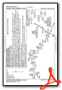
Instrument Approach Procedure (IAP) Charts
Nearby Airports with Instrument Procedures
| ID | Name | Heading / Distance | ||
|---|---|---|---|---|
 |
1B9 | Mansfield Municipal Airport | 312° | 11.2 |
|
KEWB | New Bedford Regional Airport | 167° | 12.1 |
|
KPYM | Plymouth Municipal Airport | 080° | 13.1 |
|
KOWD | Norwood Memorial Airport | 339° | 20.2 |
|
KGHG | Marshfield Municipal - George Harlow Field Airport | 048° | 20.3 |
|
KPVD | Rhode Island Tf Green International Airport | 243° | 20.6 |
|
KSFZ | North Central State Airport | 277° | 21.5 |
|
KUUU | Newport State Airport | 210° | 23.7 |
|
KOQU | Quonset State Airport | 227° | 24.4 |
|
KFMH | Cape Cod Coast Guard Air Station Airport | 120° | 25.6 |
|
1B6 | Hopedale Industrial Park Airport | 302° | 26.2 |
|
5B6 | Falmouth Airpark Airport | 128° | 27.5 |
Airport Images
Do you have a recent image of this airport? Upload it here!


