Login
Register


1B9
Mansfield Municipal Airport
Official FAA Data Effective 2026-01-22 0901Z
Chart Supplement

VFR Chart of 1B9
Sectional Charts at SkyVector.com
IFR Chart of 1B9
Enroute Charts at SkyVector.com
Location Information for 1B9
Coordinates: N42°0.05' / W71°11.88'Located 02 miles SE of Mansfield, Massachusetts on 235 acres of land. View all Airports in Massachusetts.
Surveyed Elevation is 122 feet MSL.
Operations Data
|
|
Airport Communications
| AWOS-3PT: | 118.675 Tel. 774-372-2047 |
|---|---|
| BOSTON APPROACH: | 124.1 |
| BOSTON DEPARTURE: | 124.1 343.6 |
| UNICOM: | 123.000 |
| CTAF: | 123.000 |
| WOONS STAR: | 120.6 263.1 |
| ASOS at TAN (10.9 SE): | 132.675 508-824-5005 |
| ASOS at OWD (11.4 N): | 119.95 781-762-4314 |
| ATIS at OWD (11.4 N): | 119.95 |
Nearby Navigation Aids
|
| ||||||||||||||||||||||||||||||||||||||||||||||||||||||


Runway 14/32
| Dimensions: | 3500 x 75 feet / 1067 x 23 meters | |
|---|---|---|
| Surface: | Asphalt in Good Condition | |
| Weight Limits: | S-26 | |
| Edge Lighting: | Medium Intensity | |
| Runway 14 | Runway 32 | |
| Coordinates: | N42°0.16' / W71°12.12' | N41°59.85' / W71°11.47' |
| Elevation: | 121.4 | 119.0 |
| Traffic Pattern: | Left | Left |
| Runway Heading: | 123° True | 303° True |
| Displaced Threshold: | 509 Feet | 237 Feet |
| Markings: | Basic in good condition. | Non-Precision Instrument in good condition. |
| Glide Slope Indicator | P4L (4.00° Glide Path Angle) | |
| Obstacles: | 50 ft Trees 1200 ft from runway APCH RATIO 34:1 TO DTHR. |
50 ft Trees 800 ft from runway, 125 ft right of center APCH RATIO 34:1 TO DTHR. |
Runway 04/22
| Dimensions: | 2059 x 100 feet / 628 x 30 meters | |
|---|---|---|
| Surface: | Turf in Good Condition | |
| Runway 04 | Runway 22 | |
| Coordinates: | N41°59.99' / W71°12.14' | N42°0.29' / W71°11.93' |
| Elevation: | 116.8 | 122.9 |
| Traffic Pattern: | Left | Left |
| Runway Heading: | 28° True | 208° True |
| Markings: | None | None |
| Obstacles: | 42 ft Trees 830 ft from runway | 100 ft Trees 600 ft from runway |
Services Available
| Fuel: | 100LL (blue) |
|---|---|
| Transient Storage: | Tiedowns |
| Airframe Repair: | MAJOR |
| Engine Repair: | MAJOR |
| Bottled Oxygen: | NONE |
| Bulk Oxygen: | NONE |
| Other Services: | AIR AMBULANCE SERVICES,CHARTER SERVICE,PILOT INSTRUCTION |
Ownership Information
| Ownership: | Publicly owned | |
|---|---|---|
| Owner: | TOWN OF MANSFIELD | |
| TOWN HALL, 6 PARK ROW | ||
| MANSFIELD, MA 02048 | ||
| 508-261-7370 | ||
| Manager: | KEVIN BULLOCK | |
| 265 FRUIT ST | ||
| MANSFIELD, MA 02048 | ||
| 508-930-1121 | OR 508-339-3001. | |
Other Remarks
- TURF STRIP CLSD WINTER MONTHS & AFT HVY RAINS.
- ON DEP RWY 32 TURN L TO 290 DEGS.
- ON DEP RWY 14 NO L TURNS TIL 824 FT MSL.
- NO TGLS 2100-0800.
- NO R TURNS ON DEP FM RWY 32 TIL 1000 FT MSL.
- FOR CD CTC BOSTON APCH AT 603-594-5554.
- WILDLIFE ON & INVOF ARPT.
- RWY 14/32 LGTS OTS.
- ACTVT PAPI RWY 32; MIRL RWY 14/32 - CTAF.
Weather Minimums

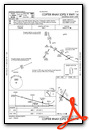
Standard Terminal Arrival (STAR) Charts
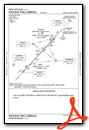
Instrument Approach Procedure (IAP) Charts


Nearby Airports with Instrument Procedures
| ID | Name | Heading / Distance | ||
|---|---|---|---|---|
 |
KTAN | Taunton Municipal/King Field Airport | 132° | 11.2 |
|
KOWD | Norwood Memorial Airport | 005° | 11.4 |
|
KSFZ | North Central State Airport | 249° | 14.0 |
|
1B6 | Hopedale Industrial Park Airport | 294° | 15.3 |
|
KPVD | Rhode Island Tf Green International Airport | 211° | 19.6 |
|
KPYM | Plymouth Municipal Airport | 104° | 21.8 |
|
KEWB | New Bedford Regional Airport | 150° | 22.2 |
|
KBOS | General Edward Lawrence Logan International Airport | 021° | 23.3 |
|
KGHG | Marshfield Municipal - George Harlow Field Airport | 075° | 24.2 |
|
KOQU | Quonset State Airport | 201° | 26.0 |
|
KUUU | Newport State Airport | 187° | 28.3 |
|
KBED | Laurence G Hanscom Field Airport | 351° | 28.4 |
Airport Images
Do you have a recent image of this airport? Upload it here!


