Login
Register
SIV
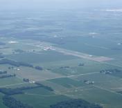
Sullivan County Airport
Official FAA Data Effective 2026-01-22 0901Z
VFR Chart of KSIV
Sectional Charts at SkyVector.com
IFR Chart of KSIV
Enroute Charts at SkyVector.com
Location Information for KSIV
Coordinates: N39°6.88' / W87°26.90'Located 03 miles NW of Sullivan, Indiana on 108 acres of land. View all Airports in Indiana.
Surveyed Elevation is 539 feet MSL.
Operations Data
|
|
Airport Communications
| HULMAN APPROACH: | 135.35 339.8 |
|---|---|
| HULMAN DEPARTURE: | 135.35 339.8 |
| UNICOM: | 122.800 |
| CTAF: | 122.800 |
| AWOS-3 at RSV (11.1 SW): | 120.50 618-586-2772 |
| ASOS at HUF (20.6 N): | 127.5 812-877-7010 |
| ATIS at HUF (21.2 N): | 269.375 |
Nearby Navigation Aids
|
| ||||||||||||||||||||||||||||||||||||||||||||||||||||||||||||
Runway 18/36
| Dimensions: | 4359 x 75 feet / 1329 x 23 meters | |
|---|---|---|
| Surface: | Asphalt / Rubberized Friction Seal Coated in Good Condition | |
| Weight Limits: | S-27, D-35 | |
| Edge Lighting: | Medium Intensity | |
| Runway 18 | Runway 36 | |
| Coordinates: | N39°7.24' / W87°26.89' | N39°6.52' / W87°26.91' |
| Elevation: | 536.9 | 534.6 |
| Traffic Pattern: | Left | Left |
| Runway Heading: | 181° True | 1° True |
| Markings: | Non-Precision Instrument in good condition. | Non-Precision Instrument in good condition. |
| Glide Slope Indicator | P2L (3.00° Glide Path Angle) | P2L (3.00° Glide Path Angle) |
| REIL: | Yes | Yes |
| Obstacles: | 10 ft Crops 380 ft from runway | 10 ft Crops 380 ft from runway |
Services Available
| Fuel: | 100LL (blue), Jet-A |
|---|---|
| Transient Storage: | Hangars,Tiedowns |
| Airframe Repair: | MINOR |
| Engine Repair: | MINOR |
| Bottled Oxygen: | NOT AVAILABLE |
| Bulk Oxygen: | NOT AVAILABLE |
| Other Services: | AIRCRAFT RENTAL |
Ownership Information
| Ownership: | Publicly owned | |
|---|---|---|
| Owner: | SULLIVAN COUNTY BOAC | |
| P.O. BOX 351 | ||
| SULLIVAN, IN 47882 | ||
| 812-268-6959 | ||
| Manager: | PAT HARMON | |
| 2001 N CR 200 W | ||
| SULLIVAN, IN 47882 | ||
| 812-268-6959 | ||
Other Remarks
- 153 FT TWR 6600 FT SE.
- MOORED BALLOON 2 MI E 1600 FT & BLW.
- FOR CD CTC HULMAN APCH AT 812-877-7581.
- ACTVT REILS RWYS 18 & 36; MIRL RWY 18/36 - CTAF. PAPI RWY 18 & 36 OPR CONSLY.
- 24 HR.
Weather Minimums
Instrument Approach Procedure (IAP) Charts
Nearby Airports with Instrument Procedures
| ID | Name | Heading / Distance | ||
|---|---|---|---|---|
 |
KRSV | Crawford County Airport | 237° | 11.1 |
 |
KHUF | Terre Haute Regional Airport | 018° | 21.2 |
 |
KLWV | Lawrenceville-Vincennes International Airport | 199° | 22.3 |
 |
3I3 | Sky King Airport | 007° | 26.2 |
 |
0I2 | Brazil Clay County Airport | 036° | 27.1 |
 |
1H8 | Casey Municipal Airport | 293° | 28.3 |
 |
KDCY | Daviess County Airport | 149° | 28.9 |
 |
KAJG | Mount Carmel Municipal Airport | 203° | 33.1 |
 |
KPRG | Edgar County Airport | 343° | 36.6 |
 |
KBMG | Monroe County Airport | 086° | 38.9 |
 |
KOLY | Olney-Noble Airport | 235° | 41.4 |
 |
KGPC | Putnam County Regional Airport | 043° | 42.9 |


