Login
Register


0I2
Brazil Clay County/Charles B Hall Field Airport
Official FAA Data Effective 2026-02-19 0901Z
Chart Supplement

VFR Chart of 0I2
Sectional Charts at SkyVector.com
IFR Chart of 0I2
Enroute Charts at SkyVector.com
Location Information for 0I2
Coordinates: N39°28.60' / W87°5.98'Located 03 miles S of Brazil, Indiana on 70 acres of land. View all Airports in Indiana.
Surveyed Elevation is 645 feet MSL.
Operations Data
|
|
Airport Communications
| HULMAN APPROACH: | 125.45 134.725 339.8 |
|---|---|
| HULMAN DEPARTURE: | 125.45 134.725 339.8 |
| UNICOM: | 122.800 |
| CTAF: | 122.800 |
| ATIS at HUF (9.7 W): | 269.375 |
| ASOS at HUF (10.5 W): | 127.5 812-877-7010 |
| AWOS-3PT at GPC (16.2 NE): | 118.125 765-653-1789 |
Nearby Navigation Aids
|
| ||||||||||||||||||||||||||||||||||||||||||||||||||||||||||||


Runway 09/27
| Dimensions: | 2941 x 40 feet / 896 x 12 meters | |
|---|---|---|
| Surface: | Asphalt in Good Condition | |
| Weight Limits: | S-8 | |
| Edge Lighting: | Low Intensity | |
| Runway 09 | Runway 27 | |
| Coordinates: | N39°28.61' / W87°6.30' | N39°28.60' / W87°5.67' |
| Elevation: | 645.0 | 631.0 |
| Traffic Pattern: | Left | Left |
| Runway Heading: | 91° True | 271° True |
| Displaced Threshold: | 620 Feet | 442 Feet |
| Markings: | Non-Precision Instrument in good condition. | Basic in good condition. |
| Obstacles: | 75 ft Trees 760 ft from runway, 125 ft left of center APCH RATIO 18:1 TO DSPLCD THR. 4 FT FENCE 28 FT FM RWY. |
51 ft Trees 350 ft from runway, 140 ft left of center APCH RATIO 15:1 TO DSPLCD THR. PVT DRIVE 20 FT L. |
Services Available
| Fuel: | 100LL (blue) |
|---|---|
| Transient Storage: | Tiedowns |
| Airframe Repair: | NOT AVAILABLE |
| Engine Repair: | NOT AVAILABLE |
| Bottled Oxygen: | NONE |
| Bulk Oxygen: | NONE |
Ownership Information
| Ownership: | Publicly owned | |
|---|---|---|
| Owner: | BRAZIL-CLAY COUNTY BOAC | |
| PO BOX 1 | ||
| KNIGHTSVILLE, IN 47857 | ||
| (812) 240-2860 | ||
| Manager: | KIP CLARK | |
| PO BOX 1 | ||
| KNIGHTSVILLE, IN 47857 | ||
| 812-240-1552 | ||
Other Remarks
- THIS AIRPORT HAS BEEN SURVEYED BY THE NATIONAL GEODETIC SURVEY.
- +80 FT WSW - ENE PLINE 4/5 MI N OF ARPT.
- LARGE FLOCKS OF GEESE ON & INVOF ARPT.
- FOR CD CTC HULMAN APCH AT 812-877-7581.
- 20 FT DEPRESSION E OF RWY END 100 FT N OF CNTRLN.
- ACTVT LIRL RY 09/27 - CTAF 3 SLOW CLICKS .
Weather Minimums

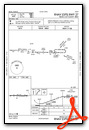
Instrument Approach Procedure (IAP) Charts
Nearby Airports with Instrument Procedures
| ID | Name | Heading / Distance | ||
|---|---|---|---|---|
 |
KHUF | Terre Haute Regional Airport | 260° | 9.8 |
|
3I3 | Sky King Airport | 288° | 13.6 |
|
KGPC | Putnam County Regional Airport | 054° | 16.3 |
|
KSIV | Sullivan County Airport | 216° | 27.1 |
|
KPRG | Edgar County Airport | 296° | 29.7 |
|
KBMG | Monroe County Airport | 131° | 30.0 |
|
KCFJ | Crawfordsville Regional Airport | 015° | 31.0 |
|
2R2 | Hendricks County-Gordon Graham Field Airport | 060° | 33.2 |
|
KRSV | Crawford County Airport | 223° | 37.7 |
|
KIND | Indianapolis International Airport | 068° | 40.0 |
|
KEYE | Eagle Creek Airpark Airport | 060° | 42.9 |
|
1H8 | Casey Municipal Airport | 256° | 43.3 |
Airport Images

By: 2flaps


