Login
Register


UTA
Tunica Municipal Airport
Official FAA Data Effective 2026-01-22 0901Z
Chart Supplement

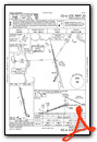
VFR Chart of KUTA
Sectional Charts at SkyVector.com
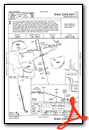
IFR Chart of KUTA
Enroute Charts at SkyVector.com
Location Information for KUTA
Coordinates: N34°41.10' / W90°20.87'Located 01 miles E of Tunica, Mississippi on 863 acres of land. View all Airports in Mississippi.
Surveyed Elevation is 194 feet MSL.
Operations Data
|
|
Airport Communications
| AWOS-3: | 118.075 Tel. 662-363-1652 |
|---|---|
| MEMPHIS APPROACH: | 119.1 291.6 |
| MEMPHIS DEPARTURE: | 119.1 291.6 |
| CLEARANCE DELIVERY: | 118.9 |
| UNICOM: | 123.000 |
| CTAF: | 123.000 |
| AWOS-3 at CKM (24.5 S): | 120.675 662-624-9777 |
| ASOS at AWM (27.9 N): | 118.175 870-733-9987 |
| D-ATIS at MEM (28.2 NE): | 127.75 |
Nearby Navigation Aids
|
| ||||||||||||||||||||||||||||||||||||||||||||||||||||||


Runway 17/35
RWY 35 CALM WIND RWY. | ||
| Dimensions: | 8500 x 150 feet / 2591 x 46 meters | |
|---|---|---|
| Surface: | Asphalt / Grooved in Good Condition | |
| Weight Limits: | 45 /F/B/X/U, S-94, D-215, ST-460, DT-720
TRIPLE TANDEM = 510
| |
| Edge Lighting: | High Intensity | |
| Runway 17 | Runway 35 | |
| Coordinates: | N34°41.79' / W90°21.06' | N34°40.42' / W90°20.68' |
| Elevation: | 194.4 | 194.4 |
| Traffic Pattern: | Right | |
| Runway Heading: | 167° True | 347° True |
| Markings: | Precision Instrument in good condition. | Precision Instrument in good condition. |
| Glide Slope Indicator | P4L (3.00° Glide Path Angle) | P4L (3.00° Glide Path Angle) |
| Approach Lights: | MALSR 1,400 Foot Medium-intensity Approach Lighting System with runway alignment indicator lights. | |
| REIL: | Yes | |
Services Available
| Fuel: | 100LL (blue), Jet-A |
|---|---|
| Transient Storage: | Hangars,Tiedowns |
| Airframe Repair: | MAJOR |
| Engine Repair: | MAJOR |
| Bottled Oxygen: | HIGH |
| Bulk Oxygen: | HIGH |
| Other Services: | CROP DUSTING SERVICES |
Ownership Information
| Ownership: | Publicly owned | |
|---|---|---|
| Owner: | TUNICA COUNTY AIRPORT COMMISSION | |
| PO BOX 158 | ||
| TUNICA, MS 38676 | ||
| 662-357-7320 | ||
| Manager: | MARIE WARNER | |
| 209 S ARPT BLVD-PO BOX 158 | ||
| TUNICA, MS 38676 | ||
| 662-357-7320 | ||
Other Remarks
- 24 HR PPR COML FLT OVR 30 PAX - AMGR.
- FOR CD CTC MEMPHIS APCH AT 901-842-8457.
- AGRICULTURAL ACT INVOF ARPT DALGT.
- GEESE INVOF ARPT NOV - FEB.
- CLSD TO SKED ACR OPS WITH MORE THAN 9 PAX SEATS & UNSKED ACR OPS WITH MORE THAN 30 PAX SEATS.
- ACTVT MALSR RWY 35; REIL RWY 17; HIRL RWY 17/35 - CTAF.
Weather Minimums
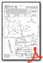
Instrument Approach Procedure (IAP) Charts
Nearby Airports with Instrument Procedures
| ID | Name | Heading / Distance | ||
|---|---|---|---|---|
 |
KHEE | Thompson-Robbins Airport | 248° | 17.5 |
|
6M7 | Marianna/Lee County-Steve Edwards Field Airport | 284° | 23.6 |
|
KCKM | Fletcher Field Airport | 199° | 24.5 |
|
KMMS | Selfs Airport | 173° | 27.3 |
|
KAWM | West Memphis Municipal Airport | 011° | 27.5 |
|
KMEM | Frederick W Smith International Airport | 040° | 28.2 |
|
KPMU | Panola County Airport | 130° | 29.7 |
|
KOLV | Olive Branch/Taylor Field Airport | 057° | 32.8 |
|
M01 | General Dewitt Spain Airport | 025° | 34.1 |
|
KDRP | Delta Regional Airport | 317° | 35.2 |
|
2M8 | Charles W Baker Airport | 029° | 41.0 |
|
M41 | Holly Springs-Marshall County Airport | 079° | 41.5 |
Airport Images
Do you have a recent image of this airport? Upload it here!


