Login
Register


OLV
Olive Branch/Taylor Field Airport
Official FAA Data Effective 2025-11-27 0901Z
Chart Supplement

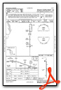
KOLV Airport Diagram

VFR Chart of KOLV
Sectional Charts at SkyVector.com
IFR Chart of KOLV
Enroute Charts at SkyVector.com
Location Information for KOLV
Coordinates: N34°58.72' / W89°47.21'Located 03 miles NE of Olive Branch, Mississippi on 414 acres of land. View all Airports in Mississippi.
Surveyed Elevation is 401 feet MSL.
Operations Data
|
|
Airport Communications
| ATIS: | 119.925 |
|---|---|
| AWOS-3: | 119.925 Tel. 662-893-5906 |
| OLIVE BRANCH TOWER: | 125.275 |
| OLIVE BRANCH GROUND: | 121.2 |
| MEMPHIS APPROACH: | 120.075 125.8 338.3 |
| MEMPHIS DEPARTURE: | 124.15 385.45 |
| CLEARANCE DELIVERY: | 121.2 121.3 ;WHEN TWR CLSD |
| UNICOM: | 122.950 |
| CTAF: | 125.275 |
| D-ATIS at MEM (10.1 NW): | 127.75 |
| ASOS at MEM (10.9 NW): | 127.75 901-842-8483 |
| AWOS-3PT at M01 (18.7 NW): | 118.35 901-354-9296 |
Nearby Navigation Aids
|
| ||||||||||||||||||||||||||||||||||||||||||||||||||||||


Runway 18/36
| Dimensions: | 6000 x 100 feet / 1829 x 30 meters | |
|---|---|---|
| Surface: | Asphalt / Grooved in Excellent Condition | |
| Weight Limits: | S-110, D-151, ST-205, DT-599
PCR VALUE: 459/F/D/X/T
| |
| Edge Lighting: | High Intensity | |
| Runway 18 | Runway 36 | |
| Coordinates: | N34°59.22' / W89°47.22' | N34°58.23' / W89°47.21' |
| Elevation: | 401.2 | 394.1 |
| Traffic Pattern: | Left | Left |
| Runway Heading: | 180° True | 360° True |
| Markings: | Precision Instrument in good condition. | Non-Precision Instrument in good condition. |
| Glide Slope Indicator | V4L (3.00° Glide Path Angle) | V4L (3.00° Glide Path Angle) |
| Approach Lights: | MALSR 1,400 Foot Medium-intensity Approach Lighting System with runway alignment indicator lights. | |
| REIL: | Yes | |
| Obstacles: | 37 ft Trees 1590 ft from runway | |
Services Available
| Fuel: | 100LL (blue), Jet-A |
|---|---|
| Transient Storage: | Hangars,Tiedowns |
| Airframe Repair: | MAJOR |
| Engine Repair: | MAJOR |
| Bottled Oxygen: | HIGH BOTTLE OXY AVBL ON REQ CALL 662-895-2978. |
| Bulk Oxygen: | NONE |
| Other Services: | AVIONICS,PILOT INSTRUCTION,AIRCRAFT RENTAL |
Ownership Information
| Ownership: | Publicly owned | |
|---|---|---|
| Owner: | CITY OF OLIVE BRANCH | |
| 9200 PIGEON ROOST RD | ||
| OLIVE BRANCH, MS 38654 | ||
| 662-895-2978 | ||
| Manager: | DAVID TAYLOR JR | |
| 8000 TERMINAL DR | ||
| OLIVE BRANCH, MS 38654 | ||
| 662-895-2978 | ||
Other Remarks
- THIS AIRPORT HAS BEEN SURVEYED BY THE NATIONAL GEODETIC SURVEY.
- FIXED DIST MKRS.
- READ BACK RQRD OF ALL HOLD BACK INSTRUCTIONS.
- TWY H CLSD EXC TO SNGL & LGT TWIN ACFT ONLY.
- 0LL SELF-SVC FUEL AVBL 24 HRS WITH CREDIT CARD.
- ACTVT MALSR RWY 18 - CTAF.
Weather Minimums


Instrument Approach Procedure (IAP) Charts


Nearby Airports with Instrument Procedures
| ID | Name | Heading / Distance | ||
|---|---|---|---|---|
 |
KMEM | Memphis International Airport | 292° | 10.1 |
|
M41 | Holly Springs-Marshall County Airport | 128° | 16.8 |
|
M01 | General Dewitt Spain Airport | 315° | 18.7 |
|
2M8 | Charles W Baker Airport | 338° | 19.3 |
|
KNQA | Millington/Memphis Airport | 349° | 23.0 |
|
KFYE | Fayette County Airport | 054° | 23.7 |
|
KAWM | West Memphis Municipal Airport | 293° | 24.0 |
|
KUTA | Tunica Municipal Airport | 237° | 32.8 |
|
KPMU | Panola County Airport | 188° | 37.2 |
|
M04 | Covington Municipal Airport | 015° | 37.5 |
|
KUOX | University-Oxford Airport | 160° | 37.7 |
|
M08 | William L Whitehurst Field Airport | 068° | 39.3 |
Fuel Providers

Airport Images
Do you have a recent image of this airport? Upload it here!


