Login
Register
W73
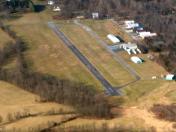
Mid Atlantic Soaring Center Airport
Official FAA Data Effective 2025-12-25 0901Z
VFR Chart of W73
Sectional Charts at SkyVector.com
IFR Chart of W73
Enroute Charts at SkyVector.com
Location Information for W73
Coordinates: N39°45.42' / W77°21.08'Located 02 miles SE of Fairfield, Pennsylvania on 75 acres of land. View all Airports in Pennsylvania.
Estimated Elevation is 573 feet MSL.
TPA 1365' MSL.
Operations Data
|
|
Airport Communications
| CTAF: | 123.300 |
|---|---|
| ASOS at HGR (17.6 W): | 126.375 301-745-3497 |
| AWOS-3 at DMW (18.2 SE): | 121.25 410-876-1281 |
| AWOS-3 at N68 (18.8 NW): | 120.725 717-261-1943 |
Nearby Navigation Aids
|
| ||||||||||||||||||||||||||||||||||||||||||||||||||||||||||||
Runway 15/33
| Dimensions: | 2700 x 50 feet / 823 x 15 meters | |
|---|---|---|
| Surface: | Asphalt in Good Condition | |
| Weight Limits: | S-12, D-12 | |
| Runway 15 | Runway 33 | |
| Traffic Pattern: | Left | Right |
| Displaced Threshold: | 900 Feet | |
| Markings: | Basic in good condition. | |
| Obstacles: | 82 ft Trees 370 ft from runway, 92 ft left of center RY 15 HAS +15 FT ROAD AT RY END 125 FT L/R OF CNTRLN. |
60 ft Trees 1022 ft from runway, 163 ft left of center RY 33 APPROACH SLOPE 20:1 TO DSPLCD THLD. |
Services Available
| Fuel: | NONE |
|---|---|
| Transient Storage: | NONE |
| Airframe Repair: | NONE |
| Engine Repair: | NONE |
| Bottled Oxygen: | NONE |
| Bulk Oxygen: | NONE |
Ownership Information
| Ownership: | Privately Owned | |
|---|---|---|
| Owner: | MID-ATLANTIC SOARING ASSOC. | |
| 154 PECHER RD | ||
| FAIRFIELD, PA 17320 | ||
| 717-642-9907 | ||
| Manager: | MARK PHILIP | |
| 154 PECHER RD, 165 PECHER RD | ||
| FAIRFIELD, PA 17320 | ||
| 770-540-5503 | ||
Other Remarks
- EXTSV GLDR OPNS.
- RY 15 CLSD FOR LANDINGS.
- KARLINDO PERSONAL USE ARPT LCTD 1300 FT E OF RYS.
- ARPT OPS RESTRICTED, IAW TFR RULES, WHEN P-40 EXPANDED TO 10 NM RADIUS.
- GLIDERS OCCASSIONALLY LAND ON TURF AREA ADJACENT TO RY 15/33.
- FOR CD CTC POTOMAC APCH AT 866-709-4993.
- RY 15 NOT MARKED WITH THLD OR MAGNETIC HEADING.
- MULTICOM 123.3 USED DURING GLIDER ACTIVITY.
- TPA 1365' MSL.
Nearby Airports with Instrument Procedures
| ID | Name | Heading / Distance | ||
|---|---|---|---|---|
 |
W05 | Gettysburg Regional Airport | 035° | 6.2 |
 |
KHGR | Hagerstown Regional/Richard A Henson Field Airport | 260° | 17.6 |
 |
KDMW | Carroll County Regional/Jack B Poage Field Airport | 119° | 18.2 |
 |
N68 | Franklin County Regional Airport | 313° | 18.7 |
 |
KFDK | Frederick Municipal Airport | 183° | 20.4 |
 |
2W2 | Clearview Airpark Airport | 138° | 23.3 |
 |
KTHV | York Airport | 066° | 24.1 |
 |
N94 | Carlisle Airport | 017° | 27.1 |
 |
W50 | Davis Airport | 163° | 32.2 |
 |
KCXY | Capital City Airport | 039° | 36.0 |
 |
KMRB | Eastern Wv Regional/Shepherd Field Airport | 234° | 36.2 |
 |
KGAI | Montgomery County Airpark Airport | 166° | 36.3 |


