Login
Register


IOW
Iowa City Municipal Airport
Official FAA Data Effective 2024-12-26 0901Z
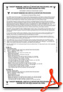
Chart Supplement

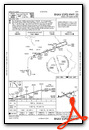
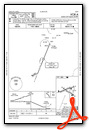
VFR Chart of KIOW
Sectional Charts at SkyVector.com
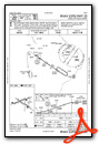
IFR Chart of KIOW
Enroute Charts at SkyVector.com
Location Information for KIOW
Coordinates: N41°38.38' / W91°32.87'Located 02 miles SW of Iowa City, Iowa on 450 acres of land. View all Airports in Iowa.
Surveyed Elevation is 683 feet MSL.
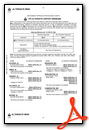
Operations Data
|
|
Airport Communications
| ASOS: | 128.075 Tel. 319-339-9491 |
|---|---|
| CEDAR RAPIDS APPROACH: | 119.7 134.05 266.8 |
| CEDAR RAPIDS DEPARTURE: | 119.7 134.05 266.8 |
| CLEARANCE DELIVERY: | 119.05 |
| UNICOM: | 122.800 |
| CTAF: | 122.800 |
| ASOS at CID (16.4 NW): | 319-558-5153 |
| ATIS at CID (16.4 NW): | 124.15 |
| AWOS-3 at AWG (22.5 S): | 127.825 319-653-4149 |
- APCH/DEP SVC PRVDD BY CHICAGO ARTCC ON FREQS 132.8/328.4 (CEDAR RAPIDS RCAG) WHEN CEDAR RAPIDS APCH CTL CLSD.
Nearby Navigation Aids
|
| ||||||||||||||||||||||||||||||||||||||||||


Runway 07/25
| Dimensions: | 5002 x 100 feet / 1525 x 30 meters | |
|---|---|---|
| Surface: | Concrete / Grooved in Good Condition | |
| Weight Limits: | 15 /R/C/W/T, S-25, D-45 | |
| Edge Lighting: | Medium Intensity | |
| Runway 07 | Runway 25 | |
| Coordinates: | N41°38.29' / W91°33.47' | N41°38.56' / W91°32.43' |
| Elevation: | 683.7 | 650.5 |
| Traffic Pattern: | Right | Left |
| Runway Heading: | 71° True | 251° True |
| Displaced Threshold: | 130 Feet | |
| Declared Distances: | TORA:5002 TODA:5152 ASDA:5002 LDA:5002 | TORA:5002 TODA:5002 ASDA:5002 LDA:4872 |
| Markings: | Non-Precision Instrument in fair condition. | Non-Precision Instrument in fair condition. |
| Glide Slope Indicator | P4L (3.50° Glide Path Angle) | P4L (3.00° Glide Path Angle) |
| REIL: | Yes | Yes |
| Obstacles: | 88 ft Pole 2079 ft from runway, 263 ft right of center | 46 ft Tree 950 ft from runway, 50 ft left of center RWY 25 APCH SLOPE 23:1 TO DTHR. |
Runway 12/30
| Dimensions: | 4200 x 75 feet / 1280 x 23 meters | |
|---|---|---|
| Surface: | Concrete / Grooved in Fair Condition | |
| Weight Limits: | 6 /R/C/W/T, S-15, D-20 | |
| Edge Lighting: | Medium Intensity | |
| Runway 12 | Runway 30 | |
| Coordinates: | N41°38.51' / W91°33.16' | N41°38.12' / W91°32.40' |
| Elevation: | 661.0 | 648.5 |
| Traffic Pattern: | Right | Left |
| Runway Heading: | 125° True | 305° True |
| Displaced Threshold: | 500 Feet | 300 Feet |
| Markings: | Non-Precision Instrument in fair condition. | Non-Precision Instrument in fair condition. |
| Glide Slope Indicator | P2L (3.00° Glide Path Angle) | |
| REIL: | Yes | |
| Obstacles: | 85 ft Tree 1454 ft from runway, 25 ft left of center | 84 ft Tree 1327 ft from runway, 409 ft left of center |
Services Available
| Fuel: | 100LL (blue), Jet-A |
|---|---|
| Transient Storage: | Hangars,Tiedowns |
| Airframe Repair: | MAJOR |
| Engine Repair: | MAJOR |
| Bottled Oxygen: | NONE |
| Bulk Oxygen: | NONE |
| Other Services: | CHARTER SERVICE,PILOT INSTRUCTION,AIRCRAFT RENTAL,AIRCRAFT SALES |
Ownership Information
| Ownership: | Publicly owned | |
|---|---|---|
| Owner: | CITY OF IOWA CITY | |
| 410 EAST WASHINGTON | ||
| IOWA CITY, IA 52240 | ||
| 319-356-5010 | ||
| Manager: | MICHAEL THARP | |
| 1801 S. RIVERSIDE | ||
| IOWA CITY, IA 52246 | ||
| 319-356-5045 | ||
Other Remarks
- NOISE ABATEMENT PROCEDURES IN EFFECT, CTC ARPT MGR 319-356-5045.
- RY 25 DESIGNATED AS CALM WIND RY.
- WATERFOWL & DEER ON & INVOF ARPT.
- HEL ACTIVITY 3/4 MILE N OF ARPT INVOF UNIVERSITY OF IOWA HOSPITAL.
- NUMEROUS UNLGTD CRANES 200 FT AGL 2 NM RDS OF ARPT.
- GLIDER ACTIVITY ON & INVOF ARPT.
- STADIUM WITHIN 3NM, CHECK FOR EVENTS.
- MIRL RWY 07/25 & 12/30 PRESET LOW INTST; TO INCR INTST & ACTVT PAPI RWY 07, 25 & 30; REIL RWY 07, 25 & 30 - CTAF.
Weather Minimums
Instrument Approach Procedure (IAP) Charts
Nearby Airports with Instrument Procedures
| ID | Name | Heading / Distance | ||
|---|---|---|---|---|
 |
KCID | The Eastern Iowa Airport | 333° | 16.4 |
|
8C4 | Mathews Memorial Airport | 067° | 19.2 |
|
KAWG | Washington Municipal Airport | 194° | 22.6 |
|
C17 | Marion Airport | 001° | 23.4 |
|
KMUT | Muscatine Municipal Airport | 131° | 24.3 |
|
KTZT | Belle Plaine Municipal Airport | 293° | 36.1 |
|
KMXO | Monticello Regional Airport | 026° | 38.9 |
|
KFFL | Fairfield Municipal Airport | 209° | 40.1 |
|
KVTI | Vinton Veterans Memorial Airpark Airport | 328° | 40.8 |
|
KMPZ | Mount Pleasant Municipal Airport | 177° | 41.6 |
|
KDVN | Davenport Municipal Airport | 092° | 43.2 |
|
KOQW | Maquoketa Municipal Airport | 055° | 43.8 |
Airport Images

By: rairden


Comments
Services