Login
Register
SPB
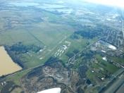
Scappoose Airport
Official FAA Data Effective 2025-02-20 0901Z
VFR Chart of KSPB
Sectional Charts at SkyVector.com
IFR Chart of KSPB
Enroute Charts at SkyVector.com
Location Information for KSPB
Coordinates: N45°46.26' / W122°51.71'Located 01 miles NE of Scappoose, Oregon on 196 acres of land. View all Airports in Oregon.
Surveyed Elevation is 58 feet MSL.
Operations Data
|
|
Airport Communications
| ASOS: | 135.875 Tel. 503-543-6401 |
|---|---|
| PORTLAND APPROACH: | 124.35 299.2 |
| PORTLAND DEPARTURE: | 133.0 299.2 |
| CLEARANCE DELIVERY: | 121.65 |
| CTAF: | 122.800 |
| UNICOM: | 122.800 |
| ASOS at VUO (12.5 SE): | 135.125 360-696-1280 |
| ASOS at HIO (14.0 S): | 503-615-4314 |
| ATIS at HIO (14.2 S): | 127.65 |
Nearby Navigation Aids
|
| ||||||||||||||||||||||||||||||||||||||||||||||||
Runway 15/33
RWY 15 CALM WIND RWY. | ||
| Dimensions: | 5100 x 100 feet / 1554 x 30 meters | |
|---|---|---|
| Surface: | Asphalt in Fair Condition | |
| Weight Limits: | S-30, D-50, ST-90 | |
| Edge Lighting: | Medium Intensity | |
| Runway 15 | Runway 33 | |
| Coordinates: | N45°46.67' / W122°51.83' | N45°45.85' / W122°51.59' |
| Elevation: | 58.1 | 30.0 |
| Traffic Pattern: | Left | Right |
| Runway Heading: | 169° True | 349° True |
| Markings: | Non-Precision Instrument in fair condition. | Non-Precision Instrument in good condition. |
| Glide Slope Indicator | P4L (3.73° Glide Path Angle) | P4L (3.00° Glide Path Angle) |
| REIL: | Yes | |
| Obstacles: | 58 ft Tree 475 ft from runway, 262 ft right of center | |
Services Available
| Fuel: | 100LL (blue), Jet-A |
|---|---|
| Transient Storage: | Tiedowns |
| Airframe Repair: | MAJOR |
| Engine Repair: | MAJOR |
| Bottled Oxygen: | NOT AVAILABLE |
| Bulk Oxygen: | NOT AVAILABLE |
| Other Services: | CROP DUSTING SERVICES,PILOT INSTRUCTION,AIRCRAFT RENTAL |
Ownership Information
| Ownership: | Publicly owned | |
|---|---|---|
| Owner: | PORT OF COLUMBIA COUNTY | |
| PO BOX 190 | ||
| COLUMBIA CITY, OR 97018 | ||
| 503-397-2888 | ||
| Manager: | CRAIG ALLISON | |
| PO BOX 190 | ||
| COLUMBIA CITY, OR 97018 | ||
| 503-397-2888 | ||
Other Remarks
- THIS AIRPORT HAS BEEN SURVEYED BY THE NATIONAL GEODETIC SURVEY.
- BLUE LGTS & CNTRLN REFLECTORS E SIDE TWY EXITS.
- ULTRALIGHT ACT W SIDE PARL TWY.
- TWY B MED INTST TWY LGTS.
- FOR CD CTC PORTLAND APPROACH AT 503-493-7545.
- ACTVT REIL RWY 15; PAPI RWY 15 & 33; MIRL RWY 15/33; - CTAF. ACTVT REIL 7 CLICKS.
Weather Minimums
Instrument Approach Procedure (IAP) Charts
Nearby Airports with Instrument Procedures
| ID | Name | Heading / Distance | ||
|---|---|---|---|---|
 |
KVUO | Pearson Field Airport | 136° | 12.5 |
 |
KHIO | Portland-Hillsboro Airport | 195° | 14.2 |
 |
KPDX | Portland International Airport | 134° | 15.6 |
 |
KKLS | Southwest Washington Regional Airport | 355° | 20.9 |
 |
KTTD | Portland-Troutdale Airport | 124° | 23.5 |
 |
KUAO | Aurora State Airport | 172° | 31.7 |
 |
KMMV | Mc Minnville Municipal Airport | 198° | 36.5 |
 |
KTDO | Ed Carlson Memorial Field/South Lewis County Airport | 003° | 42.4 |
 |
KTMK | Tillamook Airport | 242° | 45.4 |
 |
KAST | Astoria Regional Airport | 298° | 48.5 |
 |
KSLE | Mcnary Field Airport | 186° | 52.0 |
 |
KCLS | Chehalis-Centralia Airport | 354° | 54.6 |


