Login
Register
11R
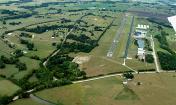
Brenham Municipal Airport
Official FAA Data Effective 2025-01-23 0901Z
VFR Chart of 11R
Sectional Charts at SkyVector.com
IFR Chart of 11R
Enroute Charts at SkyVector.com
Location Information for 11R
Coordinates: N30°13.18' / W96°22.46'Located 03 miles NE of Brenham, Texas on 180 acres of land. View all Airports in Texas.
Estimated Elevation is 317 feet MSL.
Operations Data
|
|
Airport Communications
| AWOS-3: | 121.125 Tel. 979-836-2303 |
|---|---|
| HOUSTON APPROACH: | 134.3 360.85 |
| HOUSTON DEPARTURE: | 134.3 360.85 |
| UNICOM: | 123.075 |
| CTAF: | 123.075 |
| AWOS-3PT at 60R (16.3 NE): | 120.925 936-825-0798 |
| ATIS at CLL (22.1 N): | 126.85 |
| ASOS at CLL (22.2 N): | 979-846-1708 |
Nearby Navigation Aids
|
| ||||||||||||||||||||||||||||||||||||||||||||||||||||||||||||
Runway 16/34
| Dimensions: | 6003 x 75 feet / 1830 x 23 meters | |
|---|---|---|
| Surface: | Asphalt in Fair Condition | |
| Weight Limits: | S-30 | |
| Edge Lighting: | Medium Intensity | |
| Runway 16 | Runway 34 | |
| Coordinates: | N30°13.67' / W96°22.55' | N30°12.69' / W96°22.38' |
| Elevation: | 317.7 | 250.4 |
| Traffic Pattern: | Left | Left |
| Runway Heading: | 171° True | 351° True |
| Markings: | Non-Precision Instrument in fair condition. | Non-Precision Instrument in fair condition. |
| Glide Slope Indicator | P2L (3.00° Glide Path Angle) | P4L (3.50° Glide Path Angle) |
| REIL: | Yes | Yes |
| Obstacles: | 31 ft Tree 803 ft from runway, 209 ft right of center | 35 ft Trees 670 ft from runway, 320 ft right of center |
Services Available
| Fuel: | 100LL (blue), Jet-A |
|---|---|
| Transient Storage: | Tiedowns |
| Airframe Repair: | MAJOR |
| Engine Repair: | MAJOR |
| Bottled Oxygen: | LOW |
| Bulk Oxygen: | NOT AVAILABLE |
| Other Services: | CHARTER SERVICE,AIRCRAFT RENTAL |
Ownership Information
| Ownership: | Publicly owned | |
|---|---|---|
| Owner: | CITY OF BRENHAM | |
| PO BOX 1059 | ||
| BRENHAM, TX 77834 | ||
| 979-337-7232 | ||
| Manager: | JIM HALLEY | |
| 3001 AVIATION WAY | ||
| BRENHAM, TX 77833 | ||
| 979-337-7230 | ||
Other Remarks
- FOR CD CTC HOUSTON APCH AT 281-443-5844 TO CNL IFR CALL 281-443-5888.
- 94 FT LGTD RADAR ANT, 1060 FT WEST OF RWY 16 END.
- 0LL FUEL 24 HR SELF-SVC. FULL SVC AVBL DURG ATNDD HRS. FOR AFT HRS SVC 979-830-1361.
- ACTVT MIRL RWY 16/34 - CTAF.
Weather Minimums
Instrument Approach Procedure (IAP) Charts
Nearby Airports with Instrument Procedures
| ID | Name | Heading / Distance | ||
|---|---|---|---|---|
 |
60R | Navasota Municipal Airport | 056° | 16.2 |
 |
KCLL | Easterwood Field Airport | 001° | 22.1 |
 |
KRWV | Caldwell Municipal Airport | 316° | 24.6 |
 |
KCFD | Coulter Field Airport | 004° | 29.8 |
 |
KGYB | Giddings-Lee County Airport | 264° | 31.6 |
 |
KTME | Houston Exec Airport | 134° | 35.1 |
 |
3T5 | Fayette Regional Air Center Airport | 238° | 35.3 |
 |
KELA | Eagle Lake Airport | 175° | 37.2 |
 |
KLHB | Hearne Municipal Airport | 341° | 41.1 |
 |
84R | Smithville Crawford Municipal Airport | 254° | 42.8 |
 |
KDWH | David Wayne Hooks Memorial Airport | 102° | 43.8 |
 |
KIWS | West Houston Airport | 123° | 43.7 |


Comments
Stop here
Stopped here for fuel during a cross country because it just worked out. Happily discovered that the on field restaurant is open every day except Monday. New fuel pump system is perfect. Coffee and snacks, pilot lounge, even the guy in the big jet was accommodating and funny while I was nose to nose with him while taxiing to the pumps. I bet the place is packed on weekends. You should go out of your way and make the trip to Brenham.