Login
Register
COE
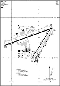
Coeur D'Alene/Pappy Boyington Field Airport
Official FAA Data Effective 2024-11-28 0901Z
VFR Chart of KCOE
Sectional Charts at SkyVector.com
IFR Chart of KCOE
Enroute Charts at SkyVector.com
Location Information for KCOE
Coordinates: N47°46.46' / W116°49.17'Located 09 miles NW of Coeur D'Alene, Idaho on 1140 acres of land. View all Airports in Idaho.
Surveyed Elevation is 2320 feet MSL.
Operations Data
|
|
Airport Communications
| AWOS-3PT: | 135.075 Tel. 208-772-8215 |
|---|---|
| SPOKANE APPROACH: | 132.1 263.0 |
| SPOKANE DEPARTURE: | 132.1 263.0 |
| CTAF: | 122.800 |
| UNICOM: | 122.800 |
| ASOS at SFF (21.0 W): | 120.55 509-535-3290 |
| ATIS at SFF (21.0 W): | 120.55 |
| ASOS at DEW (27.3 NW): | 135.175 509-276-2303 |
Nearby Navigation Aids
|
| ||||||||||||||||||||||||||||||||||||||||||||||||
Runway 06/24
| Dimensions: | 7400 x 100 feet / 2256 x 30 meters | |
|---|---|---|
| Surface: | Asphalt / Grooved in Good Condition | |
| Weight Limits: | 30 /F/B/X/T, S-57, D-95, ST-165 | |
| Edge Lighting: | High Intensity | |
| Runway 06 | Runway 24 | |
| Coordinates: | N47°46.31' / W116°50.22' | N47°46.73' / W116°48.53' |
| Elevation: | 2277.4 | 2320.3 |
| Traffic Pattern: | Left | Left |
| Runway Heading: | 70° True | 250° True |
| Declared Distances: | TORA:7400 TODA:7400 ASDA:7400 LDA:7400 | TORA:7400 TODA:7400 ASDA:7400 LDA:7400 |
| Markings: | Precision Instrument in good condition. | Precision Instrument in good condition. |
| Glide Slope Indicator | P4R (3.00° Glide Path Angle) | P4R (3.00° Glide Path Angle) |
| Approach Lights: | MALSR 1,400 Foot Medium-intensity Approach Lighting System with runway alignment indicator lights. RY 06 NSTD MALSR; THLD BAR EXTENDS 5 FT BYD RY EDGE LGTS EACH SIDE. | |
| REIL: | Yes | |
Runway 02/20
| Dimensions: | 5400 x 75 feet / 1646 x 23 meters | |
|---|---|---|
| Surface: | Asphalt / Grooved in Good Condition | |
| Weight Limits: | 21 /F/B/X/T, S-50, D-83, ST-150 | |
| Edge Lighting: | Medium Intensity | |
| Runway 02 | Runway 20 | |
| Coordinates: | N47°46.00' / W116°49.25' | N47°46.75' / W116°48.55' |
| Elevation: | 2305.6 | 2319.0 |
| Traffic Pattern: | Right | Left |
| Runway Heading: | 32° True | 212° True |
| Declared Distances: | TORA:5400 TODA:5400 ASDA:5400 LDA:5400 | TORA:5400 TODA:5400 ASDA:5400 LDA:5400 |
| Markings: | Non-Precision Instrument in good condition. | Non-Precision Instrument in good condition. |
| Glide Slope Indicator | P2L (3.00° Glide Path Angle) | P2L (3.00° Glide Path Angle) |
| REIL: | Yes | |
Services Available
| Fuel: | 100 (green), Jet-A |
|---|---|
| Transient Storage: | Hangars,Tiedowns |
| Airframe Repair: | MAJOR |
| Engine Repair: | MAJOR |
| Bottled Oxygen: | HIGH/LOW |
| Bulk Oxygen: | HIGH/LOW |
| Other Services: | AVIONICS,CHARTER SERVICE,PILOT INSTRUCTION,AIRCRAFT RENTAL |
Ownership Information
| Ownership: | Publicly owned | |
|---|---|---|
| Owner: | KOOTENAI COUNTY | |
| PO BOX 9000 | ||
| COEUR D ALENE, ID 83816 | ||
| 208-446-1600 | ||
| Manager: | GASTON PATTERSON | |
| 10375 SENSOR AVE | ||
| HAYDEN, ID 83835 | ||
| 208-446-1860 | ||
Other Remarks
- MIGRATORY BIRDS ON & INVOF ARPT OCT-NOV.
- RWY: CONDS NOT MNTD 5 PM TO 7 AM DLY.
- FOR CD IF UNA CTC ON 132.1 CTC SPOKANE APCH AT 509-742-2522.
- PJE IN VCNTY.
- 0 AFT HRS FUEL. SELF SVC AVBL WITH CREDIT CARD.
- ACTVT MIRL RY 02/20, HIRL RY 06/24, REIL RYS 02 & 24, & MALSR RY 06 - CTAF. PAPI RYS 02, 20, 06, & 24 OPER CONTINUOUSLY.
Weather Minimums
Instrument Approach Procedure (IAP) Charts
Departure Procedure Obstacles (DPO) Charts
Nearby Airports with Instrument Procedures
| ID | Name | Heading / Distance | ||
|---|---|---|---|---|
 |
KSFF | Felts Field Airport | 255° | 21.1 |
 |
KDEW | Deer Park Airport | 295° | 27.2 |
 |
KGEG | Spokane International Airport | 252° | 30.5 |
 |
KSZT | Sandpoint Airport | 018° | 33.2 |
 |
KSKA | Fairchild AFB Airport | 254° | 35.2 |
 |
65S | Boundary County Airport | 020° | 60.9 |
 |
S59 | Libby Airport | 059° | 61.7 |
 |
KPUW | Pullman/Moscow Regional Airport | 191° | 63.1 |
 |
2S8 | Wilbur Airport | 269° | 77.9 |
 |
KLWS | Lewiston/Nez Perce County Airport | 185° | 84.4 |
 |
8S1 | Polson Airport | 091° | 106.8 |
 |
KMWH | Grant County International Airport | 252° | 107.2 |


