Login
Register
24CL
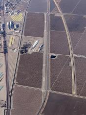
Boswell Airport
Official FAA Data Effective 2024-11-28 0901Z
VFR Chart of 24CL
Sectional Charts at SkyVector.com
IFR Chart of 24CL
Enroute Charts at SkyVector.com
Location Information for 24CL
Coordinates: N36°5.32' / W119°32.50'Located 02 miles SE of Corcoran, California on 31 acres of land. View all Airports in California.
Surveyed Elevation is 205 feet MSL.
Operations Data
|
|
Airport Communications
| AWOS-3PT at TLR (11.1 E): | 120.0 559-686-2613 |
|---|---|
| ASOS at HJO (13.9 N): | 134.75 559-585-8076 |
| AWOS-3PT at VIS (15.4 NE): | 119.925 559-651-2418 |
Nearby Navigation Aids
|
| ||||||||||||||||||||||||||||||||||||||||||||||||
Runway 14/32
| Dimensions: | 6815 x 75 feet / 2077 x 23 meters | |
|---|---|---|
| Surface: | Asphalt | |
| Edge Lighting: | High Intensity | |
| Runway 14 | Runway 32 | |
| Coordinates: | N36°5.84' / W119°32.76' | N36°4.80' / W119°32.23' |
| Elevation: | 205.2 | 202.6 |
| Traffic Pattern: | Left | Right |
| Displaced Threshold: | 794 Feet | 618 Feet |
| Markings: | Non-Precision Instrument in good condition. | Non-Precision Instrument in good condition. |
| Glide Slope Indicator | V2L (4.00° Glide Path Angle) | V2L (3.00° Glide Path Angle) |
| Approach Lights: | MALSR 1,400 Foot Medium-intensity Approach Lighting System with runway alignment indicator lights. | |
Services Available
| Fuel: | NONE |
|---|---|
| Transient Storage: | NONE |
| Airframe Repair: | NONE |
| Engine Repair: | NONE |
| Bottled Oxygen: | NOT AVAILABLE |
| Bulk Oxygen: | NOT AVAILABLE |
Ownership Information
| Ownership: | Privately Owned | |
|---|---|---|
| Owner: | JG BOSWELL COMPANY | |
| PO BOX 457 | ||
| CORCORAN, CA 93212 | ||
| 559-992-2141 | ||
| Manager: | TIM BIENLIEN | |
| JG BOSWELL CO PO BOX 457 | ||
| CORCORAN, CA 93212 | ||
| 559-762-3591 | ||
Other Remarks
- FOR CD CTC OAKLAND ARTCC AT 510-745-3380.
- ACTVT MALSR RWY 32, VASI RWYS 14 & 32, HIRL - 122.85. PCL NON-STANDARD ON 122.85; 5 CLICKS TO ACTUATE, 3 TO DIM, AND 7 TO TURN OFF.
Nearby Airports with Instrument Procedures
| ID | Name | Heading / Distance | ||
|---|---|---|---|---|
 |
KTLR | Mefford Field Airport | 068° | 11.2 |
 |
KHJO | Hanford Municipal Airport | 343° | 14.3 |
 |
KVIS | Visalia Municipal Airport | 027° | 15.6 |
 |
KPTV | Porterville Municipal Airport | 098° | 23.6 |
 |
KDLO | Delano Municipal Airport | 144° | 25.4 |
 |
O32 | Reedley Municipal Airport | 007° | 35.2 |
 |
C80 | New Coalinga Municipal Airport | 277° | 36.9 |
 |
KMIT | Shafter-Minter Field Airport | 153° | 38.8 |
 |
KFCH | Fresno Chandler Exec Airport | 340° | 40.8 |
 |
KFAT | Fresno Yosemite International Airport | 348° | 42.1 |
 |
KBFL | Meadows Field Airport | 148° | 45.8 |
 |
L45 | Bakersfield Municipal Airport | 149° | 53.0 |


