Login
Register
0P2
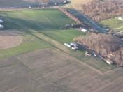
Shoestring Aviation Airfield Airport
Official FAA Data Effective 2026-01-22 0901Z
VFR Chart of 0P2
Sectional Charts at SkyVector.com
IFR Chart of 0P2
Enroute Charts at SkyVector.com
Location Information for 0P2
Coordinates: N39°47.78' / W76°38.78'Located 03 miles NW of Stewartstown, Pennsylvania on 15 acres of land. View all Airports in Pennsylvania.
Estimated Elevation is 1000 feet MSL.
Operations Data
|
|
Airport Communications
| CTAF: | 122.900 |
|---|---|
| ASOS at THV (12.7 NW): | 119.275 717-792-5529 |
| AWOS-3 at DMW (20.1 SW): | 121.25 410-876-1281 |
| AWOS-3PT at 0W3 (24.4 SE): | 132.725 667-340-6003 |
Nearby Navigation Aids
|
| ||||||||||||||||||||||||||||||||||||||||||||||||||||||||||||
Runway 06U/24U
| Dimensions: | 1000 x 100 feet / 305 x 30 meters | |
|---|---|---|
| Surface: | Turf in Good Condition | |
| Runway 06U | Runway 24U | |
| Coordinates: | N39°47.73' / W76°38.87' | N39°47.83' / W76°38.70' |
| Elevation: | 993.0 | 995.0 |
| Traffic Pattern: | Right | |
| Runway Heading: | 53° True | 233° True |
| Obstacles: | 54 ft Trees 396 ft from runway, 42 ft left of center APCH RATIO 15:1 TO 410 FT DTHR. |
10 ft Crops 12 ft from runway POSSIBLE CROPS GROWING NEAR RWY END. |
Runway 15/33
| Dimensions: | 1000 x 100 feet / 305 x 30 meters | |
|---|---|---|
| Surface: | Turf in Good Condition | |
| Runway 15 | Runway 33 | |
| Traffic Pattern: | Right | Left |
| Displaced Threshold: | 500 Feet | |
| Markings: | Non-Standard | |
| Obstacles: | 27 ft Trees 113 ft from runway, 39 ft right of center RWY 33 APCH RATIO 19:1 TO DTHR. |
|
Services Available
| Fuel: | NONE |
|---|---|
| Transient Storage: | Tiedowns |
| Airframe Repair: | MAJOR |
| Engine Repair: | MAJOR |
| Bottled Oxygen: | NOT AVAILABLE |
| Bulk Oxygen: | NOT AVAILABLE |
Ownership Information
| Ownership: | Privately Owned | |
|---|---|---|
| Owner: | THOMAS E HOPKINS | |
| 14388 EBAUGH RD | ||
| STEWARTSTOWN, PA 17363 | ||
| 717-235-6724 | ||
| Manager: | THOMAS E HOPKINS | |
| 14388 EBAUGH RD | ||
| STEWARTSTOWN, PA 17363 | ||
| 717-235-6724 | ||
Other Remarks
- EXTSV ULTRALIGHT ACT ON & INVOF ARPT.
- MAJOR AIRFRAME & POWERPLANT RPR FOR LGT SPORT ACFT ONLY.
- DTHRS MKD WITH 3 WHITE PAVERS EACH SIDE.
- RWY 15/33 & 06U/24U USED FOR ULTRALIGHT OPS.
- FOR CD CTC POTOMAC APCH AT 866-429-5882.
- RWY 06U/24U & RWY 15/33 MKD WITH ORANGE PATIO BLOCKS.
Nearby Airports with Instrument Procedures
| ID | Name | Heading / Distance | ||
|---|---|---|---|---|
 |
KTHV | York Airport | 304° | 12.7 |
 |
N71 | Donegal Springs Airpark Airport | 010° | 18.1 |
 |
KDMW | Carroll County Regional/Jack B Poage Field Airport | 236° | 20.2 |
 |
KMDT | Harrisburg International Airport | 347° | 24.4 |
 |
0W3 | Harford County Airport | 123° | 24.6 |
 |
KLNS | Lancaster Airport | 039° | 25.4 |
 |
2W2 | Clearview Airpark Airport | 221° | 26.2 |
 |
KCXY | Capital City Airport | 339° | 26.9 |
 |
W05 | Gettysburg Regional Airport | 275° | 29.2 |
 |
58N | Reigle Field Airport | 006° | 29.6 |
 |
KMTN | Martin State Airport | 158° | 30.2 |
 |
08N | Keller Brothers Airport | 026° | 33.1 |


