Login
Register
12TN
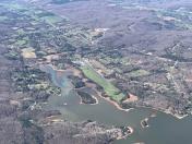
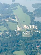
Meadowlake Airport
Official FAA Data Effective 2026-01-22 0901Z
VFR Chart of 12TN
Sectional Charts at SkyVector.com
IFR Chart of 12TN
Enroute Charts at SkyVector.com
Location Information for 12TN
Coordinates: N35°49.42' / W84°32.33'Located 03 miles SW of Kingston, Tennessee on 27 acres of land. View all Airports in Tennessee.
Estimated Elevation is 750 feet MSL.
Operations Data
|
|
Airport Communications
| AWOS-3 at RKW (9.4 NW): | 118.775 865-354-9262 |
|---|---|
| AWOS-3 at MNV (18.5 SE): | 118.475 423-442-6170 |
| AWOS-3 at MMI (25.8 S): | 125.425 423-745-3422 |
Nearby Navigation Aids
|
| ||||||||||||||||||||||||||||||||||||||||||||||||||||||
Runway 05/23
| Dimensions: | 2600 x 40 feet / 792 x 12 meters | |
|---|---|---|
| Surface: | Asphalt in Good Condition | |
| Edge Lighting: | Non-Standard NSTD LIRL DUE TO SPACING. | |
| Runway 05 | Runway 23 | |
| Traffic Pattern: | Left | Left |
| Displaced Threshold: | 490 Feet | |
| Markings: | Basic in fair condition. | Basic in fair condition. |
| Obstacles: | 68 ft Trees 1002 ft from runway, 62 ft left of center APCH RATIO 21:1 TO DSPLCD THR. |
45 ft Trees 414 ft from runway, 88 ft left of center |
Services Available
| Fuel: | 100LL (blue) |
|---|---|
| Transient Storage: | Tiedowns |
| Airframe Repair: | MINOR |
| Engine Repair: | MINOR |
| Bottled Oxygen: | NOT AVAILABLE |
| Bulk Oxygen: | NOT AVAILABLE |
| Other Services: | PILOT INSTRUCTION |
Ownership Information
| Ownership: | Privately Owned | |
|---|---|---|
| Owner: | MEADOWLAKE AIRPARK LLC | |
| 155 HARBOUR PLACE | ||
| LENOIR CITY, TN 37772 | ||
| 865-363-2058 | ||
| Manager: | SAMMY JONES | |
| 159 ANGLERS COVE ROAD | ||
| KINGSTON, TN 37763 | ||
| 865-363-2058 | ||
Other Remarks
- TREES & BLDGS IN PRIMARY SFC W SIDE OF RWY.
- HIGH TERRAIN E & W OF ARPT.
- FLT TRNG, GLIDER & AEROBATIC ACT NA.
- TSNT ACFT NA 1700-0800 EXC PPR - AMGR.
- FOR CD CTC ATLANTA ARTCC AT 770-210-7692.
Nearby Airports with Instrument Procedures
| ID | Name | Heading / Distance | ||
|---|---|---|---|---|
 |
KRKW | Rockwood Municipal Airport | 308° | 9.4 |
 |
KMNV | Monroe County Airport | 155° | 18.4 |
 |
KMMI | Mcminn County Airport | 182° | 25.5 |
 |
KTYS | Mc Ghee Tyson Airport | 091° | 26.6 |
 |
KCSV | Crossville Memorial-Whitson Field Airport | 286° | 27.7 |
 |
2A0 | Mark Anton Airport | 223° | 27.9 |
 |
KDKX | Knoxville Downtown Island Airport | 075° | 33.5 |
 |
KJAU | Colonel Tommy C Stiner Airfield Airport | 030° | 35.6 |
 |
2A1 | Jamestown Municipal Airport | 327° | 37.2 |
 |
KSCX | Scott Municipal Airport | 356° | 37.9 |
 |
KRZR | Cleveland Regional Jetport Airport | 199° | 38.8 |
 |
KGKT | Gatlinburg-Pigeon Forge Airport | 087° | 49.3 |


