Login
Register


24S
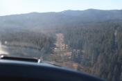
Pinehurst State Airport
Official FAA Data Effective 2024-05-16 0901Z
Chart Supplement

VFR Chart of 24S
Sectional Charts at SkyVector.com
IFR Chart of 24S
Enroute Charts at SkyVector.com
Location Information for 24S
Coordinates: N42°6.61' / W122°22.99'Located 01 miles SW of Pinehurst, Oregon on 103 acres of land. View all Airports in Oregon.
Estimated Elevation is 3643 feet MSL.
Operations Data
|
|
Airport Communications
| CTAF: | 122.900 |
|---|---|
| ASOS at SIY (20.6 S): | 121.125 530-459-0267 |
| ATIS at MFR (27.0 NW): | 127.25 |
| ASOS at MFR (27.3 NW): | 127.25 541-776-1238 |
Nearby Navigation Aids
|
| ||||||||||||||||||||||||||||||||||||||||||


Runway 04/22
| Dimensions: | 2800 x 30 feet / 853 x 9 meters | |
|---|---|---|
| Surface: | Asphalt in Good Condition | |
| Runway 04 | Runway 22 | |
| Coordinates: | N42°6.48' / W122°23.24' | N42°6.74' / W122°22.73' |
| Elevation: | 3643.0 | 3588.0 |
| Traffic Pattern: | Left | Left |
| Runway Heading: | 55° True | 235° True |
| Markings: | Basic in good condition. | Basic in good condition. |
| Obstacles: | 17 ft Trees 252 ft from runway +2-25 FT TREES 10-200 FT FM RWY END TO 125 FT BOTH SIDES OF CNTRLN. |
18 ft Trees 281 ft from runway PILES OF ROCKS AND +10 FT TREES FM RY END TO 200 FT 65 FT R OF CNTRLN. 50' TREE AT 10' FROM RY END 100' L OF CL 15' TREES AT 100' FROM RY END 75' L OF CL |
Services Available
| Fuel: | NONE |
|---|---|
| Transient Storage: | Tiedowns |
| Airframe Repair: | NONE |
| Engine Repair: | NONE |
| Bottled Oxygen: | NONE |
| Bulk Oxygen: | NONE |
Ownership Information
| Ownership: | Publicly owned | |
|---|---|---|
| Owner: | OREGON DEPT. OF AVIATION | |
| 3040 25TH ST, SE | ||
| SALEM, OR 97302-1125 | ||
| 503-378-4880 | ||
| Manager: | STATE AIRPORT MGR | |
| 3040 25TH ST, SE | ||
| SALEM, OR 97310 | ||
| 503-378-4880 | ||
Operational Statistics
| Single Engine Aircraft Based on Field: | 6 | Statistics collected for 12 month period ending 2021-05-11 | |
|---|---|---|---|
| Multi-Engine Aircraft Based on Field: | 1 | Annual Commercial Operations: | none |
| Jet Aircraft Based on Field: | none | Annual Commuter Operations: | none |
| Helicopters Based on Field: | none | Annual Air Taxi Operations: | none |
| Military Aircraft Based on Field: | none | Annual Military Operations: | none |
| Gliders Based on Field: | none | Annual GA Local Operations: | 150 |
| Ultralights Based on Field: | none | Annual GA Itinerant Operations: | 470 |
Other Remarks
- RWY 22 SLOPES UP TO THE SW, WITH ABRUPT 4 0/0 RISE ON SW HALF OF RWY.
- RWY 04/22 12 FT TREES WI 25 FEET OF CNTRLN FULL LEN.
- OWNER ADVISES CTC OREGON DEPT OF AVIATION (503-378-4880) PRIOR TO USE.
- IRREGULAR WINTER MAINT. ARPT MAY BE CLSD BY SNOW.
- STRONG WINDS FROM ANY DIRECTION WILL LIKELY CAUSE LOW-LEVEL TURBULENCE.
- SURFACE CONDITIONS NOT REPORTED.
- FOR CD CTC SEATTLE ARTCC AT 253-351-3694.
Nearby Airports with Instrument Procedures
| ID | Name | Heading / Distance | ||
|---|---|---|---|---|
 |
KMFR | Rogue Valley International - Medford Airport | 306° | 27.0 |
|
KLMT | Crater Lake/Klamath Regional Airport | 084° | 29.1 |
|
O46 | Weed Airport | 184° | 37.9 |
|
3S8 | Grants Pass Airport | 298° | 50.8 |
|
KRBG | Roseburg Regional Airport | 327° | 80.3 |
|
KBOK | Brookings Airport | 269° | 85.2 |
|
KCEC | Jack Mc Namara Field Airport | 257° | 85.3 |
|
KLKV | Lake County Airport | 087° | 88.6 |
|
KAAT | Alturas Municipal Airport | 114° | 89.8 |
|
O85 | Benton Field Airport | 180° | 92.1 |
|
4S1 | Gold Beach Municipal Airport | 282° | 92.8 |
|
KRDD | Redding Regional Airport | 177° | 96.1 |
Airport Images

By: skitheo
By: skitheo


