Login
Register
AVP
Wilkes-Barre/Scranton International Airport
Official FAA Data Effective 2026-01-22 0901Z
VFR Chart of KAVP
Sectional Charts at SkyVector.com
IFR Chart of KAVP
Enroute Charts at SkyVector.com
Location Information for KAVP
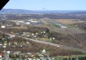
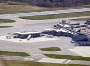
Coordinates: N41°20.31' / W75°43.40'Located 05 miles SW of Wilkes-Barre/Scranton, Pennsylvania on 910 acres of land. View all Airports in Pennsylvania.
Surveyed Elevation is 961 feet MSL.
Operations Data
|
|
Airport Communications
| ATIS: | 135.75 |
|---|---|
| ASOS: | Tel. 570-456-5433 |
| WILKES-BARRE TOWER: | 120.1 257.8 |
| WILKES-BARRE GROUND: | 121.9 |
| WILKES-BARRE APPROACH: | 120.95 ;280-100 126.3 ;101-279 256.7 |
| WILKES-BARRE DEPARTURE: | 120.95 ;280-100 126.3 ;101-279 256.7 |
| UNICOM: | 122.950 |
| TRSA: | 120.95 ;280-100 126.3 ;101-279 256.7 |
| EMERG: | 121.5 243.0 |
| ASOS at MPO (19.6 SE): | 120.275 570-839-1584 |
| AWOS-3 at HZL (24.4 SW): | 119.975 570-459-4901 |
| AWOS-3PT at 22N (31.7 S): | 119.350 570-386-3423 |
Nearby Navigation Aids
|
| ||||||||||||||||||||||||||||||||||||||||||||||||||||||||||||
Runway 04/22
PRECIPITOUS DROP-OFF EACH RY END. | ||
| Dimensions: | 7502 x 150 feet / 2287 x 46 meters | |
|---|---|---|
| Surface: | Asphalt / Grooved in Good Condition | |
| Weight Limits: | S-133, D-173, ST-300
PCR VALUE: 770/F/C/X/T
| |
| Edge Lighting: | High Intensity | |
| Runway 04 | Runway 22 | |
| Coordinates: | N41°19.72' / W75°43.89' | N41°20.76' / W75°43.01' |
| Elevation: | 961.7 | 911.3 |
| Traffic Pattern: | Left | Right |
| Runway Heading: | 33° True | 213° True |
| Declared Distances: | TORA:7502 TODA:7502 ASDA:7502 LDA:7502 | TORA:7502 TODA:7502 ASDA:7502 LDA:7502 |
| Markings: | Precision Instrument in good condition. | Precision Instrument in good condition. |
| Glide Slope Indicator | P4R (3.00° Glide Path Angle) | V4L (3.00° Glide Path Angle) |
| RVR Equipment | Touchdown Rollout | Touchdown Rollout |
| Approach Lights: | MALSR 1,400 Foot Medium-intensity Approach Lighting System with runway alignment indicator lights. | |
| REIL: | Yes | |
| Obstacles: | 112 ft Trees 4567 ft from runway, 723 ft right of center | |
Runway 10/28
| Dimensions: | 4300 x 150 feet / 1311 x 46 meters | |
|---|---|---|
| Surface: | Asphalt / Grooved in Good Condition | |
| Weight Limits: | S-58, D-80, ST-125
PCR VALUE: 480/F/C/X/T
| |
| Edge Lighting: | Medium Intensity | |
| Runway 10 | Runway 28 | |
| Coordinates: | N41°20.44' / W75°43.79' | N41°20.41' / W75°42.86' |
| Elevation: | 921.9 | 934.5 |
| Traffic Pattern: | Right | Right |
| Runway Heading: | 92° True | 272° True |
| Declared Distances: | TORA:4300 TODA:4300 ASDA:4300 LDA:4300 | TORA:4300 TODA:4300 ASDA:4300 LDA:4300 |
| Markings: | Non-Precision Instrument in good condition. | Non-Precision Instrument in good condition. |
| Glide Slope Indicator | P2L (3.00° Glide Path Angle) | |
| REIL: | Yes | Yes |
| Obstacles: | 21 ft Trees 348 ft from runway, 234 ft right of center | |
Services Available
| Fuel: | 100LL (blue), Jet-A |
|---|---|
| Transient Storage: | Hangars,Tiedowns |
| Airframe Repair: | MAJOR |
| Engine Repair: | MINOR |
| Bottled Oxygen: | LOW |
| Bulk Oxygen: | LOW |
| Other Services: | AIR FREIGHT SERVICES,AVIONICS,CARGO HANDLING SERVICES,CHARTER SERVICE,PILOT INSTRUCTION,AIRCRAFT RENTAL |
Ownership Information
| Ownership: | Publicly owned | |
|---|---|---|
| Owner: | LUZERNE AND LACKAWANNA CO | |
| 100 TERMINAL DRIVE | ||
| AVOCA, PA 18641 | ||
| (570) 602-2040 | ||
| Manager: | CARL R. BEARDSLEY, JR. | |
| 100 TERMINAL DRIVE | ||
| AVOCA, PA 18641 | ||
| 570-602-2000 | ||
Other Remarks
- DEER & BIRDS ON & INVOF ARPT.
- RY 28 UNLGTD HIGH TERRAIN TREES: 1155 FT MSL .91 MI EAST AER 28; 1463 FT MSL 1.49 MI EAST-SOUTHEAST AER 28; 1667 FT MSL 2.25 MI EAST AER 28; 1920 FT MSL 2.84 MI EAST AER 28.
- UNLGTD TOWER 1130 FT MSL (20 FT AGL) 1.3 MI EAST AER 28; UNLGTD TOWER 1463 FT MSL (20 FT AGL) 1.7 MI EAST AER 28; UNLGTD TOWER 1652 FT MSL (20 FT AGL) 2.4 MI EAST AER 28.
- FOR FBO SERVICE 0000-0500 LOCAL M-F AND 2100-0000 LOCAL SAT-SUN CALL (570) 457-4485.
- ENGINEERED MATERIAL ARRESTING SYSTEM (EMAS) 324 FT IN LENGTH BY 170 FT IN WIDTH LCTD 50 FT OFF DER 04.
- ENGINEERED MATERIAL ARRESTING SYSTEM (EMAS) 162 FT IN LENGTH BY 170 FT IN WIDTH LCTD 35 FT OFF DER 22.
Weather Minimums
Instrument Approach Procedure (IAP) Charts
Departure Procedure (DP) Charts
Nearby Airports with Instrument Procedures
| ID | Name | Heading / Distance | ||
|---|---|---|---|---|
 |
KWBW | Wilkes-Barre Wyoming Valley Airport | 247° | 6.3 |
 |
9N3 | Seamans Field Airport | 354° | 15.1 |
 |
KMPO | Pocono Mountains Regional Airport | 127° | 19.7 |
 |
N30 | Cherry Ridge Airport | 063° | 23.8 |
 |
KHZL | Hazleton Regional Airport | 210° | 24.4 |
 |
22N | Jake Arner Memorial Airport | 183° | 31.8 |
 |
N13 | Bloomsburg Municipal Airport | 237° | 38.2 |
 |
1N7 | Blairstown Airport | 123° | 39.6 |
 |
N27 | Bradford County Airport | 306° | 40.5 |
 |
N43 | Braden Airpark Airport | 148° | 41.9 |
 |
KABE | Lehigh Valley International Airport | 162° | 43.1 |
 |
KMSV | Sullivan County International Airport | 062° | 47.2 |


