Login
Register
EWN
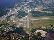
Coastal Carolina Regional Airport
Official FAA Data Effective 2025-12-25 0901Z
VFR Chart of KEWN
Sectional Charts at SkyVector.com
IFR Chart of KEWN
Enroute Charts at SkyVector.com
Location Information for KEWN
Coordinates: N35°4.37' / W77°2.58'Located 03 miles SE of New Bern, North Carolina on 785 acres of land. View all Airports in North Carolina.
Surveyed Elevation is 17 feet MSL.
Operations Data
|
|
Airport Communications
| ASOS: | 118.525 Tel. 252-514-2086 |
|---|---|
| NEW BERN TOWER: | 124.25 |
| NEW BERN GROUND: | 121.7 |
| CHERRY POINT APPROACH: | 119.35 377.175 |
| CHERRY POINT DEPARTURE: | 119.35 377.175 |
| CLEARANCE DELIVERY: | 121.7 120.525 ;WHEN EWN TWR CLSD |
| CTAF: | 124.250 |
| EMERG: | 121.5 |
| ATIS at NKT (12.9 SE): | 127.475 |
| ATIS at NJM (23.0 S): | 292.15 |
| ASOS at MRH (27.9 SE): | 135.375 252-728-2055 |
- APCH/DEP SVC PRVDD BY NAS CHERRY POINT APCH CNTL ON FREQ 120.525.
- RVA INC.
Nearby Navigation Aids
|
| ||||||||||||||||||||||||||||||||||||||||||||||||||||||||||||
Runway 04/22
| Dimensions: | 6452 x 150 feet / 1967 x 46 meters | |
|---|---|---|
| Surface: | Asphalt / Grooved in Good Condition | |
| Weight Limits: | S-80, D-123
PCR VALUE: 250/F/B/X/T
| |
| Edge Lighting: | High Intensity | |
| Runway 04 | Runway 22 | |
| Coordinates: | N35°3.88' / W77°2.93' | N35°4.80' / W77°2.27' |
| Elevation: | 13.4 | 14.5 |
| Traffic Pattern: | Left | Left |
| Runway Heading: | 31° True | 211° True |
| Displaced Threshold: | 299 Feet | |
| Declared Distances: | TORA:6453 TODA:6453 ASDA:6053 LDA:5753 | TORA:6453 TODA:6453 ASDA:6153 LDA:6153 |
| Markings: | Precision Instrument in good condition. | Precision Instrument in good condition. |
| Glide Slope Indicator | P4L (3.00° Glide Path Angle) | P4L (3.00° Glide Path Angle) |
| REIL: | Yes | Yes |
| Obstacles: | 68 ft Trees 2543 ft from runway, 558 ft left of center | |
Runway 14/32
RWY 14/32 NOT AVBL FOR PART 121/PART 380 OPS WITH SKED PAX CARRYING OPS MORE THAN 9 PAX SEATS AND NON-SKED PAX CARRYING OPS MORE THAN 30 PAX SEATS. | ||
| Dimensions: | 4001 x 150 feet / 1220 x 46 meters | |
|---|---|---|
| Surface: | Asphalt in Good Condition | |
| Weight Limits: | S-28, D-45
PCR VALUE: 250/F/C/X/T
| |
| Edge Lighting: | Medium Intensity | |
| Runway 14 | Runway 32 | |
| Coordinates: | N35°4.62' / W77°2.87' | N35°4.22' / W77°2.24' |
| Elevation: | 11.6 | 17.6 |
| Traffic Pattern: | Left | Left |
| Runway Heading: | 128° True | 308° True |
| Markings: | Non-Precision Instrument in good condition. | Non-Precision Instrument in good condition. |
| Glide Slope Indicator | P2L (4.00° Glide Path Angle) | P2L (3.00° Glide Path Angle) |
| REIL: | Yes | Yes |
| Obstacles: | 28 ft Trees 1000 ft from runway, 500 ft right of center | 26 ft Tree 862 ft from runway, 80 ft left of center |
Services Available
| Fuel: | 100LL (blue), Jet-A |
|---|---|
| Transient Storage: | Hangars,Tiedowns |
| Airframe Repair: | MAJOR |
| Engine Repair: | MAJOR |
| Bottled Oxygen: | NONE |
| Bulk Oxygen: | NONE |
| Other Services: | AIR FREIGHT SERVICES,CARGO HANDLING SERVICES,CHARTER SERVICE,PILOT INSTRUCTION,AIRCRAFT RENTAL |
Ownership Information
| Ownership: | Publicly owned | |
|---|---|---|
| Owner: | CRAVEN COUNTY | |
| PO BOX 3258 | ||
| NEW BERN, NC 28560 | ||
| 252-638-8591 | ||
| Manager: | ANDREW SHORTER | |
| 200 TERMINAL DRIVE | ||
| NEW BERN, NC 28562-6455 | ||
| 252-638-8591 | ||
Other Remarks
- MIL TACTICAL JET ACFT; STRAIGHT IN, FULL STOP LDGS ONLY; RWY 14/32 FOR EUO.
- RWY 14/32 ASSOCD TWYS NOT AVBL FOR SKED ACR OPNS WITH MORE THAN 9 PSGR SEATS OR UNSKED ACR AT LEAST 31 PSGR SEATS.
- ACTVT REIL RWY 04, 22, 14 & 32; HIRL 04/22; MIRL 14/32 - CTAF. PAPI RWY 04, 22, 14 & 32 OPER CONSLY.
- ARRESTING GEAR/SYSTEM: ENGINEERED MATERIALS ARRESTING SYSTEM (EMAS) 279.42 FT IN LENGTH BY 162 FT IN WIDTH LOCATED AT THE DEPARTURE END OF RWY 22.
Weather Minimums
Instrument Approach Procedure (IAP) Charts
Nearby Airports with Instrument Procedures
| ID | Name | Heading / Distance | ||
|---|---|---|---|---|
 |
KNKT | Cherry Point MCAS (Cunningham Field) Airport | 141° | 12.9 |
 |
KMRH | Michael J Smith Field Airport | 136° | 27.7 |
 |
KNCA | New River MCAS (Mccutcheon Field) Airport | 222° | 29.3 |
 |
KOCW | Washington-Warren Airport | 359° | 29.8 |
 |
KOAJ | Albert J Ellis Airport | 242° | 31.6 |
 |
KISO | Kinston Regional Jetport At Stallings Field Airport | 299° | 31.8 |
 |
KPGV | Pitt-Greenville Airport | 333° | 37.6 |
 |
KDPL | Duplin County Airport | 264° | 46.5 |
 |
KPMZ | Plymouth Municipal Airport | 017° | 46.4 |
 |
KGSB | Seymour Johnson AFB Airport | 289° | 47.9 |
 |
KMCZ | Martin County Airport | 352° | 47.7 |
 |
W40 | Mount Olive Municipal Airport | 280° | 49.8 |


