Login
Register


RHP
Western Carolina Regional Airport
Official FAA Data Effective 2024-04-18 0901Z
Chart Supplement

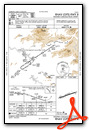
VFR Chart of KRHP
Sectional Charts at SkyVector.com
IFR Chart of KRHP
Enroute Charts at SkyVector.com
Location Information for KRHP
Coordinates: N35°11.71' / W83°51.78'Located 02 miles W of Andrews, North Carolina on 206 acres of land. View all Airports in North Carolina.
Surveyed Elevation is 1698 feet MSL.
Operations Data
|
|
Airport Communications
| AWOS-3: | 119.675 Tel. 828-321-1049 |
|---|---|
| UNICOM: | 122.800 |
| CTAF: | 122.800 |
| AWOS-3PT at DZJ (21.5 S): | 119.325 706-745-9271 |
| AWOS-3 at 1A5 (21.8 E): | 118.225 828-349-3156 |
| AWOS-3 at MNV (32.8 NW): | 118.475 423-442-6170 |
- APCH/DEP SVC PRVDD BY ATLANTA ARTCC (ZTL) ON FREQS 134.8/379.95 (MOUNT OGLETHORPE RCAG).
Nearby Navigation Aids
|
| ||||||||||||||||||||||||||||||||||||||||||||||||||||||||||||


Runway 08/26
| Dimensions: | 5500 x 100 feet / 1676 x 30 meters | |
|---|---|---|
| Surface: | Asphalt in Excellent Condition | |
| Weight Limits: | S-25, D-45 | |
| Edge Lighting: | Medium Intensity | |
| Runway 08 | Runway 26 | |
| Coordinates: | N35°11.57' / W83°52.31' | N35°11.86' / W83°51.26' |
| Elevation: | 1682.0 | 1698.1 |
| Traffic Pattern: | Right | Left |
| Runway Heading: | 71° True | 251° True |
| Displaced Threshold: | 215 Feet | |
| Markings: | Non-Precision Instrument in good condition. | Non-Precision Instrument in good condition. |
| Glide Slope Indicator | P2L (3.50° Glide Path Angle) PAPI UNUSBL BYD 2 DEG LEFT AND 8 DEG RIGHT OF CNTRLN (DUE TO TRRN). | P2L (4.00° Glide Path Angle) PAPI UNUSBL BYD 2 DEG RIGHT OF CNTRLN. |
| REIL: | Yes | |
| Obstacles: | 20 ft Railroad 216 ft from runway, 246 ft right of center APCH RATIO 19:1 AT DSPLCD THLD DUE TO RR. HAS 5 FT CROPS 0-200 FT FM END OFFSET 150 FT RIGHT OF CNTRLN AND 2 FT BRUSH 189 FT FM END OFFSET 65 FT LEFT OF CNTRLN. |
51 ft Trees 1144 ft from runway, 92 ft left of center 3 FT BERM 20 FT FM THLD OFFSET 81 FT RIGHT OF CNTRLN. |
Services Available
| Fuel: | 100LL (blue), Jet-A, Jet A-1+ |
|---|---|
| Transient Storage: | Hangars,Tiedowns |
| Airframe Repair: | MAJOR |
| Engine Repair: | MAJOR |
| Bottled Oxygen: | NONE |
| Bulk Oxygen: | NONE |
| Other Services: | CHARTER SERVICE,PILOT INSTRUCTION,AIRCRAFT RENTAL |
Ownership Information
| Ownership: | Publicly owned | |
|---|---|---|
| Owner: | CHEROKEE COUNTY | |
| 75 PEACHTREE STREET | ||
| MURPHY, NC 28906 | ||
| 828-835-8578 | ||
| Manager: | CHRIS WILLIAMS | |
| 5840 AIRPORT ROAD | ||
| ANDREWS, NC 28901 | ||
| 828-321-5114 | ||
Operational Statistics
| Single Engine Aircraft Based on Field: | 39 | Statistics collected for 12 month period ending 2023-07-26 | |
|---|---|---|---|
| Multi-Engine Aircraft Based on Field: | 4 | Annual Commercial Operations: | none |
| Jet Aircraft Based on Field: | none | Annual Commuter Operations: | none |
| Helicopters Based on Field: | 1 | Annual Air Taxi Operations: | 1000 |
| Military Aircraft Based on Field: | none | Annual Military Operations: | 500 |
| Gliders Based on Field: | none | Annual GA Local Operations: | 14000 |
| Ultralights Based on Field: | 1 | Annual GA Itinerant Operations: | 5000 |
Other Remarks
- LOW FLYING MIL JET ACFT OVERFLY ARPT.
- TWY UNLGTD.
- 4-5 FT DITCH 75 FT FROM RWY CNTRLN ON BOTH SIDES.
- RWY 08 RR 390 FT RIGHT OF CNTRLN 260 FT FM THLD.
- ARPT SRNDD BY HIGH TRRN.
- RWY 08, 8 FT DROP-OFF, 108 FT FM THLD BOTH SIDES IN RWY SAFETY AREA.
- COLD TEMPERATURE AIRPORT. ALTITUDE CORRECTION REQUIRED AT OR BELOW -8C.
- FOR CD CTC ATLANTA ARTCC AT 770-210-7692.
- LIVESTOCK PASTURED INVOF ARPT.
- 0LL FUEL AVBL 24 HR WITH CREDIT CARD.
- ACTVT REIL RWY 08 - CTAF. PAPI RWY 08 & 26 OPER CONT. MIRL RWY 08/26 ON DUSK - DAWN. TO INCR INTST - CTAF.
Weather Minimums

Instrument Approach Procedure (IAP) Charts
Nearby Airports with Instrument Procedures
| ID | Name | Heading / Distance | ||
|---|---|---|---|---|
 |
KDZJ | Blairsville Airport | 197° | 21.5 |
|
1A5 | Macon County Airport | 085° | 21.8 |
|
1A3 | Martin Campbell Field Airport | 245° | 26.1 |
|
24A | Jackson County Airport | 076° | 32.9 |
|
KMNV | Monroe County Airport | 309° | 32.9 |
|
KMMI | Mcminn County Airport | 289° | 36.4 |
|
KTYS | Mc Ghee Tyson Airport | 350° | 37.4 |
|
KGKT | Gatlinburg-Pigeon Forge Airport | 022° | 42.9 |
|
KAJR | Habersham County Airport | 159° | 44.3 |
|
KTOC | Toccoa Rg Letourneau Field Airport | 142° | 45.7 |
|
KRZR | Cleveland Regional Jetport Airport | 271° | 46.0 |
|
KDKX | Knoxville Downtown Island Airport | 359° | 46.0 |


