Login
Register


SEM
Craig Field Airport
Official FAA Data Effective 2026-02-19 0901Z
Chart Supplement

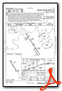
KSEM Airport Diagram

VFR Chart of KSEM
Sectional Charts at SkyVector.com
IFR Chart of KSEM
Enroute Charts at SkyVector.com
Location Information for KSEM
Coordinates: N32°20.64' / W86°59.27'Located 04 miles SE of Selma, Alabama on 1790 acres of land. View all Airports in Alabama.
Surveyed Elevation is 166 feet MSL.
Operations Data
|
|
Airport Communications
| AWOS-3PT: | 119.15 Tel. (334) 872-9090 |
|---|---|
| CRAIG TOWER: | 120.85 |
| CRAIG GROUND: | 121.675 |
| MONTGOMERY APPROACH: | 124.0 363.025 |
| MONTGOMERY DEPARTURE: | 124.0 363.025 |
| UNICOM: | 122.700 |
| CTAF: | 122.700 |
| AWOS-3P at 1A9 (24.9 E): | 118.025 334-358-0919 |
| ASOS at MGM (30.2 E): | 334-245-6083 |
| ATIS at MGM (30.2 E): | 120.675 |
- APCH/DEP SVC PRVDD BY ATLANTA ARTCC ON FREQS 120.55/270.25 (MONTGOMERY RCAG) WHEN MONTGOMERY APCH CTL CLSD.
Nearby Navigation Aids
|
| ||||||||||||||||||||||||||||||||||||||||||||||||||||||||||||


Runway 15/33
| Dimensions: | 8014 x 150 feet / 2443 x 46 meters | |
|---|---|---|
| Surface: | Asphalt-Concrete in Poor Condition SEVERE CRACKING EXISTS ON ALL RUNWAY SURFACES. REHABILITATION PROJECT IS PLANNED. | |
| Weight Limits: | S-33, D-54 | |
| Edge Lighting: | High Intensity | |
| Runway 15 | Runway 33 | |
| Coordinates: | N32°21.18' / W86°59.71' | N32°20.09' / W86°58.83' |
| Elevation: | 166.2 | 165.1 |
| Traffic Pattern: | Left | Left |
| Runway Heading: | 146° True | 326° True |
| Markings: | Precision Instrument in poor condition. | Precision Instrument in poor condition. |
| Glide Slope Indicator | P4L (3.00° Glide Path Angle) | P4L (3.00° Glide Path Angle) |
| Approach Lights: | MALS 1,400 Foot Medium-intensity Approach Lighting System. | |
| Obstacles: | 41 ft Tree 1249 ft from runway, 384 ft left of center | 43 ft Tree 1620 ft from runway, 336 ft left of center |
Services Available
| Fuel: | 100LL (blue), Jet-A |
|---|---|
| Transient Storage: | Hangars,Tiedowns |
| Airframe Repair: | MAJOR |
| Engine Repair: | MAJOR |
| Bottled Oxygen: | NOT AVAILABLE |
| Bulk Oxygen: | NONE |
| Other Services: | PILOT INSTRUCTION |
Ownership Information
| Ownership: | Publicly owned | |
|---|---|---|
| Owner: | CRAIG FLD ARPT & IND AUTH | JAMES CORRIGAN, EXECUTIVE DIRECTOR |
| PO BOX 1421 | ||
| SELMA, AL 36702 | ||
| 334-874-7419 | ||
| Manager: | DAN LANE | |
| CRAIG FIELD INDUSTRIAL, HANGAR 202, AVENUE J | ||
| SELMA, AL 36701 | ||
| 334-419-3881 | ALT 334-874-7419. | |
Other Remarks
- FOR CD IF UNA TO CTC ON FSS FREQ, CTC DANNELLY APCH AT 334-284-4575, WHEN ATCT CLSD CTC ATLANTA ARTCC AT 770-210-7692.
- RWY ID AND TD MRKGS SEVERELY FADED.
- RWY ID AND TD MRKGS SEVERELY FADED.
- 0LL 24HR 100LL AND JET A AVBL CALL 334-651-1511 AFT HRS.
- WHEN ATCT CLSD ACTVT MALS RWY 33; PAPI RWY 15/33 AND HIRL RWY 15/33 - CTAF.
Weather Minimums


Instrument Approach Procedure (IAP) Charts


Nearby Airports with Instrument Procedures
| ID | Name | Heading / Distance | ||
|---|---|---|---|---|
 |
A08 | Vaiden Field Airport | 296° | 22.5 |
|
1A9 | Prattville/Grouby Field Airport | 076° | 24.8 |
|
61A | Camden Municipal Airport | 219° | 28.2 |
|
KMGM | Montgomery Regional (Dannelly Field) Airport | 094° | 30.3 |
|
KMXF | Maxwell AFB Airport | 085° | 31.7 |
|
08A | Wetumpka Municipal Airport | 071° | 35.1 |
|
KPRN | Mac Crenshaw Memorial Airport | 147° | 35.5 |
|
02A | Chilton County Airport | 032° | 35.8 |
|
0A8 | Bibb County Airport | 351° | 35.9 |
|
7A0 | Greensboro Municipal Airport | 300° | 39.7 |
|
KDYA | Demopolis Regional Airport | 278° | 49.6 |
|
KEET | Shelby County Airport | 011° | 51.0 |
Airport Images
Do you have a recent image of this airport? Upload it here!


