Login
Register


07K
Central City Municipal/Larry Reineke Field Airport
Official FAA Data Effective 2025-11-27 0901Z
Chart Supplement

VFR Chart of 07K
Sectional Charts at SkyVector.com
IFR Chart of 07K
Enroute Charts at SkyVector.com
Location Information for 07K
Coordinates: N41°6.69' / W98°3.08'Located 03 miles W of Central City, Nebraska on 124 acres of land. View all Airports in Nebraska.
Surveyed Elevation is 1716 feet MSL.
Operations Data
|
|
Airport Communications
| CTAF: | 122.900 |
|---|---|
| AWOS-3 at AUH (13.3 S): | 121.225 402-694-5472 |
| ASOS at GRI (14.5 SW): | 308-314-0825 |
| ATIS at GRI (14.5 SW): | 127.4 |
- APCH/DEP SVC PRVDD BY MINNEAPOLIS ARTCC ON FREQS 126.05 (GRAND ISLAND RCAG) 278.8 (HASTINGS RCAG).
Nearby Navigation Aids
|
| ||||||||||||||||||||||||||||||||||||||||||||||||||||||||||||


Runway 16/34
| Dimensions: | 3700 x 60 feet / 1128 x 18 meters | |
|---|---|---|
| Surface: | Concrete in Excellent Condition | |
| Weight Limits: | S-12 | |
| Edge Lighting: | Medium Intensity | |
| Runway 16 | Runway 34 | |
| Coordinates: | N41°6.99' / W98°3.20' | N41°6.40' / W98°2.96' |
| Elevation: | 1715.1 | 1716.1 |
| Traffic Pattern: | Left | Left |
| Markings: | Non-Precision Instrument in good condition. | Non-Precision Instrument in good condition. |
| Glide Slope Indicator | P2L (3.00° Glide Path Angle) | P2L (3.00° Glide Path Angle) |
Services Available
| Fuel: | 100LL (blue) |
|---|---|
| Transient Storage: | Hangars,Tiedowns CALL FOR HANGAR AVBL 308-946-3806. |
| Airframe Repair: | MAJOR |
| Engine Repair: | MAJOR |
| Bottled Oxygen: | NONE |
| Bulk Oxygen: | NONE |
| Other Services: | CROP DUSTING SERVICES,PILOT INSTRUCTION,AIRCRAFT RENTAL |
Ownership Information
| Ownership: | Publicly owned | |
|---|---|---|
| Owner: | CITY OF CENTRAL CITY | |
| PO BOX 418 | ||
| CENTRAL CITY, NE 68826-0418 | ||
| 308-946-3806 | ||
| Manager: | CHIP COSLOR | |
| 1346 ORMSBY N RD | ||
| CENTRAL CITY, NE 68826-8009 | ||
| 308-946-3450 | ||
Other Remarks
- (E81) TURN-OFF ONLY.
- ROTG BCN & LGTD WIND SOCK ON SS-SR.
- FOR CD CTC MINNEAPOLIS ARTCC AT 651-463-5588.
- 0LL FOR FUEL AFT HRS CALL POLICE 308-946-3003.
- ACTVT PAPI RWY 16/34; MIRL RWY 16/34 - CTAF.
Weather Minimums

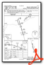
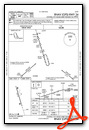
Instrument Approach Procedure (IAP) Charts
Nearby Airports with Instrument Procedures
| ID | Name | Heading / Distance | ||
|---|---|---|---|---|
 |
KAUH | Aurora Municipal/Al Potter Field Airport | 168° | 13.3 |
|
KGRI | Central Nebraska Regional Airport | 233° | 14.6 |
|
KJYR | York Municipal Airport | 123° | 23.3 |
|
08K | Harvard State Airport | 182° | 27.6 |
|
KHSI | Hastings Municipal Airport | 209° | 34.9 |
|
KBVN | Albion Municipal Airport | 359° | 37.0 |
|
KOLU | Columbus Municipal Airport | 057° | 38.0 |
|
KFMZ | Fairmont State Airport | 145° | 38.3 |
|
93Y | David City Municipal Airport | 080° | 42.7 |
|
0F4 | Loup City Municipal Airport | 284° | 43.8 |
|
KSWT | Seward Municipal Airport | 108° | 45.3 |
|
KEAR | Kearney Regional Airport | 242° | 49.2 |
Airport Images
Do you have a recent image of this airport? Upload it here!


